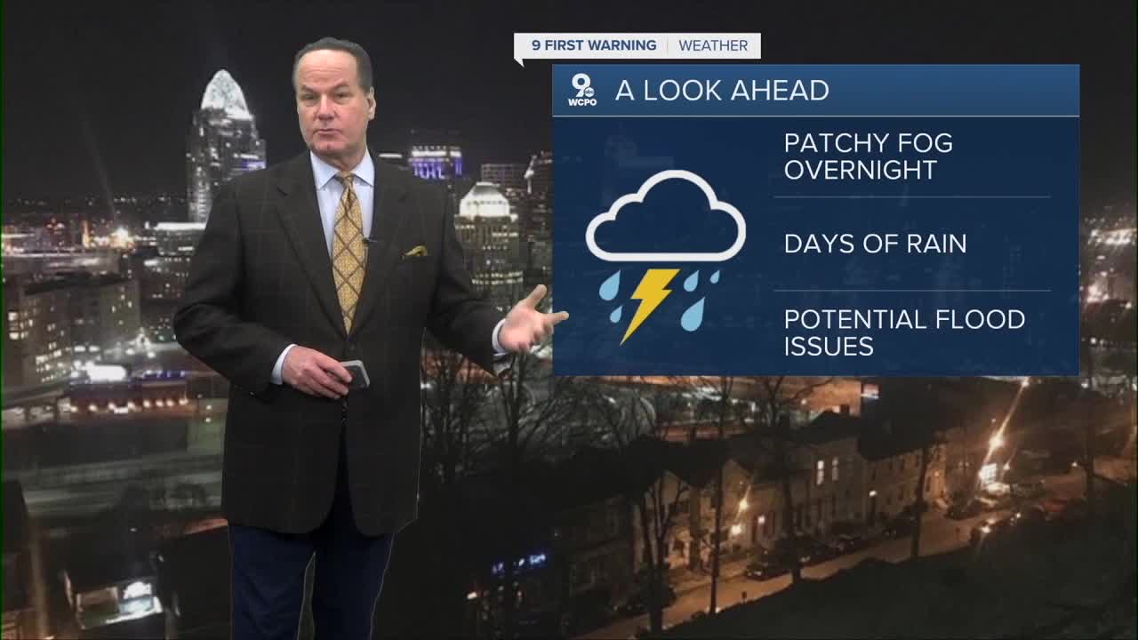


It's morning spotty rain and patchy fog to start our Tuesday with morning temps near the upper 30s and generally cloudy skies. Tuesday will see a transition to steady rain mainly in the afternoon with highs near the upper 50s and rainfall amounts of a quarter to half an inch possible.

Tuesday night into Wednesday and Thursday, multiple rounds of showers are likely with additional thunderstorms possible, and daytime highs rising into the 60s and low 70s. The warmer and wetter pattern is expected to continue through the week with southerly winds increasing moisture and aiding multiple periods of rain and embedded thunderstorms.
With forecast rain nearly every day from Tuesday through Friday and into the weekend, cumulative rainfall totals could add up, especially if thunderstorms train over the same areas, increasing the potential for flooding late this week into the weekend. The combination of several days of moderate rain and already saturated ground raises concern for urban/small stream flooding as well as creeks and rivers rising.

The Storm Prediction Center highlights a "marginal risk" for severe storms during the midweek as well.
Heading into Saturday and Sunday, the chance for additional rain continues with the potential for additional heavier downpours that could further enhance flood potential if rainfall rates are locally high.
OVERNIGHT
Overcast, isolated showers
Low: 39
TUESDAY
Overcast sky, milder
Scattered showers
High: 58
TUESDAY NIGHT
Showers continue
Overcast
Low: 51
9 First Warning Weather 24/7 Livestream
==========
- Interactive Radar: Track weather to your doorstep
- Sign up for severe weather email alerts
- Check latest school closings and delays
- WCPO traffic updates
- Metro bus detours and updates (or call the hotline at 513-632-7538)
- Latest power outages from Duke Energy
- Flight cancellations and delays from CVG, other U.S. airports
