


This summer has been a wild one across the United States regarding weather. In the last eight weeks we have seen several intense record-breaking heat waves, massive wildfires, & deadly flash flooding. But there is one thing we haven’t heard much about: Hurricanes.
Coming into the season, the NOAA’s forecast for the 2022 Atlantic Hurricane season was for 14 to 21 named storms, 6 to 10 hurricanes of which 3 to 6 would be major hurricanes (category 3 or stronger). The NOAA released a revised forecast on Thursday that continued to call for an "active" hurricane season, despite the slow start.
Colorado State University’s Dr. Bill Gray pioneered hurricane research for three decades and provided communities along the East Coast and elsewhere an idea of the fury to come. He and the university came out with a refined forecast for the season on Thursday. They predict 18 named storms, 8 hurricanes and 4 major hurricanes - reinforcing the NOAA predictions.
The 2022 Atlantic Hurricane Season has gotten off to an eerily quiet start. Through the first two months (The Atlantic Hurricane Season “officially” runs from June 1 through November 30 every year) we have only seen three total storms develop.
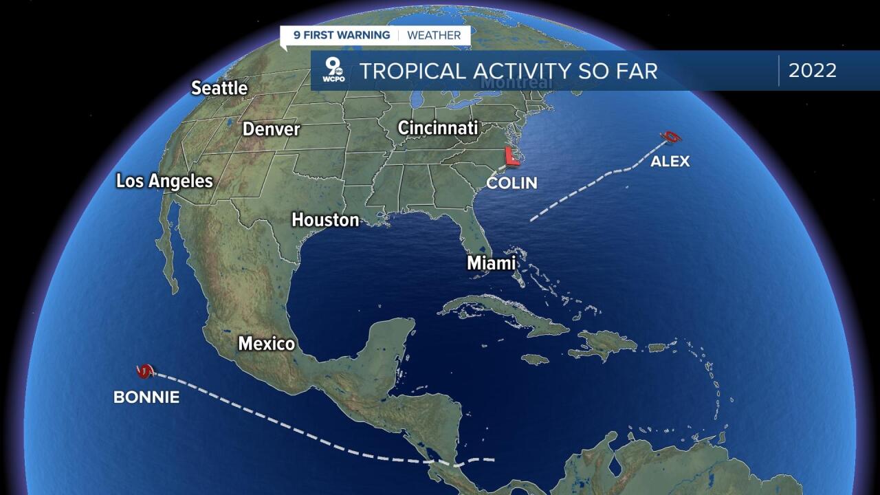
Tropical Storm Alex (June 5 through June 6), Tropical Storm Bonnie (July 1 through July 2), and Tropical Storm Colin (July 2 through July 3), are the only three storms which have formed through the first 64 days of the summer. That means we haven’t had a single hurricane form in the Atlantic this year. That is the first time that we have not seen a hurricane form in the Atlantic basin by August 1 since 2017. That also happened during the seasons of 2011, 2013, and 2015. The bigger deal was that it was a very quiet month of July.
For comparisons sake, The Hurricane Season of 2010 actually had a very similar start, with only three storms through the first two months and very little activity. However, from August 21 (Danielle - Cat 4) through November 11 (Tomas – Cat 2) of that year, we saw 16 named storms, including 11 hurricanes, and 5 major hurricanes to end the year. What’s that mean? Well, anything can still happen.
This quiet start may seem like an abnormality, but I think we just have recently bias. By this time last year we had 5 storms (one hurricane). In 2020 we had already seen 9 storms (2 hurricanes). However, the 30 year average (1991-2020) day for our first hurricane isn’t until August 11. In fact, our three named storms by August 1 is technically ahead of schedule as our average date for our third named storm doesn’t come until August 3. You can see the rest of the breakdown of our averages in the table below from the National Hurricane Center’s climatology page.

While we are off to a slow start to the season, that doesn’t mean that is how it will end. Climatologically speaking, we are still about a month away from peak hurricane season activity, which is usually around the second week of September. Late August through mid-October is the time when we typically see our greatest tropical activity.

Activity usually peaks in these months because that is when the sea surface temperatures reach their hottest mark, which is one of the most important ingredients for tropical cyclones to feed off. The warmer the temperatures of the water, generally, the faster storms strengthen and develop. One sign that things may start to become more active? The current water temperatures across the Gulf of Mexico and Caribbean are trending warmer than normal by 1 to 3 degrees overall.

Buckle up, because I think we are about to see an active few months in the tropics.
