


An active evening across the Tri-State with heavy rain and storms moving through. Those have even brought a delay to the Garth Brooks concert at Paul Brown Stadium this evening. The good news is the worst should be done and the concert should be a go soon.
Good news @garthbrooks fans! The worst of the storms are away from downtown Cincy! Still some lingering showers/rain will be with us the next 25 minutes. We should be good from there. I'd say the show should be good to start after 9:15PM #CincyWX #WCPO #OHwx @Cincywxman @WCPO
— Brandon Spinner WCPO (@wxSpinner89) May 15, 2022
Still a few strong storms at times this evening, but the main issue will be flooding. A few Flood Advisories and Flood Warnings are in effect through the late evening hours.
Now that the sun has set, our threat for severe weather has greatly diminished. We may still see a few showers and storms, but overnight we should dry out.

Overnight we’ll be mostly clear to partly cloudy with lows down to 61°.
For a majority of the day on Sunday we will stay nice and warm with highs returning back into the mid 80s. There will be plenty of sunshine on Sunday, but a few more clouds will filter in during the evening hours. Humidity won’t be terrible, but it will still be high enough to make it feel slight warmer.
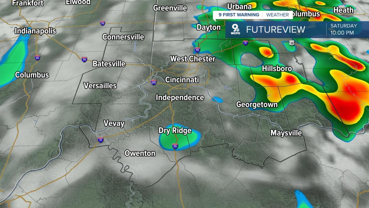
The big issue is late Sunday evening and overnight into Monday as a cold front rushes in from the northwest. This will bring the threat at some storms overnight Sunday into early Monday. Some of these storms will have the potential to be strong, borderline severe. The main threats with these storms will be strong winds of 40 to 60 mph, but one inch hail (or smaller) may be possible as well. We are in a Slight Risk for severe weather Sunday night. That is level 2 of 5. I would say the best areas for these threats are to the west of Cincinnati into southeast Indiana.

Unfortunately, these storms overnight will limit our chances of seeing the total Lunar Eclipse this weekend, but if you want more information make sure to read my breakdown here.
Storms will linger into early Monday morning before fizzling by mid-to-late morning. From there we will dry out and clear up with sunshine by the afternoon. Air on the backside of the cold front will be significantly different, only climbing into the mid-70s with much lower humidity.
THIS EVENING
Mostly sunny to partly cloudy
Isolated storms
High: 83
TONIGHT
Partly cloudy
Drying out
Low: 61
SUNDAY
Sunny & hot!
Storms late, some strong
High: 84
SUNDAY NIGHT
Storms moving through
Some may be strong and/or severe
Low: 58
MONDAY
Storms early
Afternoon clearing, a bit cooler
Low: 74
9 First Warning Weather 24/7 Livestream
==========
- Interactive Radar: Track weather to your doorstep
- Sign up for severe weather email alerts
- Check latest school closings and delays
- WCPO traffic updates
- Metro bus detours and updates (or call the hotline at 513-632-7538)
- Latest power outages from Duke Energy
- Flight cancellations and delays from CVG, other U.S. airports
