


The accumulating snow has come to an end, with most of the Tri-State seeing 8-12 inches of snow this weekend. Officially at CVG, 10.2 inches fell.
We could see a few flurries into Monday morning, and it will be frigid. Temperatures will be in the single digits in the morning.
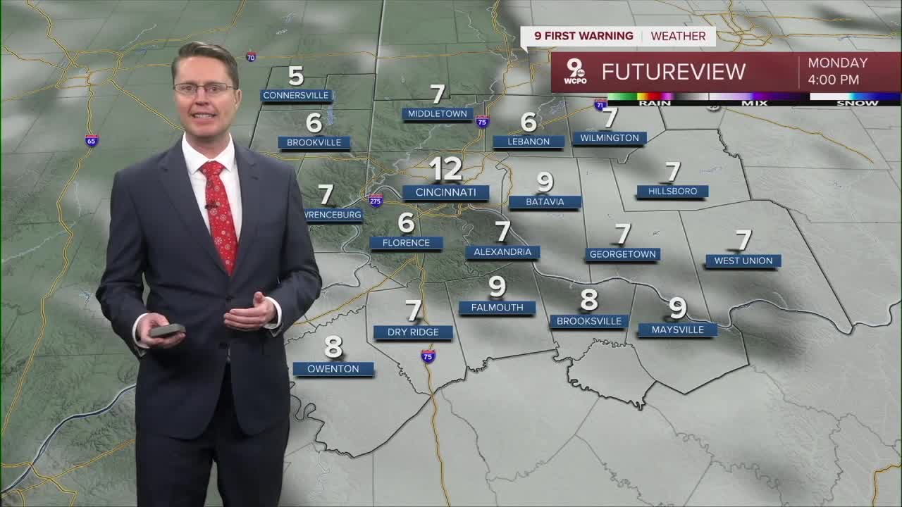
Monday afternoon will be a little windy, keeping the wind chill near 0. The wind will also blow the snow around, at times, covering roads that have already been cleared. Actual temperatures will struggle to hit the double digits in the afternoon with a mix of sun and clouds.
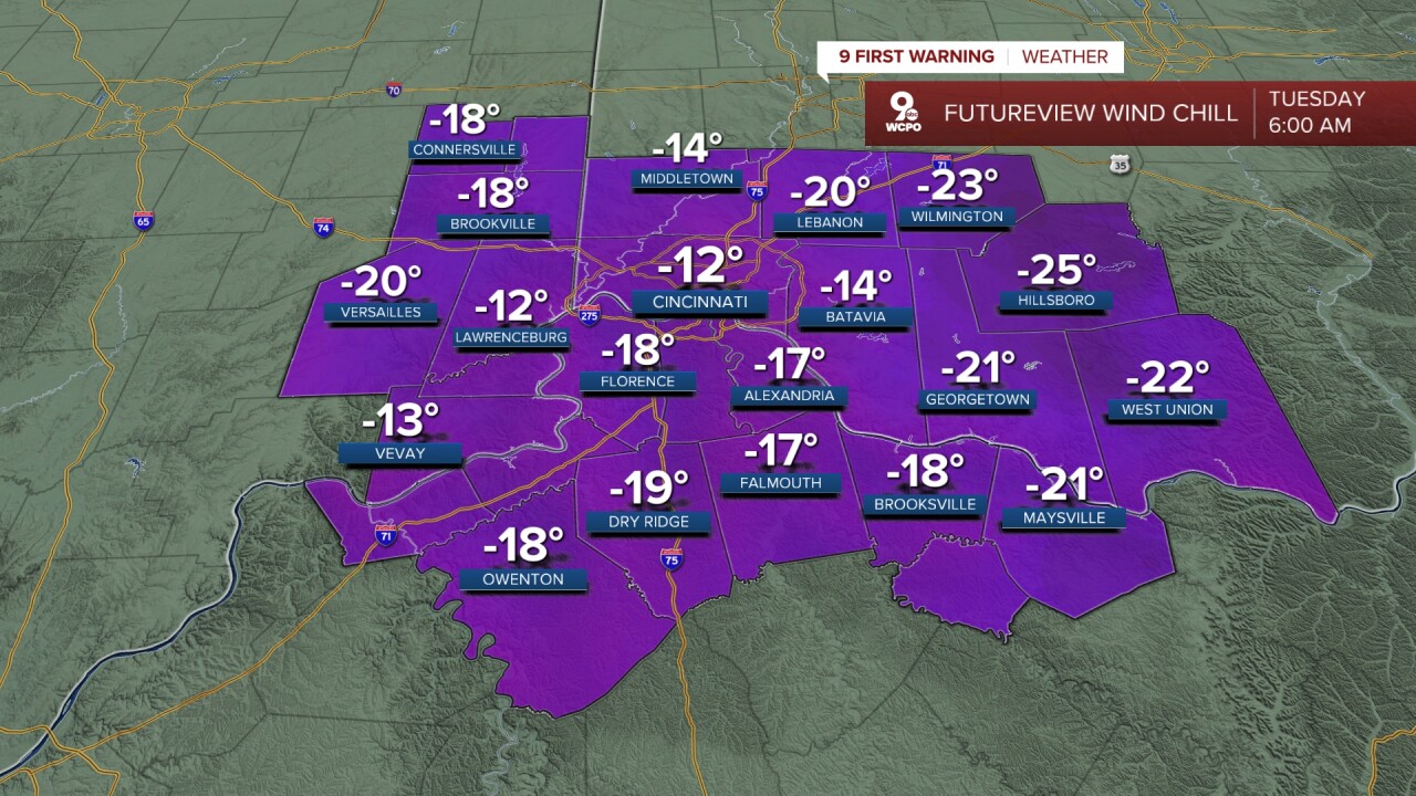
We drop below zero into Tuesday morning, and as the wind continues to blow, wind chills will drop from -25 to -15 across the region. Tuesday afternoon will be a touch warmer with highs near 20. We could see a few snowflakes late Tuesday.
The rest of the mornings this workweek will be below zero. Be prepared for school closings or delays, even after roads slowly improve.
Wednesday will be mostly cloudy with highs back down in the teens. Again, there could be a few light pockets of snow around to finish the day.
We stay in the teens both Thursday and Friday afternoons.
The weekend brings small improvements, but we stay well below average (40 for Cincy), with 20s both afternoons.
We could stay below freezing Monday and Tuesday.
OVERNIGHT
Cloudy
Flurries
Wind chill below zero
Low: 3
MONDAY
Partly cloudy
Breezy
Travel issues continue
High: 12
MONDAY NIGHT
Partly cloudy
Wind chill -25 to -15
Low: -4
TUESDAY
Partly cloudy
Breezy
High: 20
9 First Warning Weather 24/7 Livestream
==========
- Interactive Radar: Track weather to your doorstep
- Sign up for severe weather email alerts
- Check latest school closings and delays
- WCPO traffic updates
- Metro bus detours and updates (or call the hotline at 513-632-7538)
- Latest power outages from Duke Energy
- Flight cancellations and delays from CVG, other U.S. airports
