


Welcome to the heat wave!
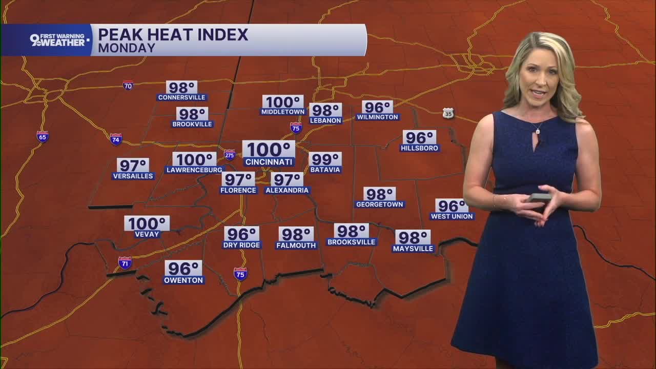
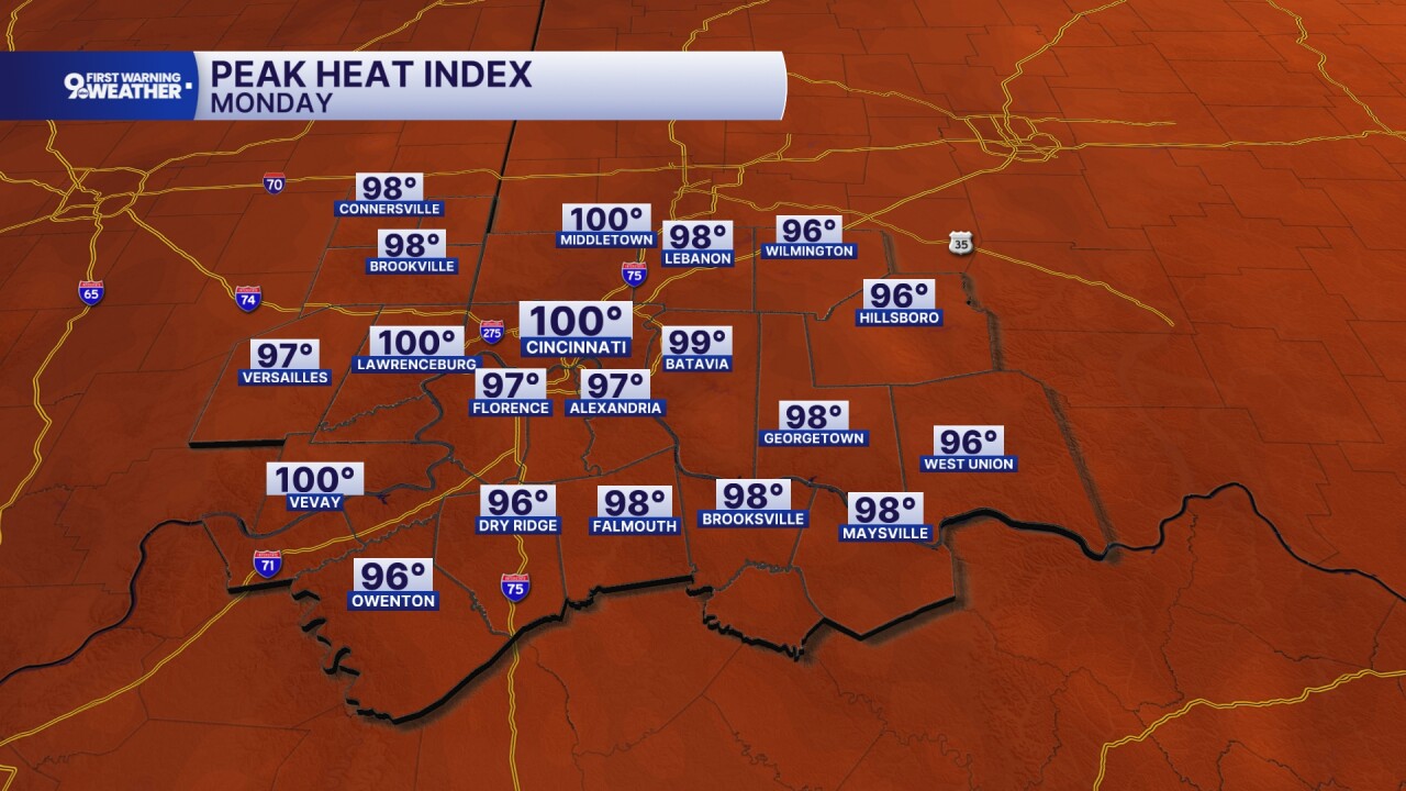
Temperatures start at 72 this morning and warm to 91 degrees this afternoon. The sky will look hazy most of the day due to higher levels of humidity. Today's heat index rises to 100 degrees between 3 and 6 p.m.
A heat advisory begins today at noon and will continue through 8 p.m. Thursday. It's possible that this advisory could be extended for additional days.

The impacts of our heat wave will only get worse with time as the heat takes more of a toll on our bodies. While heat is a normal part of summer, the extended stretch of hot and humid weather is something to be very aware of and take precautions around. Tuesday, Wednesday and Thursday will be 9 First Warning Weather Alert Days due to the impact of the heat wave.
Tuesday will be mostly sunny with a high of 93 degrees and a heat index of 103 degrees.
Wednesday is also mostly sunny, but miserable. The high of 94 degrees will feel like 103 to 105 degrees.

There isn't much rain to talk about this week as a ridge of high pressure sits down to our southeast. Eventually, this ridge of high pressure will start to break down. When that happens, the heat won't leave immediately, but we will start to see some pop-up showers and storms in the peak heat of the afternoon. This will be the case on Friday and on the Fourth of July.
MORNING RUSH
Muggy start
Hazy sky
Low: 75
MONDAY
Mostly sunny
Feels like 100°
High: 91
MONDAY NIGHT
Few clouds
Warm and muggy
Low: 73
TUESDAY
Mostly sunny
Feels like 103°
High: 93
TUESDAY NIGHT
Few clouds
Still very muggy
Low: 74
9 First Warning Weather 24/7 Livestream
==========
- Interactive Radar: Track weather to your doorstep
- Sign up for severe weather email alerts
- Check latest school closings and delays
- WCPO traffic updates
- Metro bus detours and updates (or call the hotline at 513-632-7538)
- Latest power outages from Duke Energy
- Flight cancellations and delays from CVG, other U.S. airports
