


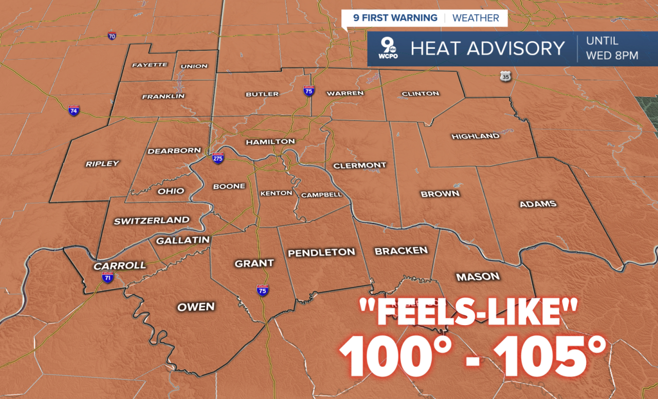
CINCINNATI — The heat and humidity have triggered another HEAT ADVISORY that will last through Wednesday night, so no surprises with the forecast...right now!
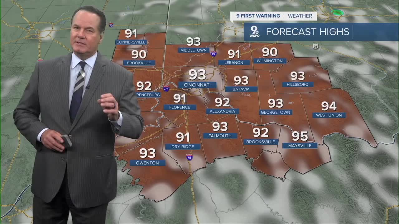
Wednesday's highs will again reach the low 90s with a heat index near or above 100 degrees. We still have a chance for a shower or storm, but the chances a very small.
The best rain chance starts Thursday as a front moves through the Tri-State. This boundary will change the game and finally give us a break from the heat and humidity. Temperatures on Friday only reach 80 degrees with a mostly sunny sky. Humidity will barely be noticeable!
Then, it's a gift from Mother Nature, as conditions will be ideal to be outside. Low humidity and highs slightly below average will make for a "go out and do it" weekend.
TONIGHT
Mostly clear
Very muggy
Low: 73
WEDNESDAY
Partly cloudy, very humid
Isolated storm chances
High: 92
WEDNESDAY NIGHT
Scattered storms
Mostly cloudy
Low: 68
9 First Warning Weather 24/7 Livestream
==========
- Interactive Radar: Track weather to your doorstep
- Sign up for severe weather email alerts
- Check latest school closings and delays
- WCPO traffic updates
- Metro bus detours and updates (or call the hotline at 513-632-7538)
- Latest power outages from Duke Energy
- Flight cancellations and delays from CVG, other U.S. airports
