


We are set to see a strong, robust Spring like storm. The concerns include:
-Heavy rain and flooding
-Severe weather potential
-Gusty, damaging winds
Here's a look at the Storm Prediction Center outlook for Friday. Most of the area is in the slight risk for severe storms. All of the storm threats are possible on Friday, including low end tornadoes.

The morning rush will be terrible with torrential rain in most areas. I would expect slow downs on the interstate as we deal with lower visibility, downpours and loss of traction at times. Rounds of rain will hit and this is why flash flooding is possible.
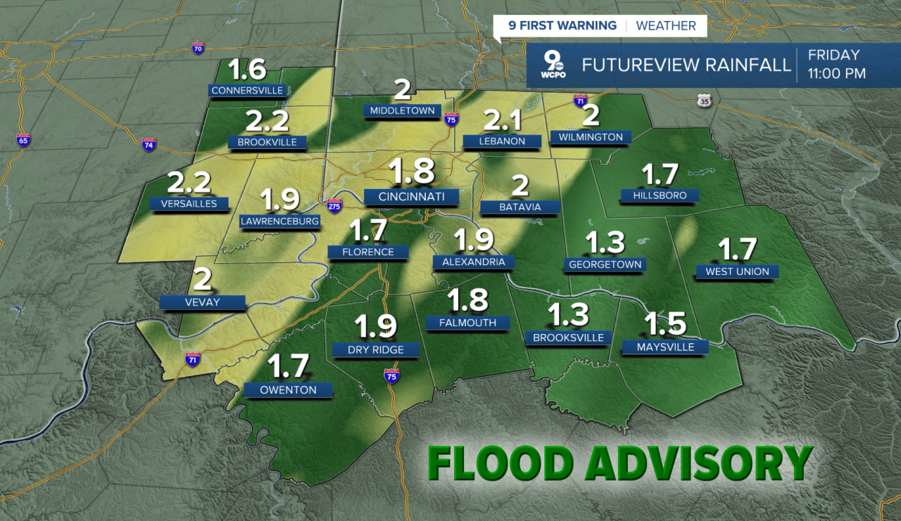
The afternoon push of showers and storms could turn a bit stronger and brings in a low end threat for severe weather too. Damaging wind gusts and isolated tornadoes cannot be ruled out. An additional push of rain will pass through the area in the afternoon hours where the greatest threat for severe weather happens with the strongest wind gusts.

Here's a look at the radar at some key dayparts Friday. As you can see, there's no doubt rain will impact your travel.


TONIGHT
Rain begins overnight
Heavy rain
Low: 42
FRIDAY
Heavy rain, gusty winds
Strong to severe storms possible
High: 60
FRIDAY NIGHT
Mostly cloudy
Colder
Low: 35
9 First Warning Weather 24/7 Livestream
==========
- Interactive Radar: Track weather to your doorstep
- Sign up for severe weather email alerts
- Check latest school closings and delays
- WCPO traffic updates
- Metro bus detours and updates (or call the hotline at 513-632-7538)
- Latest power outages from Duke Energy
- Flight cancellations and delays from CVG, other U.S. airports
