


CINCINNATI — Tracking the first accumulating snowfall of the year on Thursday, and "minor" is the word to take away from the latest outlook. The National Weather Service has issued a Winter Weather Advisory for select counties in the southern portion of the Tri-State. Those counties can be seen in the tweet at the bottom of this story.
We are forecasting light snow beginning Thursday afternoon. The most important factor will be the timing. The snow will be falling during the afternoon ride home. Although we are only talking about an inch or two of snow, it doesn't take much to create traffic issues over drive times.
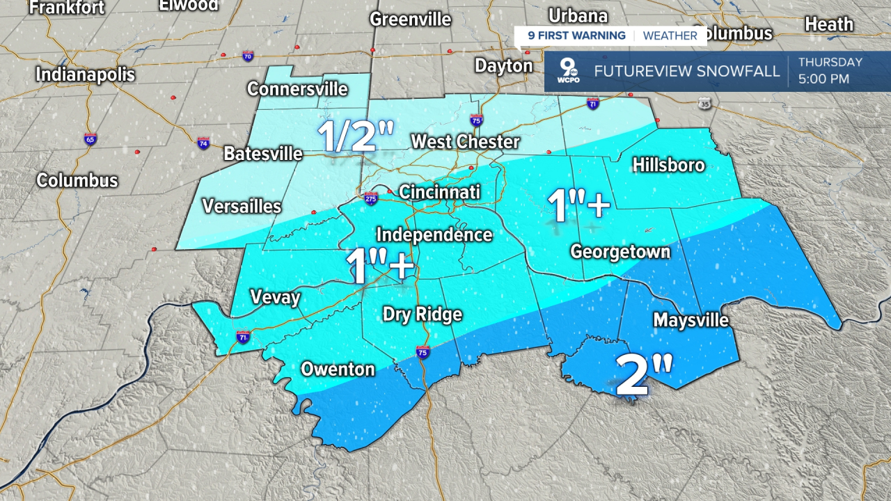
The Greater Cincinnati area will see approximately 1"-2" of snow. The lightest snowfall will be northwest and the highest totals will be to the southeast. But in the highest zones, we are not talking about a big winter storm. You can see the latest snow map at the top of this story.
THURSDAY TIMELINE
- 6 a.m. to 9 a.m. - Dry, partly cloudy, much colder
- 9 a.m. to Noon - Some snow beginning in our southern counties.
- Noon to 3 p.m. - Light snow falls, slick spots start on untreated roads
- 4 p.m. to 6 p.m. - Best chance for snow continues only to the southeast, light accumulation continues there
- 6 p.m. to 10 p.m. - Flurries possible, but very little "new" snow accumulates. System totals from a Dusting to 2" max.
9 First Warning: A WINTER WEATHER ADVISORY is now out across the highlighted counties beginning on Thursday morning. Accumulation of 1"-3" possible across this area. @wcpo #cincywx pic.twitter.com/bM1mnRe4i2
— Steve Raleigh WCPO (@Cincywxman) January 5, 2022


Keep checking back with this story for more refined updates.
==========
