


An extreme heat warning has been issued for the Tri-State and this will be in effect until Thursday evening. This is an upgrade from the heat advisory.
Heat index values around 105 degrees are expected in the afternoon hours.
Tuesday, Wednesday and Thursday are 9 First Warning Weather Alert Days due to the heat and humidity.

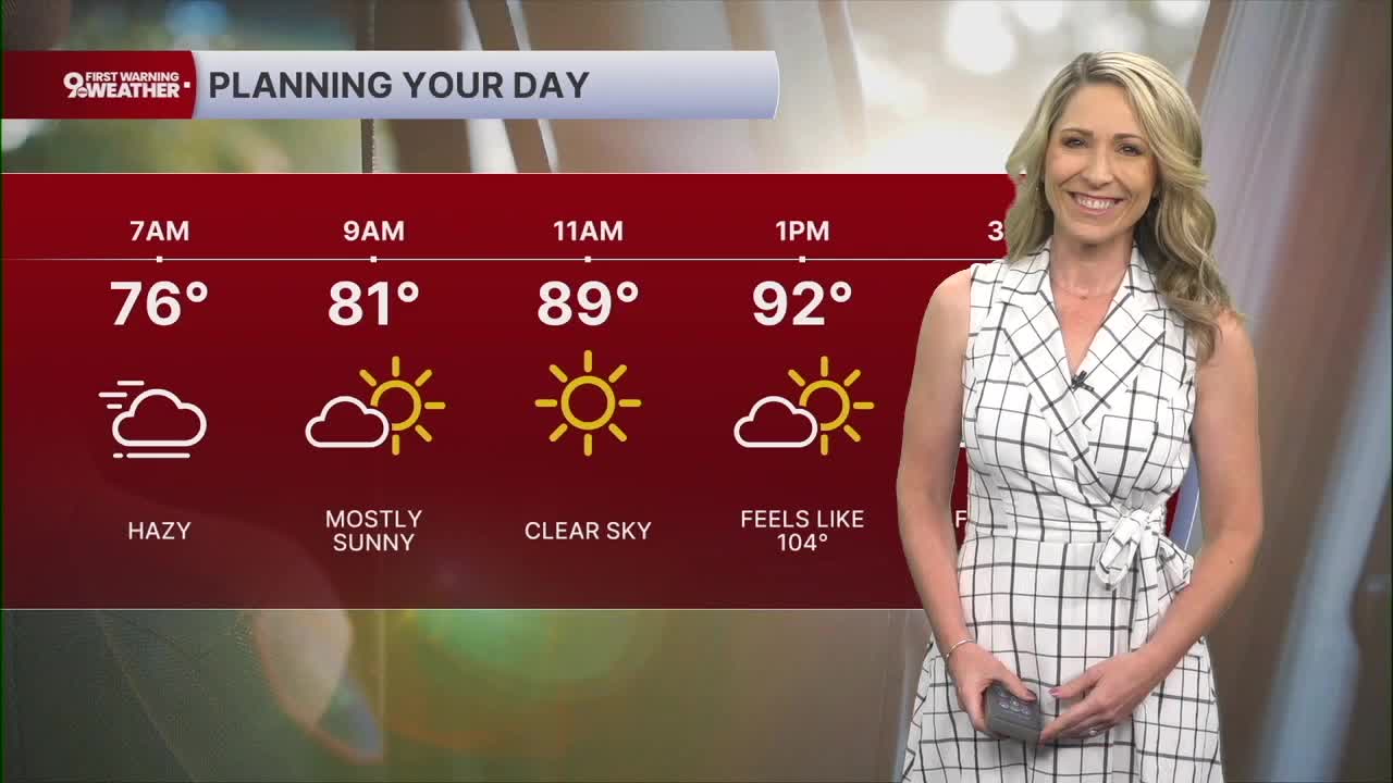
Tuesday starts at 78 and warm to 94 degrees. The sky will be hazy this morning, almost gray at times. Then we'll see mostly sunny conditions this afternoon and experience very muggy air. Feels-like temperatures rise to 105.

We'll only cool to 74 tonight. The sky will again be hazy.
Wednesday, it's a repeat forecast and that's an unfortunate thing. This will officially be day 3 of our heat wave. And it's another day where the heat index will end up around 105 degrees.
Rain chances are going to hold off until Saturday, the Fourth of July. At this point, it's a spotty storm chance and not a total washout. Highs on July Fourth will be around 90 degrees. The heat index will again top out at 100 degrees.
MORNING RUSH
Hazy start, some fog
Very muggy
Low: 75
TUESDAY
Mostly sunny
Hot, humid and hazy
High: 94
TUESDAY NIGHT
No relief from humidity
Muggy, hazy
Low: 74
WEDNESDAY
Mostly sunny
Hot, humid and hazy
High: 94
WEDNESDAY NIGHT
Few clouds
Very muggy
Low: 75
9 First Warning Weather 24/7 Livestream
==========
- Interactive Radar: Track weather to your doorstep
- Sign up for severe weather email alerts
- Check latest school closings and delays
- WCPO traffic updates
- Metro bus detours and updates (or call the hotline at 513-632-7538)
- Latest power outages from Duke Energy
- Flight cancellations and delays from CVG, other U.S. airports
