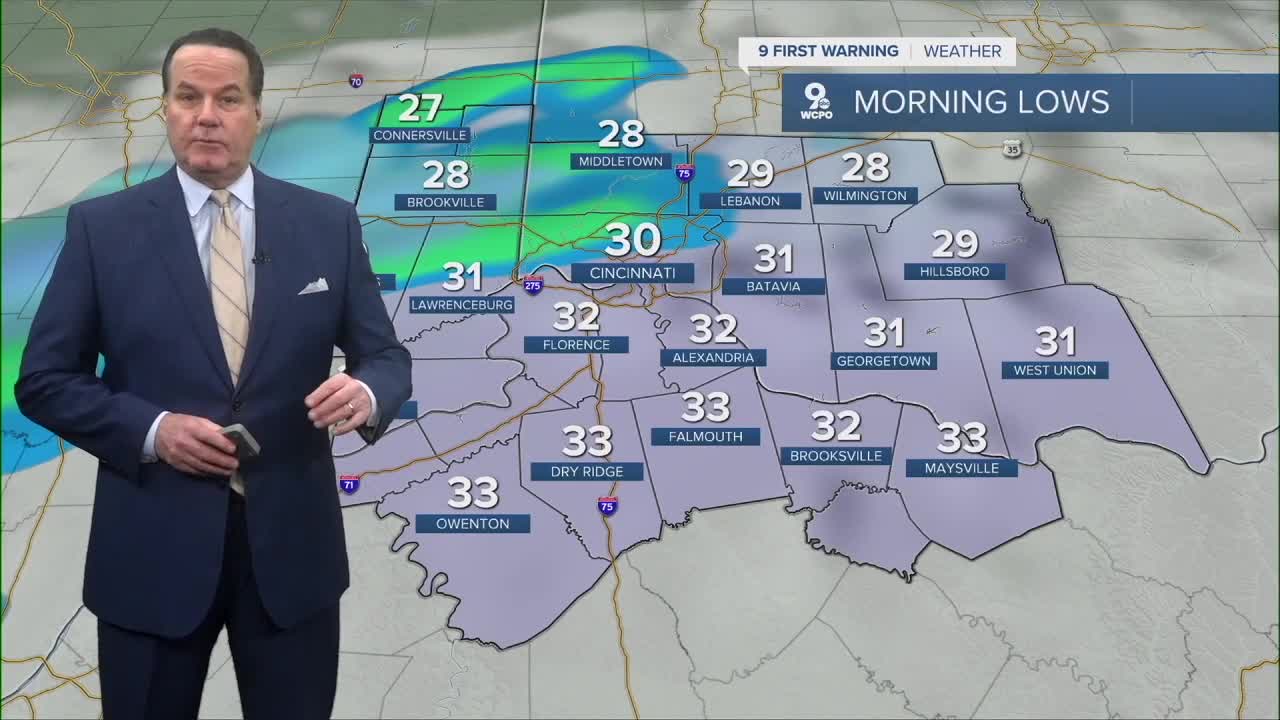


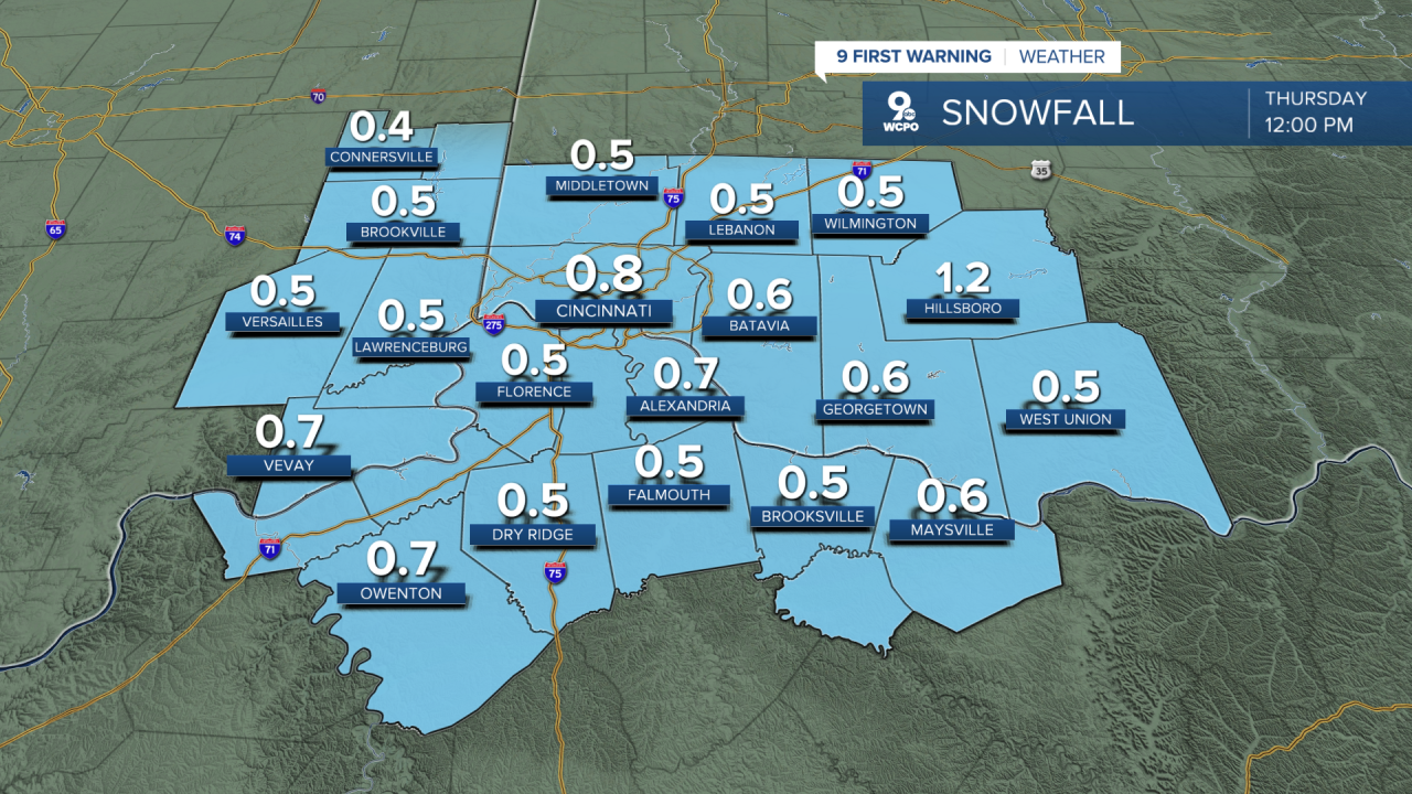
Tonight expect increasing clouds as a weak, fast-moving disturbance approaches from the west, with a slight chance of snow developing late (after about 3 AM) as temperatures settle near the lower 30s and winds go light. The main point to watch is Thursday morning: The chance of snow hits mainly around the pre-dawn into early-morning, with chances in the 30% range and any accumulation generally less than a half inch.

In plain terms: a few light snow showers/flurries are most likely around daybreak, and if you see a quick coating on colder surfaces, it should be spotty and short-lived. I believe the road impacts look limited given guidance pointing to road temperatures in the mid/upper 30s and surface temps near or just above freezing for much of the area.
As for accumulation, most totals likely an 1/2” , some areas could see a bit more. This is very similar to what we went through earlier this week. Overall, this is more in the “nuisance flakes” category.
Skies trend mostly cloudy early Thursday, then gradually brighten later in the day with highs near the mid to upper 40s. Thursday night turns mostly clear and colder.
Then, Friday and Saturday look like the weather equivalent of a high-five. We’ll see sunshine and a nice rebound with highs in the upper 50s to near, or past, 60 degrees.
By Saturday night, there’s a slight chance for a couple of showers.
Sunday cools back down under partial sun with highs in the 40s, and by Sunday night there’s another chance of a rain/snow mix returning.
In fact, Monday’s system looks like it may have a bit more punch, so stay by!
TONIGHT
A wintry mix develops overnight
Low: 30
THURSDAY
Early morning wintry mix
Turning mostly sunny in the afternoon
High: 46
THURSDAY NIGHT
Few clouds
Cool
Low: 28
9 First Warning Weather 24/7 Livestream
==========
- Interactive Radar: Track weather to your doorstep
- Sign up for severe weather email alerts
- Check latest school closings and delays
- WCPO traffic updates
- Metro bus detours and updates (or call the hotline at 513-632-7538)
- Latest power outages from Duke Energy
- Flight cancellations and delays from CVG, other U.S. airports
