


Let me set the scene....
Lightning in the distance, the rumble of thunder and then tiny ice pellets falling from the sky — and it didn't stop, coating the roads.

But what in the world was this precipitation type?
The ice pellets were very small. In some locations almost 1/2 inch of it coated the roads and cars. It almost had the appearance of graupel or sleet.
But this was definitely hail.
Why? Thunderstorms. There was a little bit of instability in Northern Kentucky. As the cell developed near CVG, the instability created lift in the atmosphere. That little upward motion caused the water droplets in the clouds to rise and freeze into tiny hail stones. The freezing level was much lower yesterday due to the fact that it was just a generally colder day.
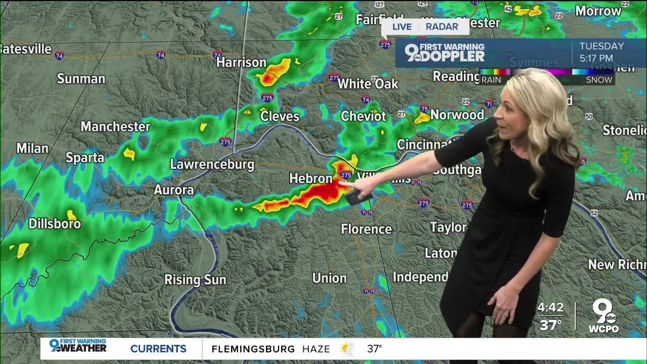
Here's a look at that thunderstorm:

I know, it didn't look like the larger hail stones that we are used to. It looked more like sleet.
But sleet forms differently. Sleet only forms when a cold layer of air at the surface causes a raindrop to fully freeze into an ice pellet before it hits the ground. It's all a downward motion. The same can be said for graupel.
If you look at the radar yesterday, the only reports of this frozen precipitation were in Boone and Kenton County around the lightning strikes. There were other downpours north of the river but without the upward motion from the thunderstorm, no hail formed, which helps confirm this was indeed hail and not sleet or graupel.


