


It's a 9 FIRST WEATHER WEATHER ALERT DAY
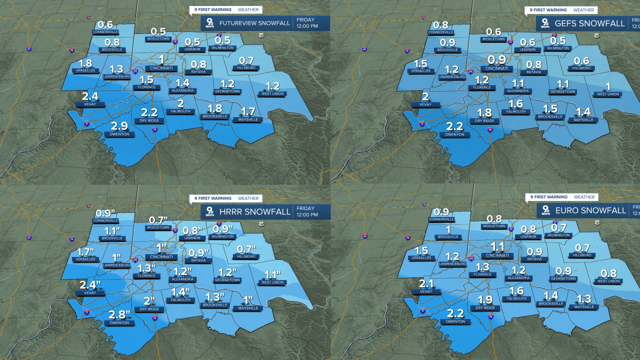
Better news heading into the morning, all the computer forecasts are slightly dropping our amounts for the morning. I'm now seeing a 1"-3" snow as the storm has taken a southerly dip.
This still means that most will see 2"-3" on the ground by 7 a.m. If we see 4" of snow, it would definitely be southwest of the Greater Cincinnati area and likely near Owenton.
The snow will mainly be done by no later than 9 am, but we will see a few flurries and mostly cloudy skies for the rest of the day. Highs will make it to the low 30s.
Round 2 sets up on Saturday for another snowstorm for the Tri-State. Early indications show more snow with this next system, but again, it depends on the track of the storm. At the moment, it does appear to show significantly more snow than the one right now.
Finally, the deep freeze is the big story by Saturday night. As skies clear out, arctic cold air will send the overnight lows plummeting into Sunday morning. It's single digits for the morning with only teens in the afternoon, making the Bengals game brutally cold.
0VERNIGHT
Snow develops
1"-3" snow total by daybreak
Low: 25
FRIDAY
AM Snow
Then Cloudy
High: 34
FRIDAY NIGHT
Mostly cloudy
Low: 25
9 First Warning Weather 24/7 Livestream
==========
- Interactive Radar: Track weather to your doorstep
- Sign up for severe weather email alerts
- Check latest school closings and delays
- WCPO traffic updates
- Metro bus detours and updates (or call the hotline at 513-632-7538)
- Latest power outages from Duke Energy
- Flight cancellations and delays from CVG, other U.S. airports
