


Today is a 9 FIRST WARNING WEATHER ALERT DAY. A Winter Weather Advisory is in effect for portions of the Tri-State tonight in anticipation of snow and a wintry mix that moves in this evening.

Here is the timeline:
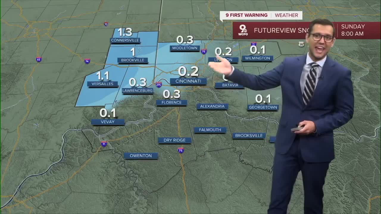
Saturday night into Sunday:
Some accumulating snow of 1+ inches is possible for our far northern counties. Areas across southeast Indiana can expect anything from a light coating to two inches. Less than an inch is possible for Cincinnati and points south and east. The rest of the area, especially Northern Kentucky, will see mainly rain with a few pockets of wintry mix.


Sunday:
Rain may linger through the morning as temperatures start above freezing. Once the cold front moves through, temperatures fall through the afternoon, which sets us up for a windy and cold end to the weekend.

Cold air sticks around as we kick off meteorological winter on Monday. Another chance for accumulating snow moves in Monday night into Tuesday, and highs stay locked in the mid-thirties through much of next week.

TONIGHT
Rain/snow mix
Breezy
Low: 32
SUNDAY
Lingering showers early
Cold & breezy
Highs: 38
SUNDAY NIGHT
Drying out
Colder
Low: 25
9 First Warning Weather 24/7 Livestream
==========
- Interactive Radar: Track weather to your doorstep
- Sign up for severe weather email alerts
- Check latest school closings and delays
- WCPO traffic updates
- Metro bus detours and updates (or call the hotline at 513-632-7538)
- Latest power outages from Duke Energy
- Flight cancellations and delays from CVG, other U.S. airports
