


HEADLINES
- Heavy accumulating snowfall will end overnight before daybreak
- High winds gusts will continue through Friday and actually get stronger midday
- Low visibility conditions
- Dangerous wind chills down to -35 degrees by daybreak
SNOWFALL EXPECTED
1"-2" of snow has fallen already and couple of inches is possible. Most areas will wake up to 2"-4" of snow

TIMELINE
- Now to 4 a.m. - Snow ending, winds continue to produce blowing and drifting snow, difficult travel, dangerous wind chills
- 4 a.m. to 9 a.m. - Difficult travel continues, wind chills drop to -35. Travel still NOT advised
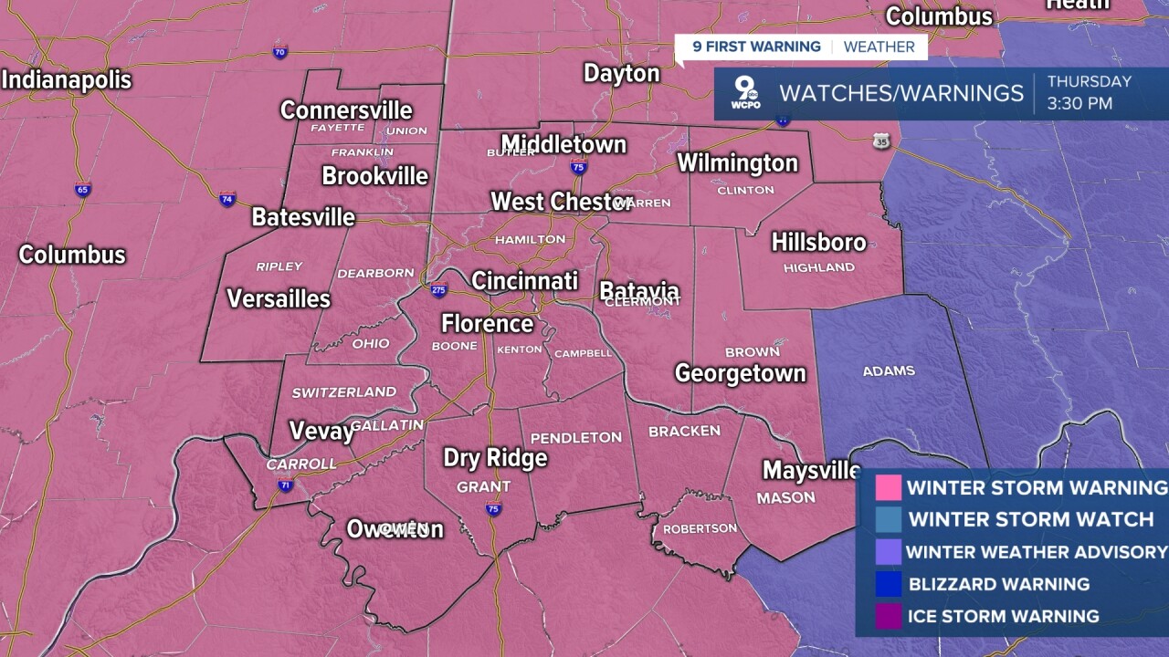
WARNINGS/ADVISORIES
A Winter Storm Warning has been issued across the Tri-State until 5 p.m. Friday. The combination of heavy snow and high winds could lead to very low visibility, if not white-out conditions. Travel will become incredibly difficult Thursday night.
The NWS has also issued a Wind Chill Warning from 1 a.m. Friday to 4 a.m. Saturday for the entire Tri-State. Wind chills will drop to -35 at times.
THURSDAY NIGHT
Heavy snow, low visibility
Highs winds and damage possible
Low: 0
FRIDAY
Brutally cold air, overcast
Wind chills down to -35
High: 5
FRIDAY NIGHT
Very cold
Dangerous cold wind chills continue
Low: 2
9 First Warning Weather 24/7 Livestream
==========
- Interactive Radar: Track weather to your doorstep
- Sign up for severe weather email alerts
- Check latest school closings and delays
- WCPO traffic updates
- Metro bus detours and updates (or call the hotline at 513-632-7538)
- Latest power outages from Duke Energy
- Flight cancellations and delays from CVG, other U.S. airports
