

Quiet conditions this evening will gradually transition to a more active weather pattern overnight. Clouds will increase through the night as low pressure approaches from the west. Temperatures will remain mild for February, with overnight lows holding in the 40s under increasing southerly flow.
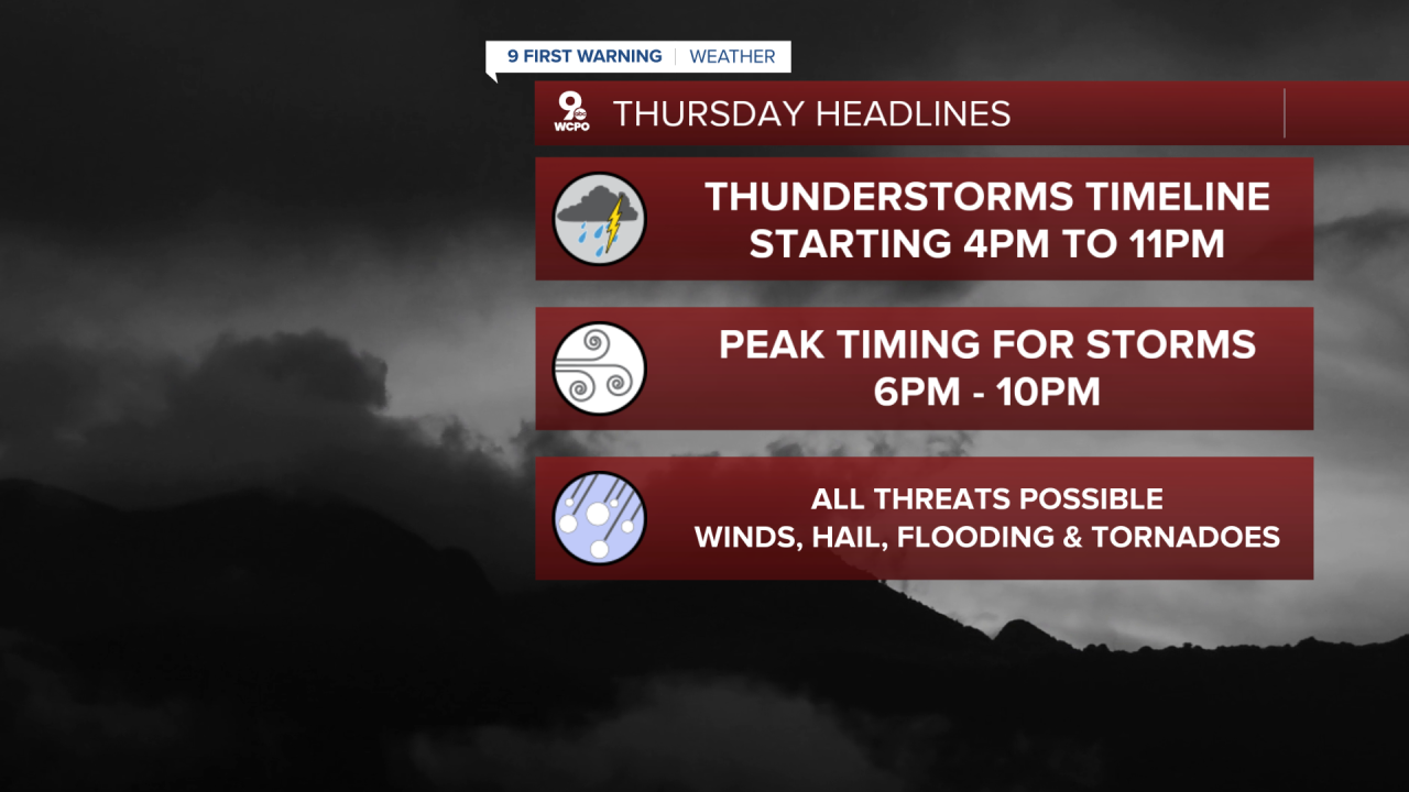
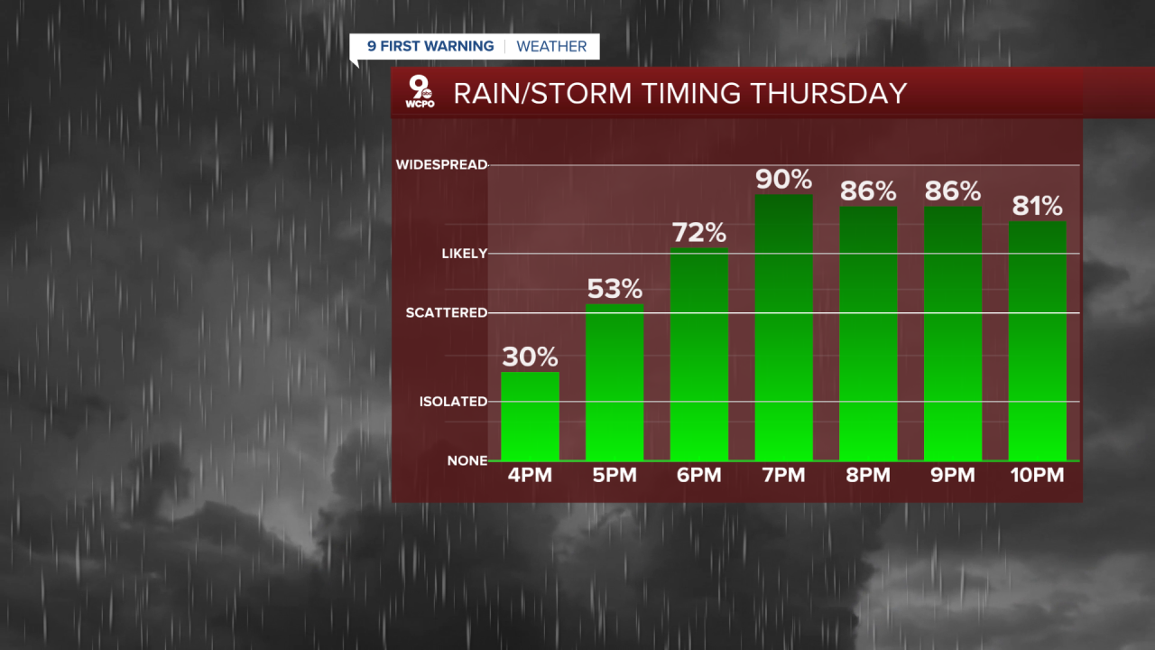
On Thursday, rain chances increase through the afternoon as moisture deepens across the area. Showers are expected to become more widespread by late afternoon, with thunderstorms developing into the evening and overnight hours. The Storm Prediction Center has outlined the region in a slight risk for severe weather, indicating scattered strong storms are possible.
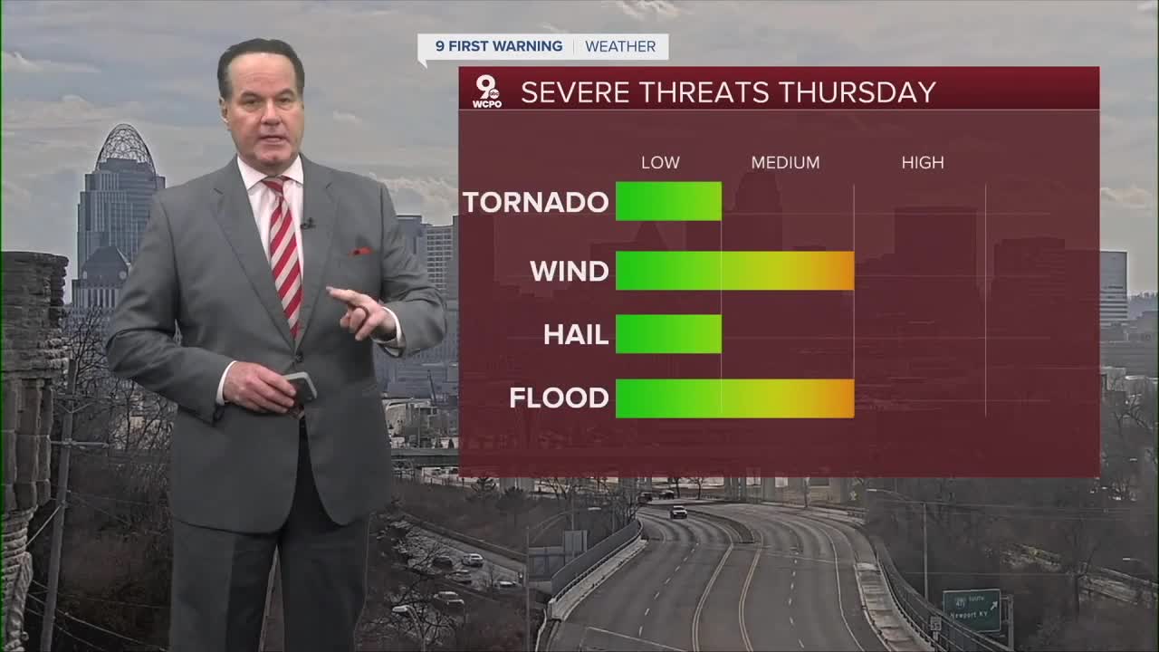
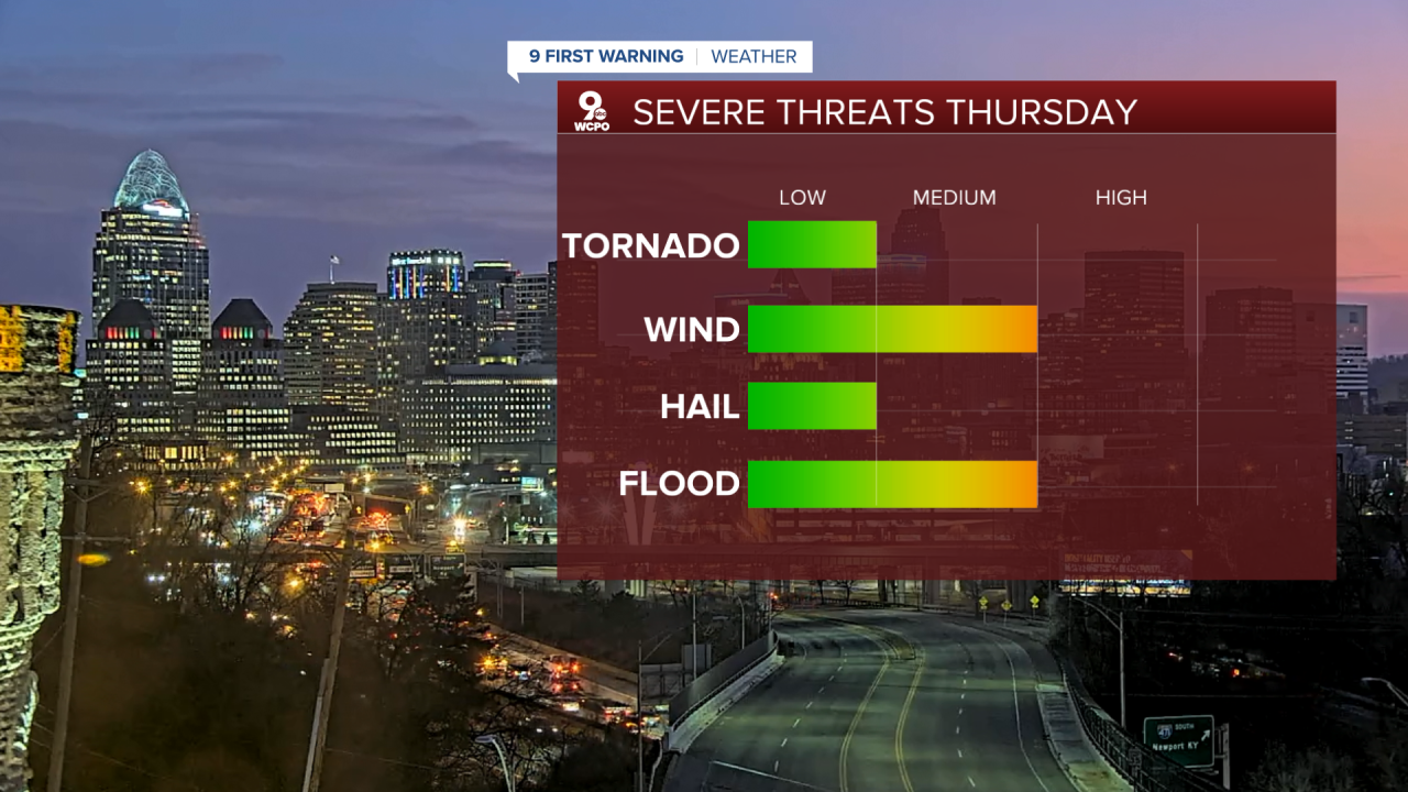
The primary concern Thursday evening into the night will be gusty winds with stronger thunderstorms. Some storms may produce locally heavy rainfall, which could lead to brief ponding on roadways and minor flooding in low-lying areas. While widespread flooding is not likely, repeated rounds of rain may cause this minor flooding. Small hail is possible, but large hail isn’t likely. An isolated tornado cannot be ruled out. However, the overall tornado threat remains limited.
Rain and embedded thunderstorms will continue overnight Thursday, tapering toward Friday morning as the system shifts east. By daybreak Friday, showers should begin diminishing, though lingering clouds and damp conditions are likely. Temperatures on Friday morning will remain mild, generally in the upper 40s to near 50 degrees.
If that wasn’t enough, colder air this weekend will push temperatures below average into the 30s by Sunday. That’s when the chance for snow showers is back in the forecast. This is mainly just nuisance snow.
TONIGHT
Clouding up
Warm
Low: 50
THURSDAY
Chance showers early
Mostly cloudy
High: 66
THURSDAY NIGHT
Strong to severe storms
Cloudy
Low: 45
9 First Warning Weather 24/7 Livestream
==========
- Interactive Radar: Track weather to your doorstep
- Sign up for severe weather email alerts
- Check latest school closings and delays
- WCPO traffic updates
- Metro bus detours and updates (or call the hotline at 513-632-7538)
- Latest power outages from Duke Energy
- Flight cancellations and delays from CVG, other U.S. airports
