


After torrential rain around the Tri-State, the weather is clearing out as we head toward daybreak. Morning lows will be warmer in the low 70s.
The heat and humidity will start to increase on Wednesday and will creep up a bit more by the end of the week. It does appear chances for rain will be small, running only around 30% and we should stay dry on Thursday.
By Friday, the heat and humidity will build up enough where pop-up storms are possible once again. On the upside, the heat index won't be as severe as the last couple of weeks. It'll feel like the lower 90s into the weekend.
OVERNIGHT
Gradual clearing
Low: 67
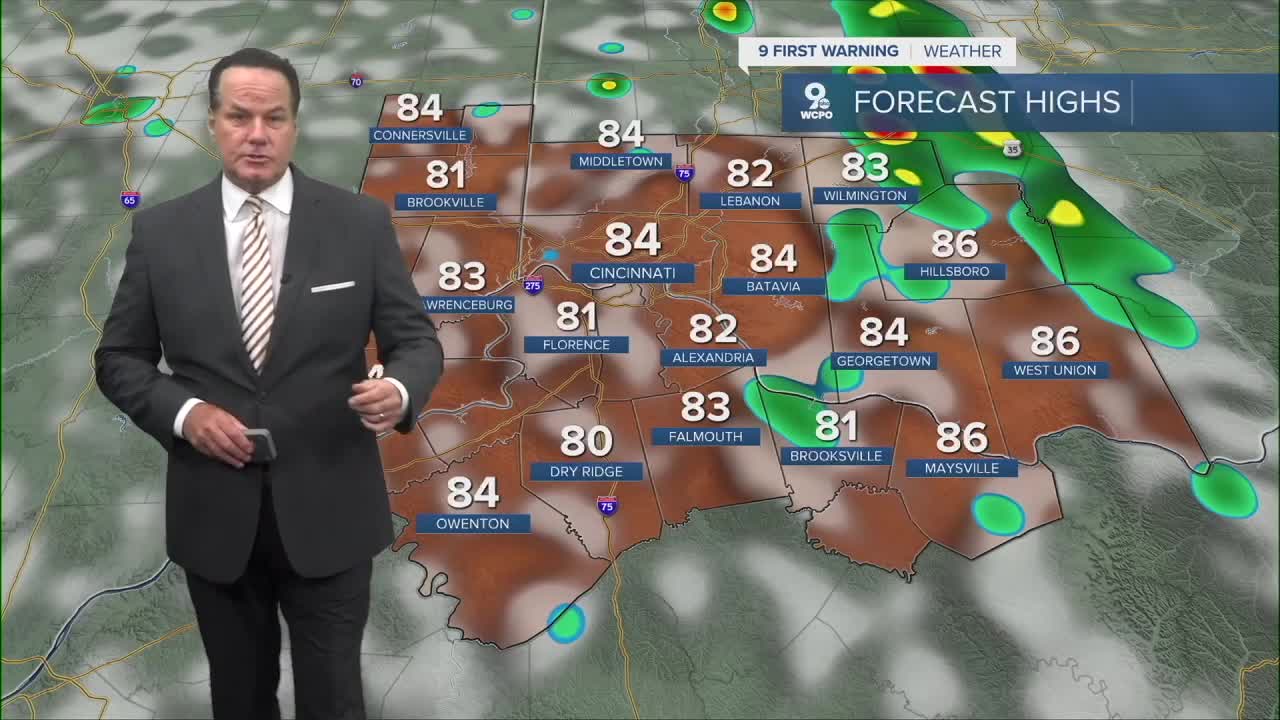
WEDNESDAY
Mostly sunny
Slight rain chance
High: 84
WEDNESDAY NIGHT
Partly cloudy
Mild
Low: 66
9 First Warning Weather 24/7 Livestream
==========
- Interactive Radar: Track weather to your doorstep
- Sign up for severe weather email alerts
- Check latest school closings and delays
- WCPO traffic updates
- Metro bus detours and updates (or call the hotline at 513-632-7538)
- Latest power outages from Duke Energy
- Flight cancellations and delays from CVG, other U.S. airports
