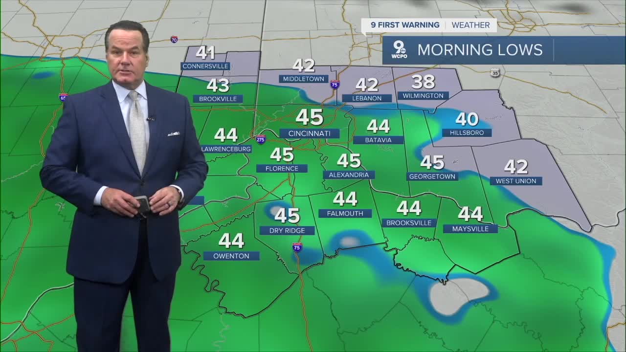


An overall cloudy day as we head into a wet day for Wednesday. In fact, a few showers will develop heading to daybreak with lows falling to the low to mid 40s. Showers will taper off by mid-morning before a wave of heavy rain moves in for the afternoon.
Heavy rain that could cause a flood advisory will move in by 3-4 p.m. This will continue through the ride home and into the early evening.
The wet weather doesn't end there and continues into Thursday. Two areas of low pressure will merge and become a strong area of low pressure. The stronger system will track over the top of the Tri-State, which will mean rainfall totals will be impressive. Most areas will see around an inch of rain, and some spots will make it to an inch and a half.

Another element will be the winds. We'll see gusts to 20mph, at times. With afternoon highs only reaching near the 50-degree mark, it will feel even cooler. Frankly, it'll be a raw day. Here's the good news: we dry out in time for Halloween. The Trick or Treat forecast looks fine for the kiddos.

There's a slight chance for a passing shower with mostly cloudy skies on Saturday. Right now, our Sunday forecast looks partly cloudy. Both days will see highs in the mid-50s. So, the Bengals game looks good, and the FC Cincinnati match looks fine in Columbus as well.
OVERNIGHT
Isolated showers possible
Overcast
Low: 45
WEDNESDAY
Rain, gusty winds
Heavy at times
High: 50
WEDNESDAY NIGHT
Rain continues
Cloudy, cool
Low: 44
9 First Warning Weather 24/7 Livestream
==========
- Interactive Radar: Track weather to your doorstep
- Sign up for severe weather email alerts
- Check latest school closings and delays
- WCPO traffic updates
- Metro bus detours and updates (or call the hotline at 513-632-7538)
- Latest power outages from Duke Energy
- Flight cancellations and delays from CVG, other U.S. airports
