


The weather pattern change has finally happened and Tuesday's weather will be quite pleasant as a result. However, it doesn't last long. In the meantime, the radar is quiet after the severe weather from Sunday night.

High pressure over the Great Lakes continues to produce winds out of the northeast which are drier and more comfortable. These seasonal conditions will hang on through Wednesday midday before the warm, moist air returns and our conditions creep back to that "air you can wear".
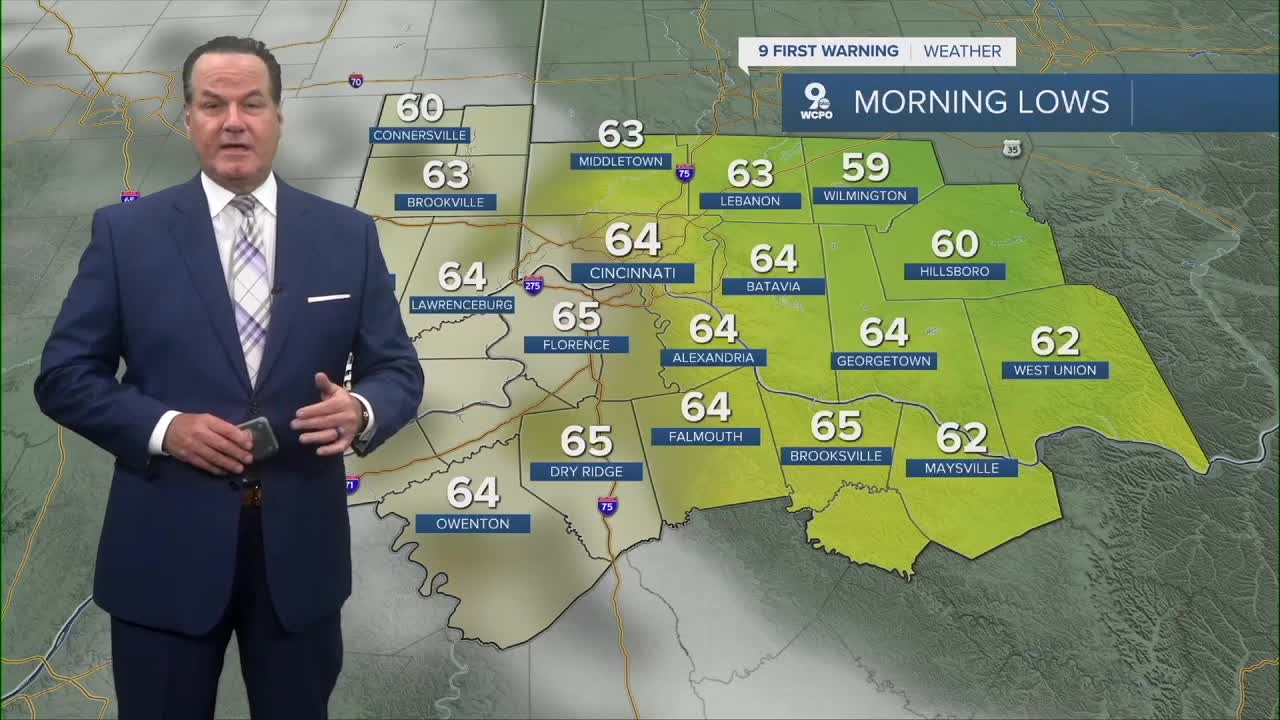
Tuesday morning temps will begin in the low to mid 60s making for great start to the day and the afternoon highs,while July hot, will make for a wonderful pool day or perhaps a nice trip to the zoo. By Thursday, we are back to the ugly conditions from the last couple of weeks. This will mean "feels-like" temps in the mid to upper 90s as the heat and dewpoints rise to uncomfortable levels.
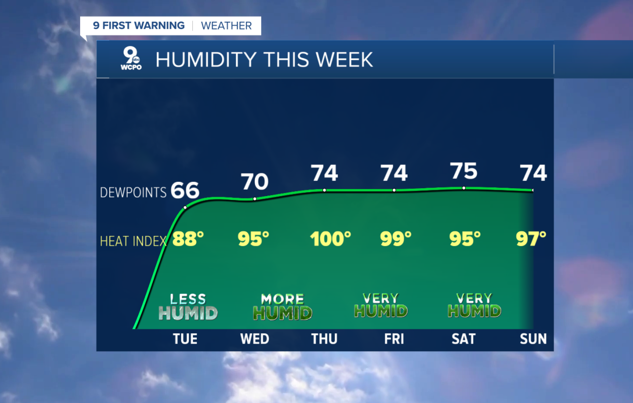
By Friday and into the weekend, there will be good chances for rain and storms again.
OVERNIGHT
Mostly clear
Pleasant
Low: 64
TUESDAY
Mostly sunny
Not as humid
High: 86
TUESDAY NIGHT
Mostly clear
Warm
Low: 65
- Interactive Radar: Track weather to your doorstep
- Sign up for severe weather email alerts
- Check latest school closings and delays
- WCPO traffic updates
- Metro bus detours and updates (or call the hotline at 513-632-7538)
- Latest power outages from Duke Energy
- Flight cancellations and delays from CVG, other U.S. airports
