


Rain chances will continue this weekend.
We got some good downpours and storms around four this afternoon but overall it was in and out pretty quick for most of us.
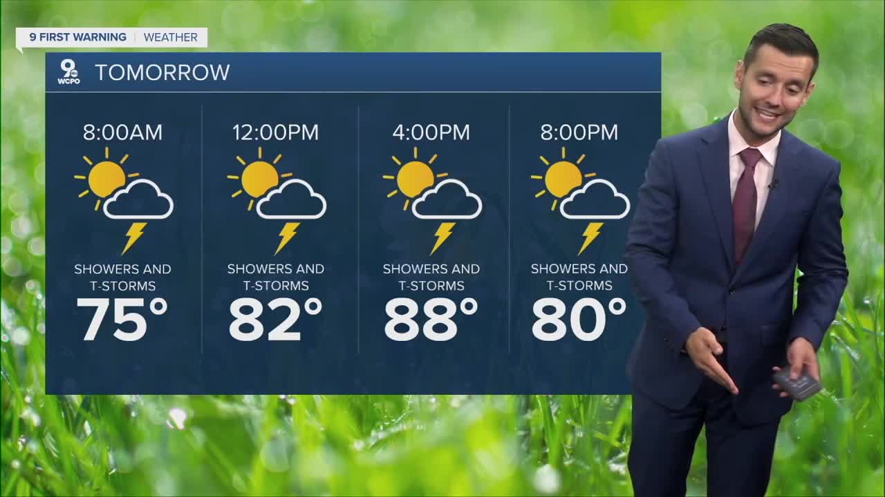
Sunday’s rain chances look a bit lower during the day, but don’t let your guard down for a late round of showers and storms after sunset. Isolated storms are still possible, and any storm that develops could bring brief, heavy rain. We’re still under a Marginal Risk for severe weather. Hot and muggy with temperatures near 90.
Looking ahead to early next week, expect drier and hotter conditions by Tuesday and Wednesday.
TONIGHT
Mostly cloudy
Slight chance
Low: 72
SUNDAY
Isolated storms
Still hot
High: 88
MONDAY
Scattered rain
Muggy
High: 86
9 First Warning Weather 24/7 Livestream
==========
- Interactive Radar: Track weather to your doorstep
- Sign up for severe weather email alerts
- Check latest school closings and delays
- WCPO traffic updates
- Metro bus detours and updates (or call the hotline at 513-632-7538)
- Latest power outages from Duke Energy
- Flight cancellations and delays from CVG, other U.S. airports
