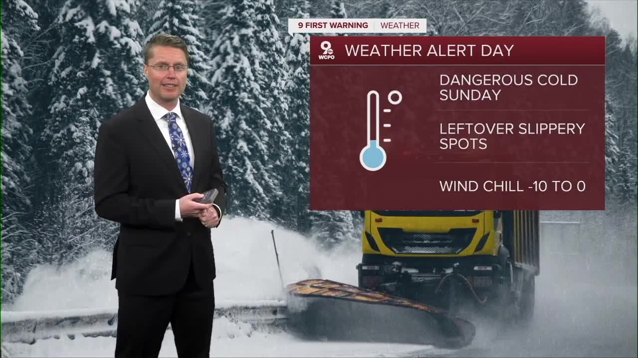


IT IS A 9 FIRST WARNING WEATHER ALERT DAY
Behind Saturday's snow, a powerful arctic blast settles into the Ohio Valley. Sunday morning will bring “feels-like” temperatures below zero, thanks to extremely cold air. During the Bengals game, air temperatures will struggle to hit the teens, even with mostly sunny skies. Wind chills will range from -10 to 0 most of the day, which is why another Weather Alert Day has been issued for Sunday.

The entire Tri-State is under a Cold Weather Advisory through Monday morning.

If you’re heading to the stadium, be prepared for dangerous cold. Limit time with skin exposed, wear multiple layers, cover your hands, face and ears, and take breaks indoors when possible. Frostbite can begin in minutes under these conditions, so caution is essential for anyone spending time outside.
The kids will need bundled up heading to school Monday as temperatures drop down into the low single digits. In the afternoon, it will be mostly sunny with mid 20s.
Tuesday starts in the teens, and then we warm up ABOVE FREEZING, into the upper 30s with a lot of sunshine.
We get back to average Wednesday afternoon with mid 40s and a few more clouds.
Thursday looks like the warmest day of the week with low 50s, but rain looks likely during the day.
We drop into the 40s for next weekend with at least a slight chance for rain Saturday and Sunday.
SUNDAY MORNING
Clearing skies
Messy travel
Low: 2
SUNDAY
Mostly sunny
Bitterly cold
High: 12
SUNDAY NIGHT
Mostly clear
Dangerous cold
Low: 2
MONDAY
Mostly sunny
Not as frigid
High: 26
9 First Warning Weather 24/7 Livestream
==========
- Interactive Radar: Track weather to your doorstep
- Sign up for severe weather email alerts
- Check latest school closings and delays
- WCPO traffic updates
- Metro bus detours and updates (or call the hotline at 513-632-7538)
- Latest power outages from Duke Energy
- Flight cancellations and delays from CVG, other U.S. airports
