



CINCINNATI — For the Tri-State, we’re staying unsettled and stormy through the end of the workweek, with the biggest concern being repeated rounds of rain that could lead to flooding. The Flood Watch remains in effect through 11 PM Wednesday, and another quarter to half-inch of rain is possible. Showers and thunderstorms are possible just ahead of daybreak, with temps holding near 70.

Wednesday starts wet, with showers and thunderstorms in the morning and mainly before early afternoon. Temperatures climb into the upper 80s, and another quarter to half-inch of rain could fall. After that, there may be a break for a time, but another round or two develops, and it’ll be more scattered into Wednesday late afternoon and into Wednesday night.

The exact timing and placement remain uncertain, but if storms return, flooding could again be a concern, along with a low-end risk for damaging winds. Wednesday night stays mostly cloudy, with showers and thunderstorms likely at times and lows around 70.

By the afternoon, we'll see more scattered storms, and a SLIGHT/MARGINAL RISK (category 1 out of 5) for severe weather is possible, according to the Storm Prediction Center.
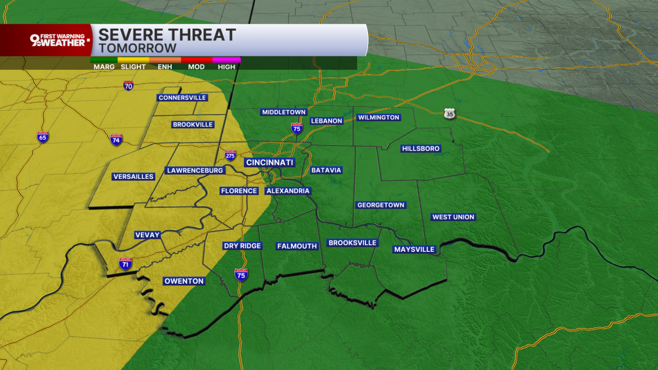

Thursday keeps the wet pattern going. There’s a chance of storms early, followed by periods of showers through the day and possibly another thunderstorm. Highs reach the mid-80s, with another quarter to half-inch possible. Thursday night looks especially wet, with showers and possibly a thunderstorm and another half-inch to three-quarters of an inch possible. However, the wet weather will be scattered or even isolated.
Friday remains unsettled, with showers likely and thunderstorms possible during the afternoon. Highs stay in the mid-80s. Rain chances decrease Friday night, and the weekend trend is toward drying. Saturday should be mostly sunny near the mid-80s, followed by a sunny Sunday near 90. A few showers could return Sunday night, but overall, the weekend looks less active than the days before it
TONIGHT
Mostly cloudy
Scattered rain & storms
Low: 70
WEDNESDAY
Scattered storms
A few stronger storms
High: 86
WEDNESDAY NIGHT
Scattered rain
Still muggy
Low: 70
9 First Warning Weather 24/7 Livestream
==========
- Interactive Radar: Track weather to your doorstep
- Sign up for severe weather email alerts
- Check latest school closings and delays
- WCPO traffic updates
- Metro bus detours and updates (or call the hotline at 513-632-7538)
- Latest power outages from Duke Energy
- Flight cancellations and delays from CVG, other U.S. airports
