


At this point, we will see an occasional snow shower overnight. Then, we'll see a few flurries through Saturday morning. Morning lows will fall to the upper teens and low 20s by daybreak.
Mostly cloudy skies will hang around for Saturday until late in the day when we could see a few peeks of sunshine as we begin to clear out. Afternoon highs will reach the upper 20s.

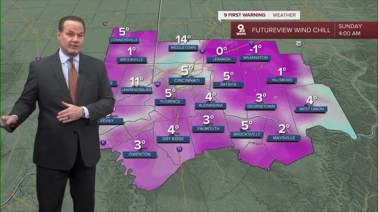
Saturday conditions will gradually clear into Sunday's daybreak and this will allow the temps to really drop. Lows will fall to the teens with a feels like temps in the single digits.
Nevertheless, Sunday's highs will finally break the freezing mark for the first time in 8 days! Enjoy the break as another arctic cold front moves in on Monday. There's a chance for snowshowers or flurries and we'll definitely see arctic cold air dropping the highs to the teens and the lows to the single digits.
OVERNIGHT
Snow ends
Chance snow showers
Low: 20
SATURDAY
Mostly cloudy
Chilly
High: 29
SATURDAY NIGHT
Clearing out
Colder
Low: 13
SUNDAY
Mostly Sunny
Dry and cold
High: 34
9 First Warning Weather 24/7 Livestream
==========
- Interactive Radar: Track weather to your doorstep
- Sign up for severe weather email alerts
- Check latest school closings and delays
- WCPO traffic updates
- Metro bus detours and updates (or call the hotline at 513-632-7538)
- Latest power outages from Duke Energy
- Flight cancellations and delays from CVG, other U.S. airports
