


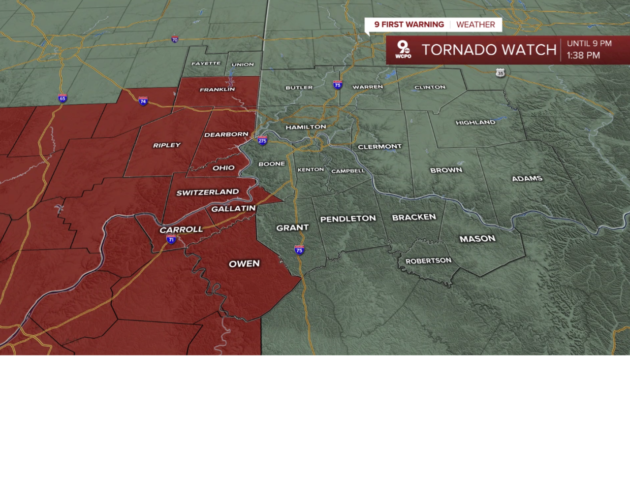
A Tornado Watch is in effect until 11 p.m. for multiple counties, including:
- Dearborn County IN
- Fayette County IN
- Franklin County IN
- Ohio County IN
- Ripley County IN
- Switzerland County IN
- Union County IN
- Butler County OH
- Clinton County OH
- Warren County OH
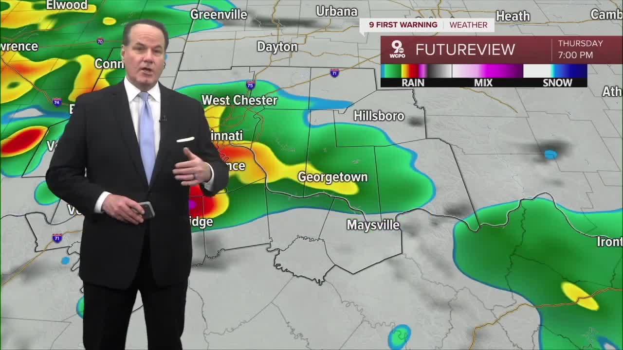
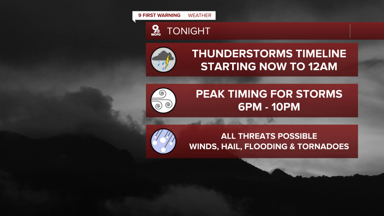
Scattered thunderstorms will develop throughout the Tri-State tonight. Here's your timeline:
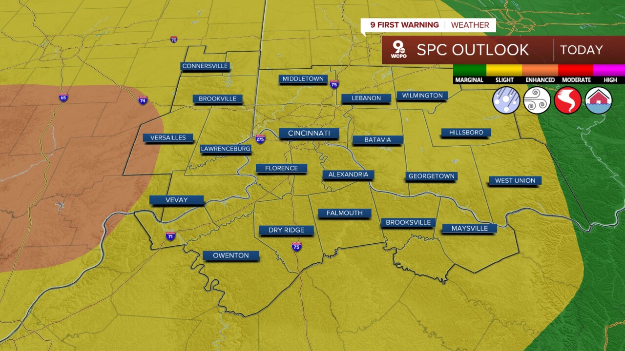
The Storm Prediction Center has our area in a "slight risk" of severe storms. That's why today is a 9 First Warning Weather Alert Day. An "enhanced risk" has been added to our very western locations.
We'll basically stay in the upper 40s for most of Friday's forecast. It's also going to be quite windy tomorrow. Winds will be coming in from the southwest at 20 mph. The sky will be mostly sunny.
Then the weekend brings back cooler air. Saturday will be partly cloudy with a high of 47. But then Sunday turns even colder with a high of 37 degrees.
There have been some rumors of snow "you could shovel" on Sunday. There is a chance of some light snow on Sunday; this will be a minor event for us. And especially with the warm air we've experienced, most of this will melt as it hits the ground. This is a nuisance snow with a dusting possible.
TONIGHT
Storms fade
Temperatures cool off
Low: 48
FRIDAY
Near steady temps in the upper 40s
Windy and mostly sunny
High: 49
FRIDAY NIGHT
Mostly clear
Cooler
Low: 31
9 First Warning Weather 24/7 Livestream
==========
- Interactive Radar: Track weather to your doorstep
- Sign up for severe weather email alerts
- Check latest school closings and delays
- WCPO traffic updates
- Metro bus detours and updates (or call the hotline at 513-632-7538)
- Latest power outages from Duke Energy
- Flight cancellations and delays from CVG, other U.S. airports
