


An extreme heat warning is in effect again for the Tri-State as the heat and humidity continue to dominate the forecast.

It's another 9 First Warning Weather Alert Day.
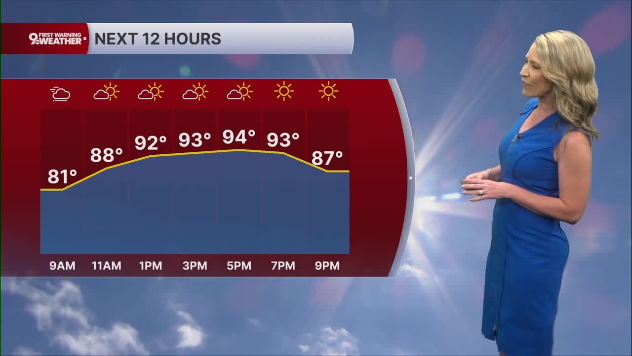
The sky will be hazy this morning and it feels very muggy outside. Areas of river valley fog will form as well. The sky will be mostly sunny throughout the rest of the day as temperatures rise to the mid 90s. The heat index will range from 101-105 across our area.
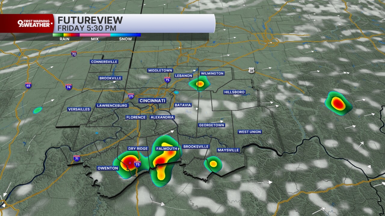
The extreme heat warning has now been extended to include Friday's forecast as well, and for a good reason. Temperatures will still top out around 93 degrees and the heat index will range from 100-105 degrees.
The only real difference in Friday's forecast is the potential for rainfall. We'll see pop-up storms developing in the peak heat of the afternoon. This activity will be isolated, so don't count on rain everywhere. But for those who do get rain, get ready for a downpour. Storms will barely move when they do form. There's a marginal risk for severe storms as well with damaging wind gusts being the only concern.
Storms fade late in the evening and it will be mostly clear again overnight but still incredibly muggy. We'll only cool to 72.
The Fourth of July is finally here on Saturday and it will be another hot and humid day. The high of 92 will still feel like 100 to 103 degrees. We will see a better chance for showers and storms in the afternoon hours as the ridge of high pressure finally breaks down and weakens. Scattered storms look likely after 2 p.m. and up through sunset. Obviously, this could pose a problem for area fireworks displays. Storms will eventually fade, but isolated storms could linger well through 11 p.m.


MORNING RUSH
Hazy, areas of fog
Very muggy
Low: 75
THURSDAY
Mostly sunny
Hot, humid and hazy
High: 94
THURSDAY NIGHT
Few clouds
Very muggy
Low: 75
FRIDAY
Mostly sunny
Isolated afternoon storms
High: 93
FRIDAY NIGHT
Few clouds
Still very muggy
Low: 72
9 First Warning Weather 24/7 Livestream
==========
- Interactive Radar: Track weather to your doorstep
- Sign up for severe weather email alerts
- Check latest school closings and delays
- WCPO traffic updates
- Metro bus detours and updates (or call the hotline at 513-632-7538)
- Latest power outages from Duke Energy
- Flight cancellations and delays from CVG, other U.S. airports
