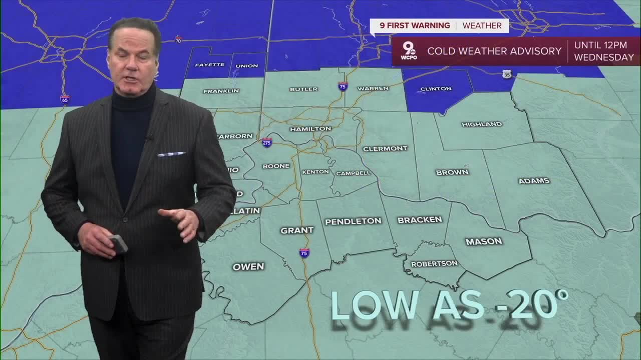


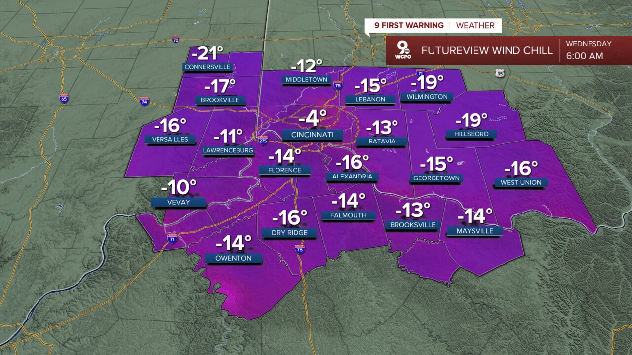
We continue on this stretch of very cold winter weather, with the most intense conditions arriving early Wednesday morning. Temperatures are expected to drop below zero, and when wind is added in, it may feel closer to 20 degrees below zero in some areas. That's why we have a COLD WEATHER ADVISORY out for the Tri-State. Plus, we could see flurries through the early evening.
This level of cold can be dangerous if you’re not dressed properly, so it’s important to bundle up with heavy coats, gloves, hats, and scarves if you’re heading outside. Even short periods of exposure can be uncomfortable and unsafe without the right clothing.
The arctic cold doesn’t let up much for the rest of the week. Afternoon highs will only climb into the teens, which is well below what’s typical for this time of year. Our average high is 40 degrees. Nights will remain bitterly cold, staying below zero, which can lead to frozen pipes and make it important to keep pets indoors. While sunshine may appear at times, it won’t do much to warm things up.

By the weekend, temperatures remain firmly in winter mode, with highs still in the teens or low 20s and overnight lows continuing near zero. While winds may calm at times, the cold air itself will still feel harsh, especially during early mornings and evenings.
OVERNIGHT
Partly cloudy
Feels like -10 to -20
Low: -4
WEDNESDAY
Morning sun
Afternoon clouds
A few flurries
High: 16
WEDNESDAY NIGHT
Partly cloudy
Bitterly cold again
Low: -1
9 First Warning Weather 24/7 Livestream
==========
- Interactive Radar: Track weather to your doorstep
- Sign up for severe weather email alerts
- Check latest school closings and delays
- WCPO traffic updates
- Metro bus detours and updates (or call the hotline at 513-632-7538)
- Latest power outages from Duke Energy
- Flight cancellations and delays from CVG, other U.S. airports
