


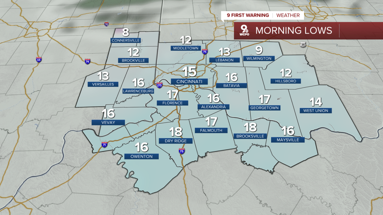
Leftover flurries diminish overnight and a transition to mostly cloudy skies with temperatures dropping into the teens.
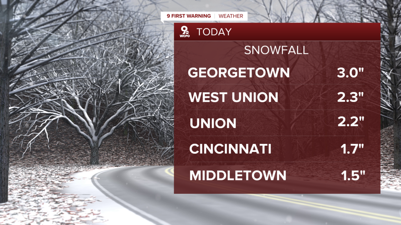
Roads may remain slick in spots overnight in the wake of the snow, while some flurries may persist, we'll generally see cold and quiet conditions through the morning.
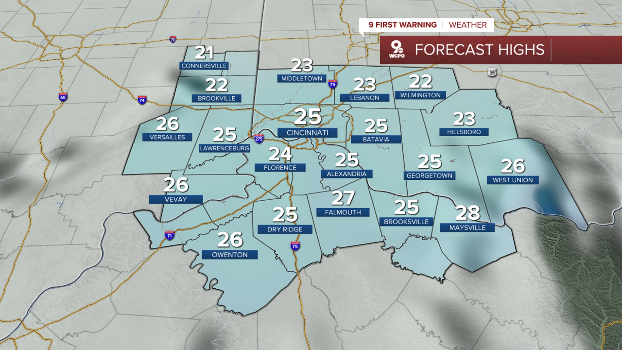
Wednesday will be cold and mostly dry, with partly sunny skies and highs well below normal for early February. High temperatures will struggle in the mid-20s, and overnight lows will fall into the single digits, reinforcing the cold air mass in place. Frigid conditions will persist through midweek, and wind chills may make it feel considerably colder.
By Thursday, skies will remain mostly cloudy with very cold highs in the low 20s, and overnight temperatures around the teens. Late in the day, clouds will thicken ahead of another system approaching the Tri-State. But right now it's looking like just a 30% chance for light snow on Friday.
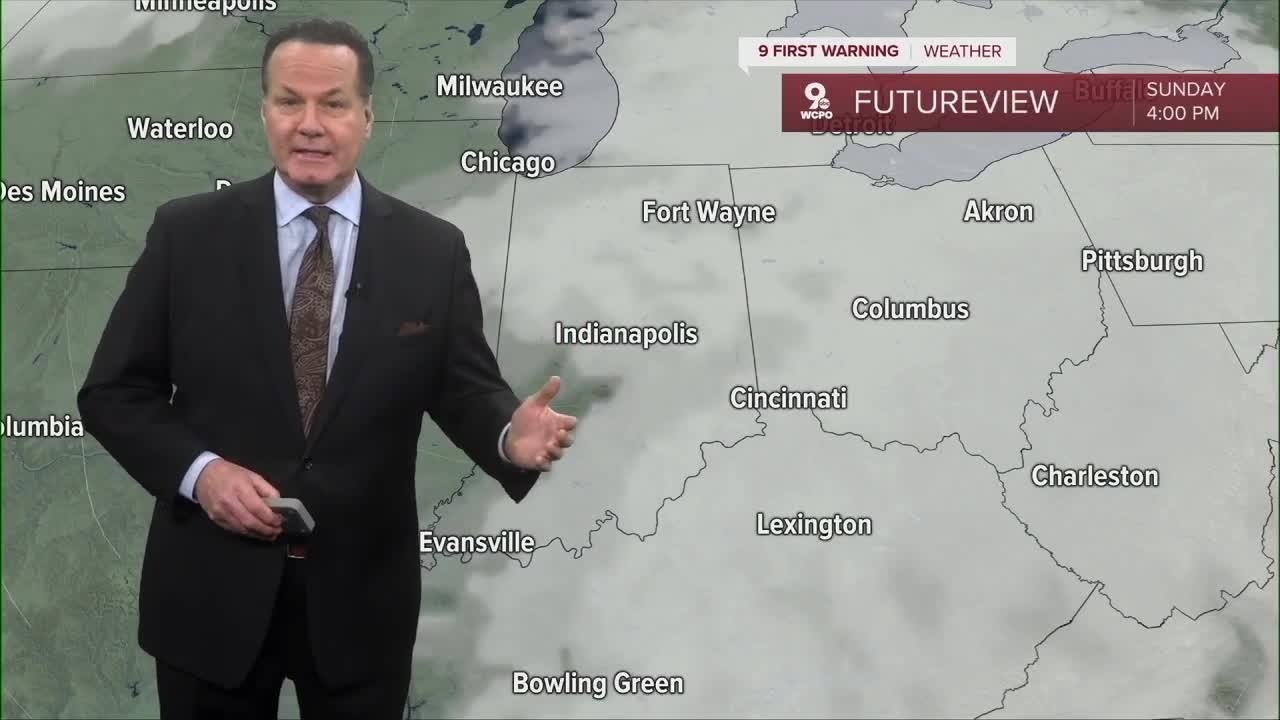
Looking toward the weekend, the forecast models indicate a chance for snow, but at the moment, we don't have total model unity. This means check back as the week continues.
OVERNIGHT
Mostly cloudy
Colder
Low: 15
WEDNESDAY
Partly cloudy
Feels like the mid to upper teens
High: 27
WEDNESDAY NIGHT
Few clouds
Colder
Low: 9
9 First Warning Weather 24/7 Livestream
==========
- Interactive Radar: Track weather to your doorstep
- Sign up for severe weather email alerts
- Check latest school closings and delays
- WCPO traffic updates
- Metro bus detours and updates (or call the hotline at 513-632-7538)
- Latest power outages from Duke Energy
- Flight cancellations and delays from CVG, other U.S. airports
