


There were two separate tornadoes confirmed on Sunday evening in the Tri-State.
The first was just north of Mount Orab, Ohio along HWY-68 in Brown County. The second was near Allensburg, Ohio near HWY-50 in Highland County.
The evolution of radar over the years has made the determination of what is happening in a storm a lot easier. Dual pol radar allows us to scan the storms not only horizontally, but also vertically to get an understanding and a picture of what is actually going on within the storm.
Here is a breakdown of both confirmed tornadoes Sunday evening:
The first tornado developed around 8:38 p.m. on Sunday north of Mount Orab. We use multiple dual pol products to scan the storm and to understand what is happening. The first is called velocity. This shows the air/particle movement within the storm itself. Green is air/particles (such as rain, snow, hail, etc) moving towards the radar. Red is air moving away from the radar. This image below shows where that air comes together on velocity, which is the first indication that there is rotation.

Another product is "shear rate" which is put together from an algorithm by our 9 First Warning Doppler Radar. This shows where there is the greatest twist within a storm.

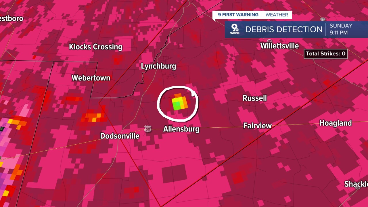
One other tool we can use is called correlation coefficient. This helps with detection of non-meteorological echoes, which is debris. That is why we call this "debris detection." When you see echos that show up in yellow, green, or blue on this map, it is an indication that the radar is picking up an article that is not similar to the other objects around it. In this case, debris.

When all three of these line up, it is a slam dunk indicator that there has been a tornado that has developed and caused damage in a certain area. As you can see in the three images above that is the case.
The images below come from the second tornado which looks to have developed to the north of Allensburg, Ohio around 9 p.m. Sunday.


At this time, there have been no reports of injuries or fatalities from Sunday's storms. The National Weather Service will conduct damage surveys over the next few days and after those are completed we will receive the official rating of the tornadoes.
Stay tuned for the latest updates, as we will pass those on as soon as we get the latest information.
