


CINCINNATI — Isolated thunderstorms are moving through the Tri-State. Some of these storms could be strong, while many locations will only see brief downpours before gradually weakening toward daybreak. Nevertheless, the Storm Prediction Center has placed us in a “MARGINAL RISK” for severe weather. Temperatures will remain quite mild, only falling into the lower 70s by sunrise.

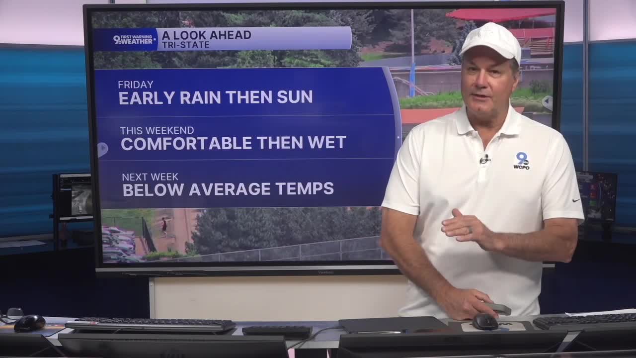
On Friday morning, any lingering showers and thunderstorms will be winding down, mainly during the early hours. Clouds may hang around for part of the morning, but conditions should steadily improve through the day with increasing sunshine by afternoon.
Behind the front, a drier and more comfortable air mass settles in, with afternoon temperatures reaching the lower 80s. Friday night looks excellent for your plans, with clear skies and temperatures dropping into the low 60s.

The weekend starts on a beautiful note. Saturday will be sunny, warm, and pleasant, with highs climbing into the low to mid 80s. However, changes arrive Saturday evening with a chance for rain as the next front approaches.
More showers and thunderstorms will develop after midnight, and rain chances continue to increase on Sunday. Expect a mostly cloudy day with periods of showers and scattered thunderstorms becoming more widespread through the morning and afternoon. If you have outdoor plans, Sunday is the day most likely to be interrupted by wet weather.
Once that system moves through, cooler and drier air returns for the first half of next week. Look for plenty of sunshine Monday through Wednesday, comfortable nights in the upper 50s, and afternoon temperatures mainly in the middle to upper 70s.
TONIGHT
Scattered showers and storms
Isolated Severe storms
Low: 72
FRIDAY
Clouds & Early chance
Turning mostly sunny
High: 82
FRIDAY NIGHT
Mostly Clear
& pleasant
Low: 60
9 First Warning Weather 24/7 Livestream
==========
- Interactive Radar: Track weather to your doorstep
- Sign up for severe weather email alerts
- Check latest school closings and delays
- WCPO traffic updates
- Metro bus detours and updates (or call the hotline at 513-632-7538)
- Latest power outages from Duke Energy
- Flight cancellations and delays from CVG, other U.S. airports
