


Temperatures will be above average into Sunday morning with low 40s common across Greater Cincinnati.
The rest of Sunday will be warmer and windy. As winds gust up to 45 mph out of the south, warmer weather will be blowing in, pushing temperatures into the low 70s. We'll see a lot more clouds than sunshine through the day.
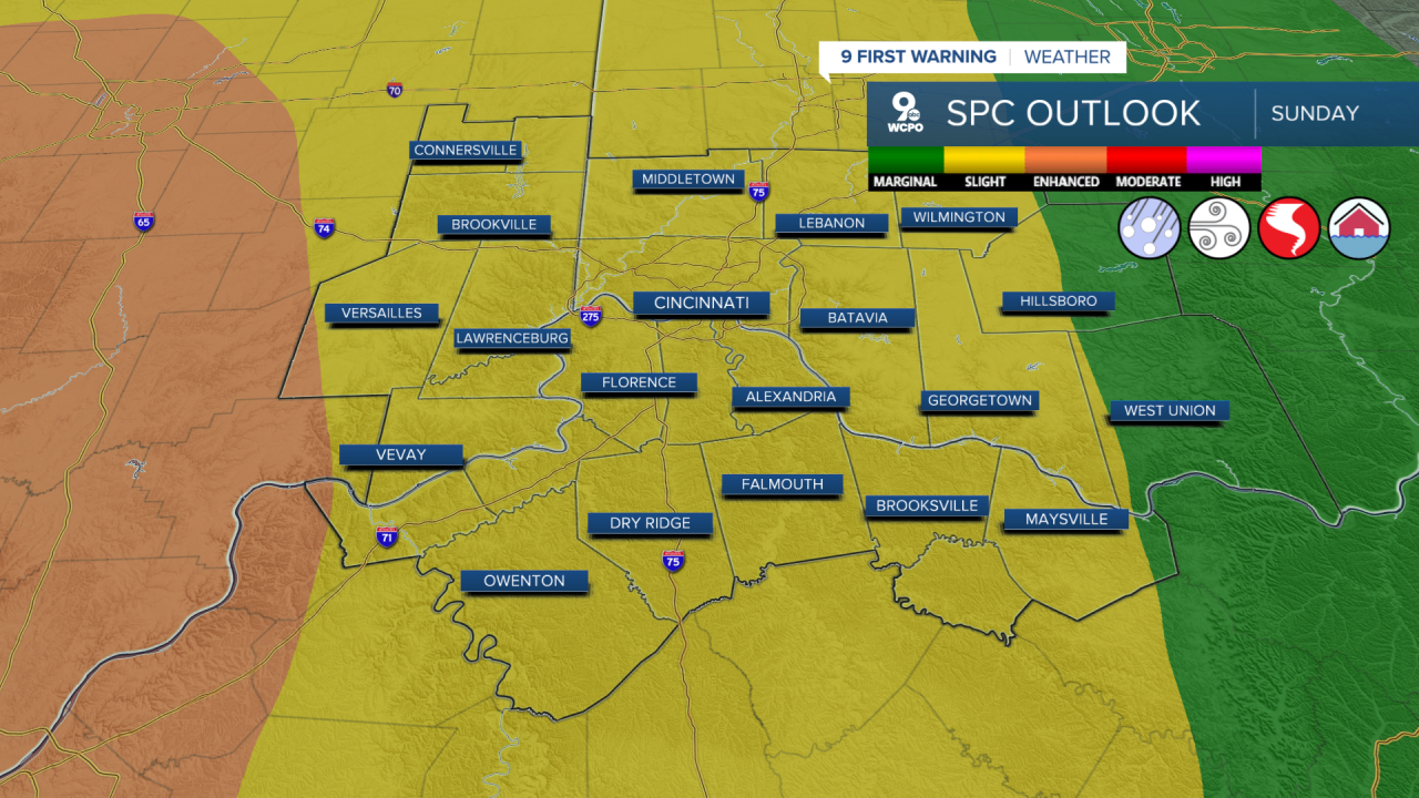
A strong cold front arrives Sunday night with a line of showers and storms. The storms will be weakening as they push in from the west, but there could be just enough instability to keep them going here. Due to the severe storm threat, we have issued a 9 First Warning Weather Alert Day. If the storms hold their strength, damaging wind will be our main concern, but a couple weaker tornadoes will also be possible in the Tri-State.

The storms will enter southeast Indiana from the west around 8-10 pm, then reach Greater Cincinnati around 10-midnight, followed by our eastern counties an hour or two later.
The Storm Prediction Center has placed us in a "Slight Risk" for severe storms, which is a level 2 of 5 on the threat scale.
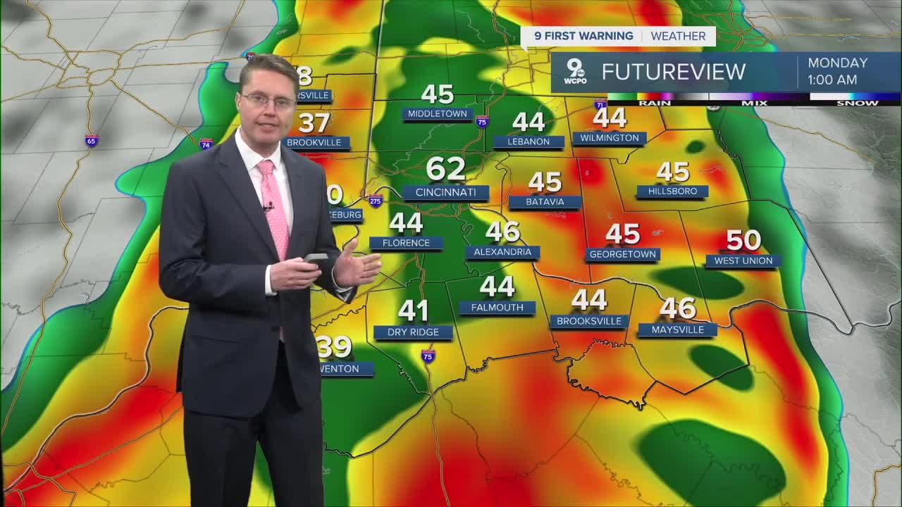
Temperatures will tumble behind the storms and the cold front. By early Monday morning, there could be a few scattered pockets of snow in the region. Even if you see some of the snow in your backyard, little to no accumulation is expected. The snow is more likely to just stick to grassy areas, the top of a car, or your backyard deck.

Monday afternoon will be windy with highs only in the mid 30s.
Tuesday, which is St. Patrick's Day, looks like the coldest day of the week. We start in the teens and only warm into the low 30s for the afternoon. Some leftover stronger wind will make it feel even colder.
Wednesday could bring some flurries in the morning, then we warm up into the mid 40s in the afternoon.
The warm-up continues Thursday with a high near 60 and a small chance for some light rain.
Friday and Saturday will be in the mid 60s with a mix of sunshine and clouds. Saturday also brings a slight chance for a little rain.
We drop back down into the upper 50s early next week.
OVERNIGHT
Partly cloudy
Above average
Low: 43
SUNDAY
Mostly cloudy
Windy
High: 73
SUNDAY NIGHT
Mostly cloudy
Rain and storms
Low: 32
MONDAY
Mostly cloudy
Spotty snow
Windy
High: 36
9 First Warning Weather 24/7 Livestream
==========
- Interactive Radar: Track weather to your doorstep
- Sign up for severe weather email alerts
- Check latest school closings and delays
- WCPO traffic updates
- Metro bus detours and updates (or call the hotline at 513-632-7538)
- Latest power outages from Duke Energy
- Flight cancellations and delays from CVG, other U.S. airports
