


9 FIRST WARNING WEATHER ALERT DAY begins and it will continue throughout Friday's forecast as heavy rain increases.
The National Weather Service has also issued a FLOOD WATCH for the Tri-State and it continues through early Saturday afternoon.

Rounds of rain continue throughout the day Friday as temperatures hold nearly steady in the low 50s. We'll get another push of showers and storms Friday night into Saturday morning as an area of low pressure sweeps through the region.
All said and done, we could be looking at 3 to 4 inches of rainfall.
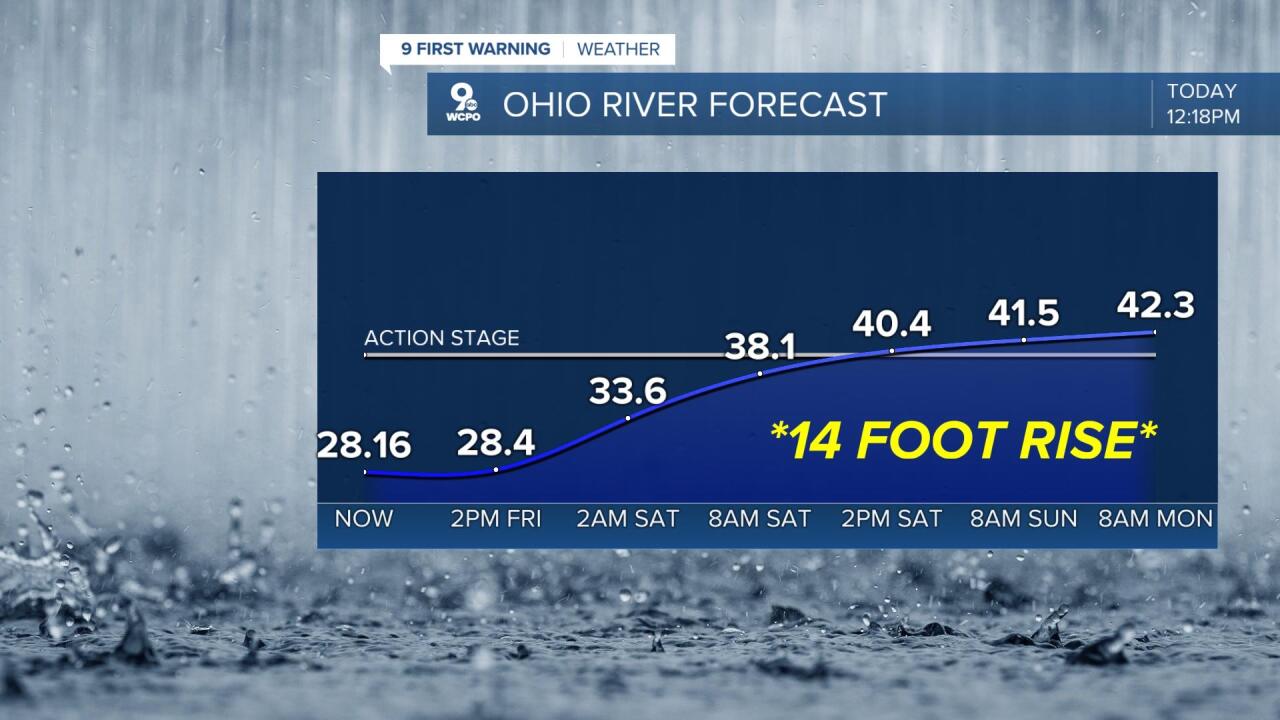
Not only will creeks and streams rise rapidly, but the Ohio River will also rise quickly. The Ohio River is projected to rise 14 feet between now and Monday due to all this rainfall. This will put us into Action Stage. Significant river level rises can be expected across all other waterways too.
OVERNIGHT
Showers and storms
Heavy rain
Low: 52
FRIDAY
Rounds of heavy rain
Near steady temperatures
High: 57
FRIDAY NIGHT
Rounds of rain continue
Heavy rain, flooding possible
Low: 47
9 First Warning Weather 24/7 Livestream
==========
- Interactive Radar: Track weather to your doorstep
- Sign up for severe weather email alerts
- Check latest school closings and delays
- WCPO traffic updates
- Metro bus detours and updates (or call the hotline at 513-632-7538)
- Latest power outages from Duke Energy
- Flight cancellations and delays from CVG, other U.S. airports
