


A cold front is headed our way, and this will bring in rain overnight. Showers begin in southeast Indiana and move southeast overnight, likely reaching Greater Cincinnati after 3 am.
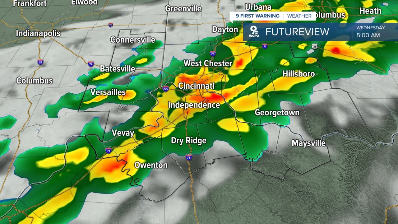
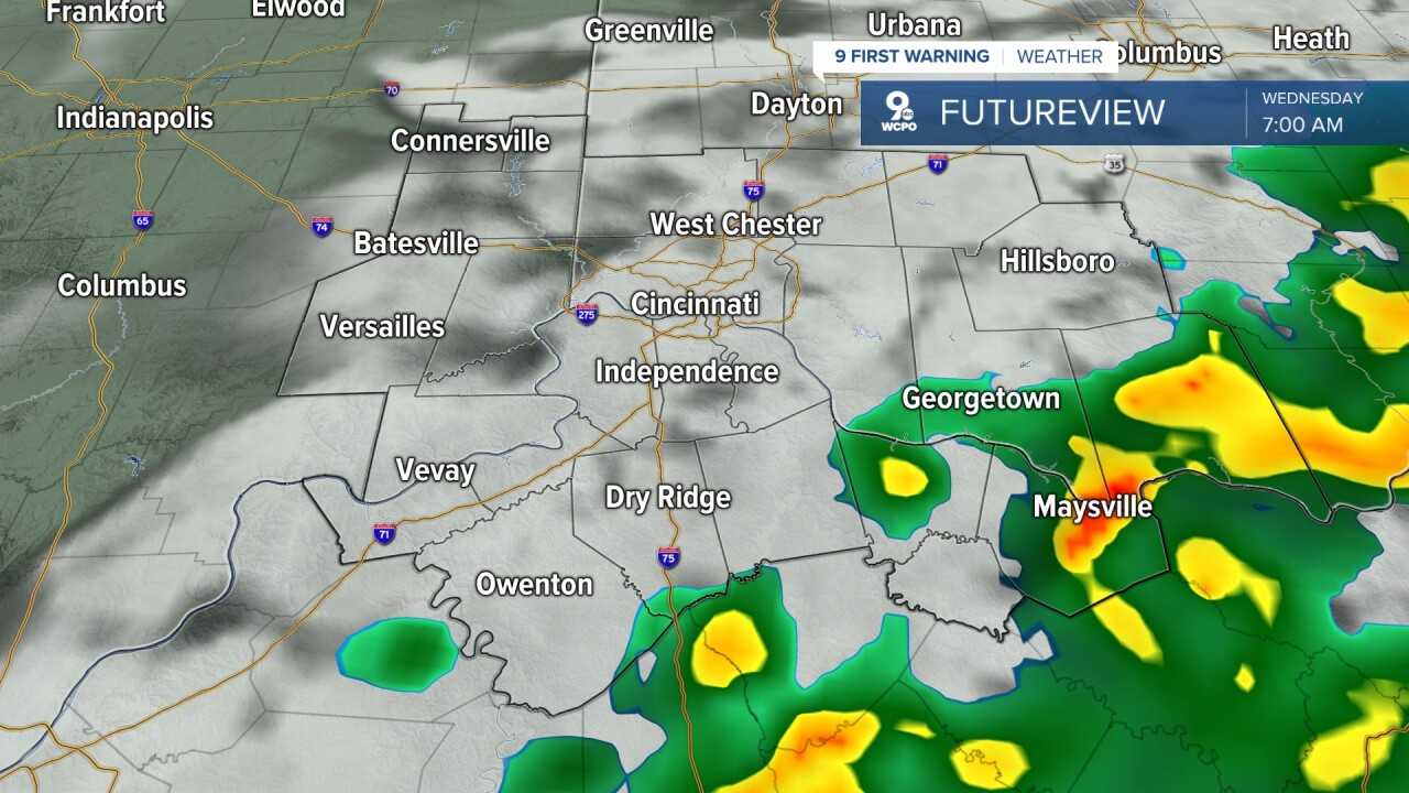
By the morning commute, most cities will be dry, but there could be some leftover rain down towards Maysville and West Union. In total, less than 0.5" of rain is expected. We could hear some rumbles of thunder, but severe weather is not expected.
Wednesday will turn partly cloudy, and temperatures will stay pleasant. We'll warm to 70 degrees early in the afternoon, but we will likely cool off faster than normal late in the day as the cooler weather continues to blow in. Winds will be breezy from the northwest at 10 to 15 mph, gusting to 25 mph.
Thursday is the coolest day of the week with a high of 64 degrees. It will be partly cloudy and dry. A rainmaker looks to potentially drop wet weather on Friday.
Temperatures warm as we end the week and head into the weekend. Highs over the weekend will be in the mid 80s both days. Right now, Saturday has a better chance of rain compared to Sunday.
The 80s and rain chances continue early next week.
OVERNIGHT
Rain
Chance storms
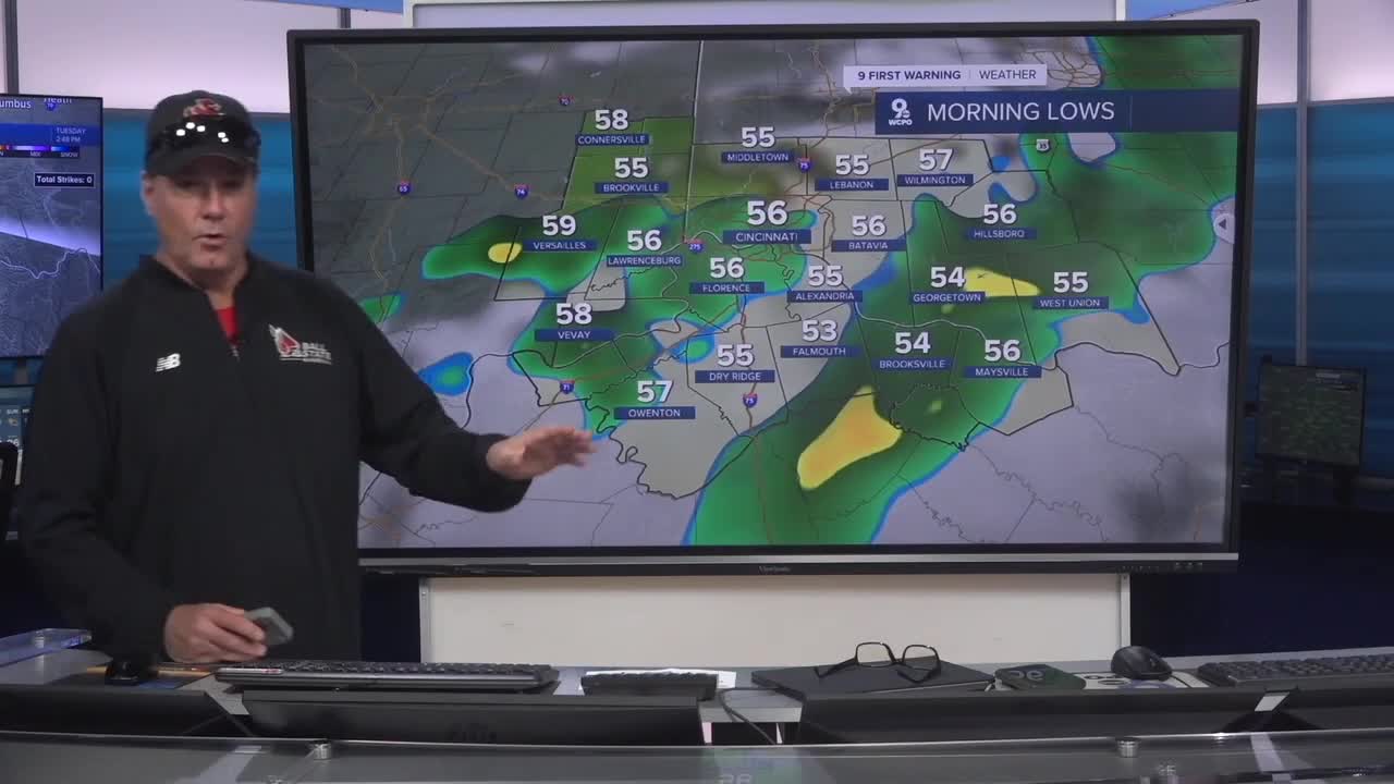
Low: 56
WEDNESDAY
Rain ends by 8 a.m.
Partly cloudy & windy
High: 70
WEDNESDAY NIGHT
Mostly clear
Cooler
Low: 43
9 First Warning Weather 24/7 Livestream
==========
- Interactive Radar: Track weather to your doorstep
- Sign up for severe weather email alerts
- Check latest school closings and delays
- WCPO traffic updates
- Metro bus detours and updates (or call the hotline at 513-632-7538)
- Latest power outages from Duke Energy
- Flight cancellations and delays from CVG, other U.S. airports
