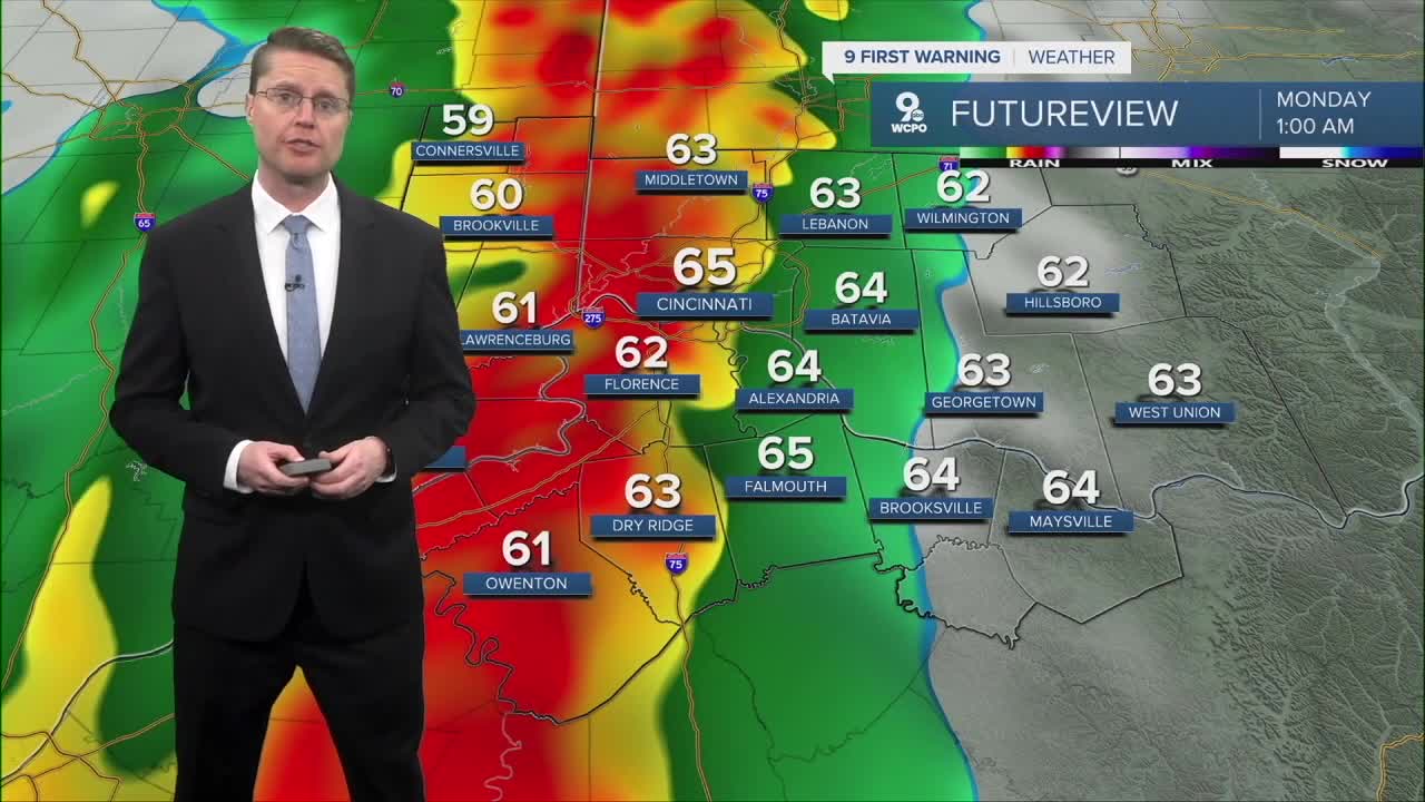


A strong cold front arrives late Sunday night with a line of showers and storms. The storms will be weakening as they push in from the west, but there could be just enough instability to keep them going here. Due to the severe storm threat, we have issued a 9 First Warning Weather Alert Day. If the storms hold their strength, damaging wind will be our main concern, but a couple weaker tornadoes will also be possible in the Tri-State.

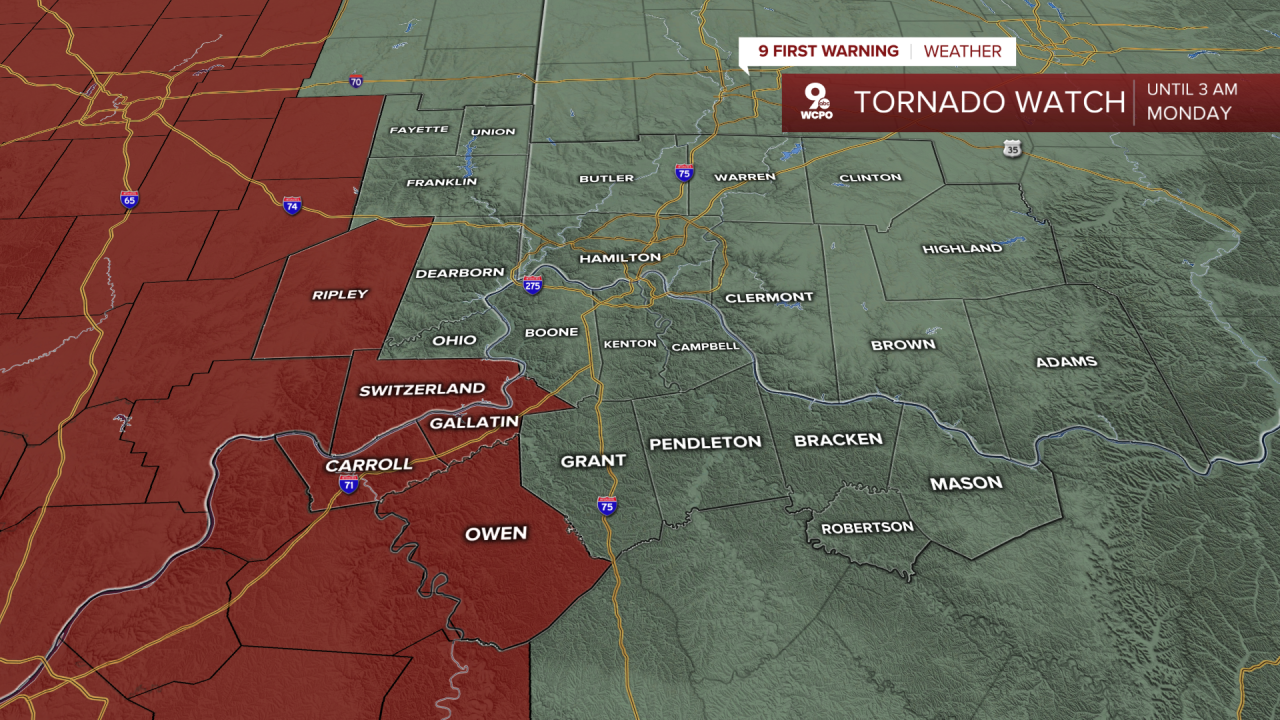
A Severe Storm Watch is in effect until 4 am Monday for most of the Tri-State, including Greater Cincinnati. The biggest threat will be for damaging winds, but a brief tornado is also possible.

A Tornado Watch has been issued for areas west of Greater Cincinnati, which will be in effect until 3 a.m. Monday. Severe storms in this area could produce a tornado. Review your safety plan with your family, and make sure you have multiple ways to get warnings in case one is issued for your city. Depending on how well these storms hold together, the watch could be extended farther east.
The storms will reach Greater Cincinnati around 1 am, followed by our eastern counties around 2 or 3 in the morning.
Temperatures will tumble behind the storms and the cold front. In fact, a Wind Advisory has been issued until 8 am Monday, because the wind could gust up to 50 mph. That's enough to cause power outages. Make sure you secure outdoor items and keep your phone charged in case you lose power.
By the early morning, there could be a few scattered pockets of snow in the region. The on and off snow will continue at times into Monday afternoon. Even if you see some of the snow in your backyard, little to no accumulation is expected. The snow is more likely to just stick to grassy areas, the top of a car, or your backyard deck.

Monday afternoon will be windy as colder air continues to blow in from the west. This will make most of the day feel like the teens and low 20s!
Tuesday, which is St. Patrick's Day, looks like the coldest day of the week. We start in the teens and only warm into the low 30s for the afternoon. Luckily, the wind won't be as strong as Monday.
Wednesday starts with some of us seeing light snow. Any accumulation would stay under an inch. We get a little warmer in the afternoon with mid 40s.
The warm-up continues Thursday with a high near 60 and a small chance for some light rain.
Friday and Saturday will be in the mid 60s with a mix of sunshine and clouds. Both days come with a small chance for light rain.
We drop back down into the upper 50s early next week.
OVERNIGHT
Mostly cloudy
Rain and storms
Windy
Morning: 34
MONDAY
Mostly cloudy
Scattered snow
Windy
Afternoon: 31
MONDAY NIGHT
Mostly cloudy
Very cold
Low: 18
TUESDAY
Partly cloudy
Below average
High: 31
9 First Warning Weather 24/7 Livestream
==========
- Interactive Radar: Track weather to your doorstep
- Sign up for severe weather email alerts
- Check latest school closings and delays
- WCPO traffic updates
- Metro bus detours and updates (or call the hotline at 513-632-7538)
- Latest power outages from Duke Energy
- Flight cancellations and delays from CVG, other U.S. airports
