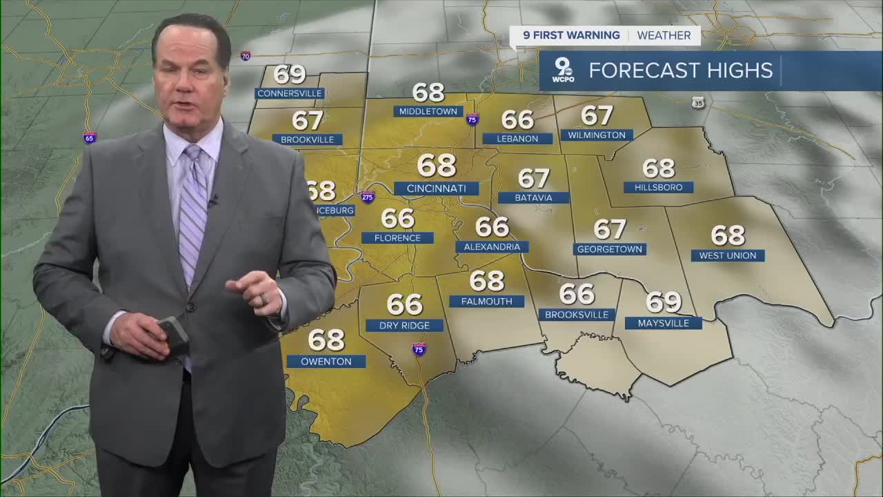


As we head toward daybreak, you should expect clouds to start sneaking in like they’re trying to crash a party—slowly at first, then bringing all their cousins. By tomorrow morning, we’ll be mostly cloudy, but don’t let that fool you: the atmosphere is about to pull off a pretty convincing Spring impersonation. Afternoon highs will soar into the upper 60s, which is Mother Nature’s way of reminding us she can be pleasant… right before she isn’t.

But before you get too cozy, the winds will pick up. And not a gentle breeze, either. Gusts will whip around Greater Cincinnati to about 30 mph. Still, with temperatures flirting with 70 degrees, it'll overall feel nice.

Later in the day, a cold front will march through the region, and there comes the chance for a spotty shower—very spotty. Consider it the atmosphere’s version of a quick sprinkle to keep us humble.
Once the front passes, however, the real shift begins. Winds will flip around to the northwest, bringing in the kind of chill that says...it is November, after all.”

Temperatures will drop back to the seasonal mid-50s by late afternoon. So enjoy the warmth while it lasts, hang onto your hats tomorrow, and get ready for the cooler, more sensible weather to return—just like it always does.
OVERNIGHT
Clouding up
Low: 54
SATURDAY
Mostly cloudy
Chance Isolated showers, breezy
High: 69
SATURDAY NIGHT
Few Isolated showers
Mostly cloudy
Low: 48
SUNDAY
Mostly Sunny
High: 55
9 First Warning Weather 24/7 Livestream
==========
- Interactive Radar: Track weather to your doorstep
- Sign up for severe weather email alerts
- Check latest school closings and delays
- WCPO traffic updates
- Metro bus detours and updates (or call the hotline at 513-632-7538)
- Latest power outages from Duke Energy
- Flight cancellations and delays from CVG, other U.S. airports
