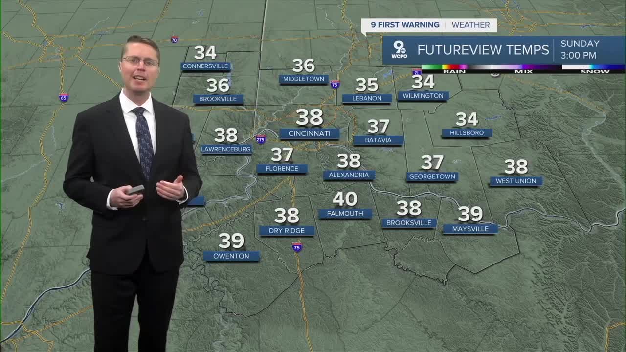


A mid-weekend cold front will make for a much colder Sunday. We will start in the mid 20s, and even with a lot of sunshine, we will only warm into the upper 30s in the afternoon. That's back below our average high of 42 right now.

We start to warm back up Monday with mostly cloudy skies. Highs will be in the mid 40s. Most of the day looks dry, but light rain could start to push in as early as the evening. Some of the rain will continue into Tuesday morning.
As we dry out Tuesday afternoon, the warm-up continues with mid 50s.
The mid 50s continue for Christmas Eve on Wednesday.
Scattered light rain moves back in Wednesday night for Santa, and some of the light rain continues into at least Christmas morning. We get drier in the afternoon, but it will be mostly cloudy and warmer with low 60s.
There could be a few leftover pockets of rain around Friday morning, keeping us mostly cloudy. The afternoon will be in the upper 50s.
We slide back into the mid 50s Saturday with a lot of clouds.
A little rain is possible early Sunday as a cold front arrives, dropping us down into the low 40s for Sunday and Monday afternoons.
OVERNIGHT
Few clouds
Chilly
Low: 26
SUNDAY
Mostly sunny
Colder
High: 38
SUNDAY NIGHT
Partly cloudy
Cold
Low: 21
MONDAY
Mostly cloudy
Light p.m. rain
High: 46
TUESDAY
Mostly cloudy
Light rain early
High: 55
9 First Warning Weather 24/7 Livestream
==========
- Interactive Radar: Track weather to your doorstep
- Sign up for severe weather email alerts
- Check latest school closings and delays
- WCPO traffic updates
- Metro bus detours and updates (or call the hotline at 513-632-7538)
- Latest power outages from Duke Energy
- Flight cancellations and delays from CVG, other U.S. airports
