


As clouds thicken up overnight, they could squeeze out a few sprinkles into Monday morning. It will also be a lot warmer than recent mornings with mid 50s to start the day.
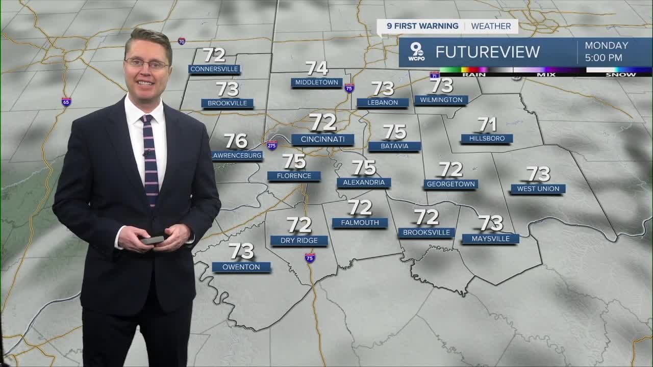
It stays mostly cloudy Monday afternoon, but our warm-up continues into the low 70s. It will be a little breezy at times too. While an isolated shower or two can't be ruled out in the Tri-State, most of us will be dry.
A few more sprinkles are possible Tuesday morning, but we should see some good sunshine in the afternoon. This will help a stronger wind out of the south push Cincinnati to about 80 degrees.
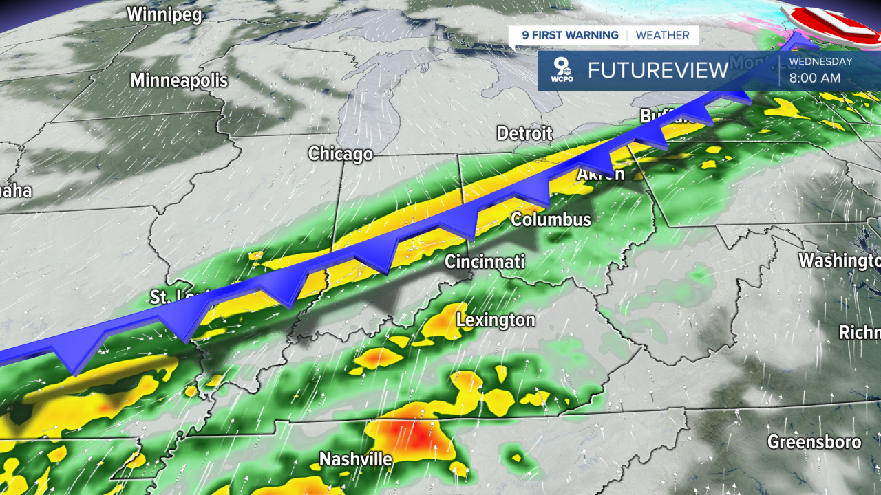
A cold front arrives Wednesday with widespread showers and storms. This drops the heat a bit with a high closer to 70.
Thursday warms into the mid 70s with mostly cloudy skies.
Timing for the week's second round of rain is a little more uncertain, arriving either late Thursday or on Friday. Temperatures stay above average Friday afternoon with low 70s.
Saturday will also be in the low 70s. A cold front will bring another round of rain later in the day.
While there will be some leftover clouds Easter morning, we should be dry Sunday. The afternoon brings some sunshine with mid 60s.
Monday looks mostly sunny with mid 50s.
An area of low pressure arrives Thursday with another round of rain, but we stay in the mid 60s.
Some of the rain could continue into Friday morning. The afternoon looks drier, letting us warm into the upper 60s.
The break from the rain won't last long, but while it is dry, we warm into the low 70s Saturday afternoon. Another wave of rain arrives late Saturday and continue into Easter morning. Sunday afternoon will be in the mid 60s.
We get even cooler Monday, dropping into the mid 50s, but it comes with a lot more sunshine.
OVERNIGHT
Mostly cloudy
Sprinkles
Low: 54
MONDAY
Mostly cloudy
Isolated Rain
High: 72
MONDAY NIGHT
Mostly cloudy
Warm
Low: 61
TUESDAY
Sprinkles Early
Clearing skies
Windy
High: 80
9 First Warning Weather 24/7 Livestream
==========
- Interactive Radar: Track weather to your doorstep
- Sign up for severe weather email alerts
- Check latest school closings and delays
- WCPO traffic updates
- Metro bus detours and updates (or call the hotline at 513-632-7538)
- Latest power outages from Duke Energy
- Flight cancellations and delays from CVG, other U.S. airports
