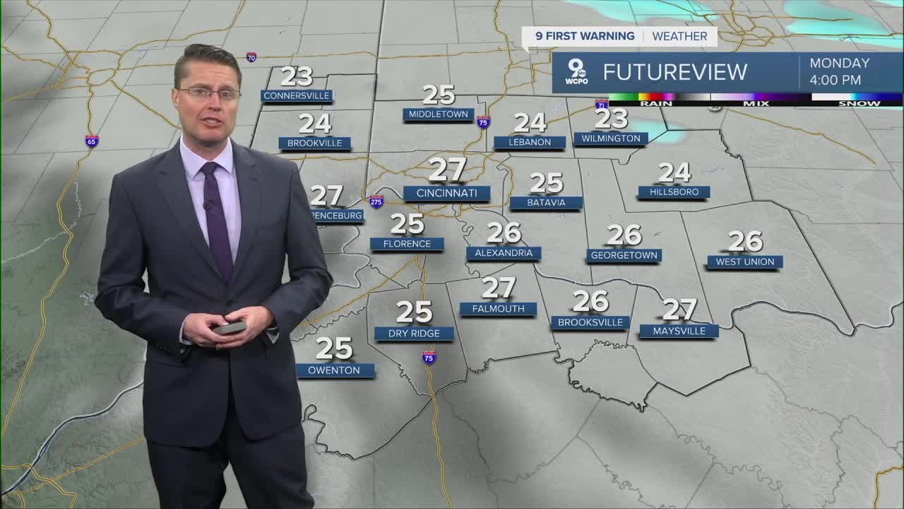


Behind the cold front, it will be windy with wind gusts up to 45 mph overnight, blowing in much colder weather from the west. The rain ends overnight, but the last bit of it could change into a few snowflakes before ending ahead of the morning commute. Temperatures will drop into the mid 20s to start Monday, and they only increase a couple of degrees for the afternoon. Wind chills will struggle to hit the teens in the afternoon... a big difference from the record warmth we enjoyed Sunday.

The wind lightens up for Tuesday, and we will see a lot more sunshine, but it stays cold. Highs will be in the upper 20s again.
We get a touch warmer for the last day of 2025. Highs will be in the mid 30s Wednesday afternoon with mostly cloudy skies.
A cold front moves in from the north Wednesday night, bringing some light snow. It may not reach all of northern Kentucky, but most spots north of the Ohio River should see some snowflakes into Thursday morning. Little to no accumulation is expected right now.

Behind the cold front, it will be a little colder Thursday. Highs will be in the low 30s, which is where we stay Friday.
We get back to the upper 30s next weekend with a small chance for a few raindrops or snowflakes.
OVERNIGHT
Mostly cloudy
Rain early
Windy
Low: 25
MONDAY
Mostly cloudy
Flurries
Windy
High: 27
MONDAY NIGHT
Clearing skies
Lighter wind
Low: 18
TUESDAY
Mostly sunny
Cold
High: 29
9 First Warning Weather 24/7 Livestream
==========
- Interactive Radar: Track weather to your doorstep
- Sign up for severe weather email alerts
- Check latest school closings and delays
- WCPO traffic updates
- Metro bus detours and updates (or call the hotline at 513-632-7538)
- Latest power outages from Duke Energy
- Flight cancellations and delays from CVG, other U.S. airports
