


It's changing weather for the Tri-State...
As we progress toward daybreak, the chances for a few showers increases as it stays very mild in the low to mid 60s.
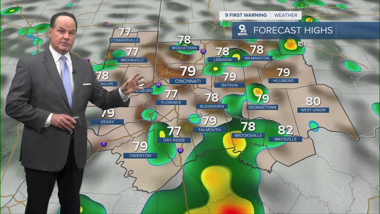
We continue a chance of showers and thunderstorms during the morning commute. Then, scattered showers are likely by late morning, and showers are likely with a possible thunderstorm around noon, Highs will reach the mid to upper 70s. More scattered, spotty wet weather continues through about dinnertime. There is a "Marginal Risk" of severe weather for Friday.
As for Friday night, I’ll keeps a 30% chance of showers and thunderstorms with a lows again in the mid 60s.

By Saturday, the front half of the day will only see a chance for rain before showers become likely in the afternoon with isolated thunderstorms, with highs near 80. There is a chance for strong to severe thunderstorms from late afternoon through the evening hours before a strong cold front moves through the Tri-State. Again, The Storm Prediction Center places us in a “Marginal Risk” for severe storms…a category 1 out of 5.

Saturday night brings showers and possibly a thunderstorm before midnight with lows falling to the low to mid 40s. Cold air behind the cold front producing the wet weather will make Easter Sunday much colder with highs only in the mid to upper 50s. Gradual clearing starts first thing in the morning.

OVERNIGHT
Chance rain
Low: 65
FRIDAY
Scattered storms
Otherwise mostly cloudy
High: 79
FRIDAY NIGHT
A few showers
Mild and mostly cloudy
Low: 64
9 First Warning Weather 24/7 Livestream
==========
- Interactive Radar: Track weather to your doorstep
- Sign up for severe weather email alerts
- Check latest school closings and delays
- WCPO traffic updates
- Metro bus detours and updates (or call the hotline at 513-632-7538)
- Latest power outages from Duke Energy
- Flight cancellations and delays from CVG, other U.S. airports
