


While a few showers/storms will remain overnight, clouds will move out by daybreak, and we'll cool down to 59 degrees. Our concerns are really about tomorrow's weather.
Wednesday morning and into the early afternoon, dry weather is expected as temperatures warm to the low 80s. The sky will be partly cloudy, and the humidity will rise.
A 9 First Warning Weather Alert Day has been issued for Wednesday night!

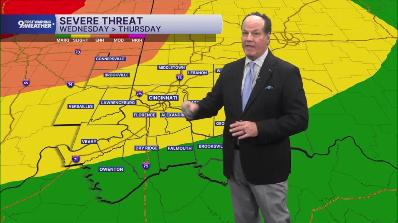
Starting in the late afternoon hours, there's a chance for rain and thunderstorms into the evening hours, and there's a small chance we could see severe storms. The SPC has much of our area in a "slight risk" for severe storms. Notice in the image below that the "enhanced" risk is to the northwest.
Strong storms will begin as we get closer to 10-11 pm and continue into the overnight. In fact, the latest shows the biggest impact may come overnight, around 3 am. We are staffing everyone on extra duty, and you should have a phone or weather radio by your bedside.
The main threats will be damaging wind and flash flooding, but a brief tornado and a couple of pockets of hail will also be possible.

The leftover rain should end Thursday morning. The afternoon looks a lot drier, but it will still be a little muggy with low 80s. The humidity will be lower on Friday and Saturday with highs in the upper 70s both days.
Rain is looking a bit more likely again for Father's Day with a high near 80.
OVERNIGHT
Showers fade
Partly cloudy by daybreak
Low: 57
WEDNESDAY
Partly cloudy
Muggy
High: 82
WEDNESDAY NIGHT
Showers and storms likely
Risk for severe weather
Low: 70
9 First Warning Weather 24/7 Livestream
==========
- Interactive Radar: Track weather to your doorstep
- Sign up for severe weather email alerts
- Check latest school closings and delays
- WCPO traffic updates
- Metro bus detours and updates (or call the hotline at 513-632-7538)
- Latest power outages from Duke Energy
- Flight cancellations and delays from CVG, other U.S. airports
