


While it'll be dry, increasing clouds will lead to rain before mid-morning as the overnight low falls to the upper 50s.
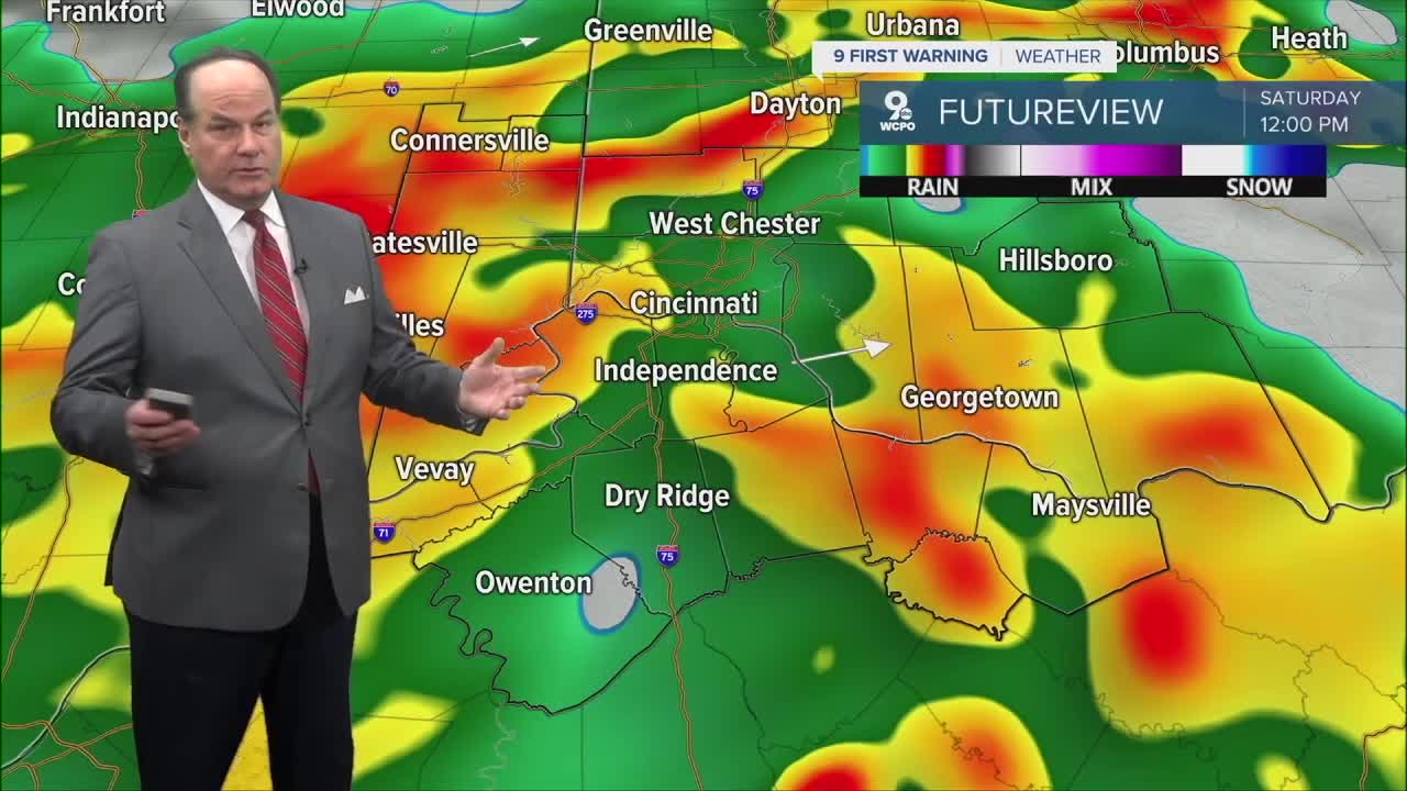
Our Saturday looks warmer and more humid, with highs reaching the upper 70s. Rain and thunderstorms are likely right from the morning on Saturday into Saturday evening as a warm front sweeps over the Tri-State.
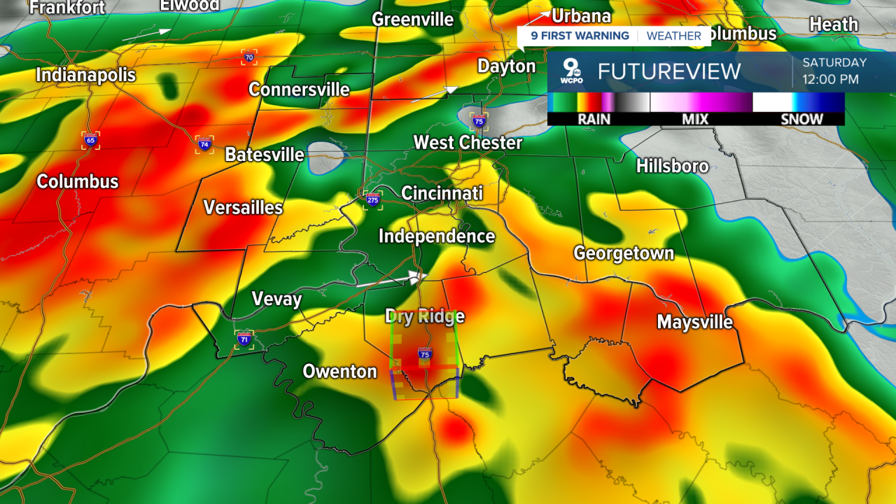
Specifically, we have moderate instability and semi-favorable elevated lapse rates, but it’s not a slam dunk for any severe conditions. Some model solutions suggest the potential for strong-to-severe storms. The Storm Prediction Center has placed us in a “Marginal Risk”, 1 out of 5, for severe storms.

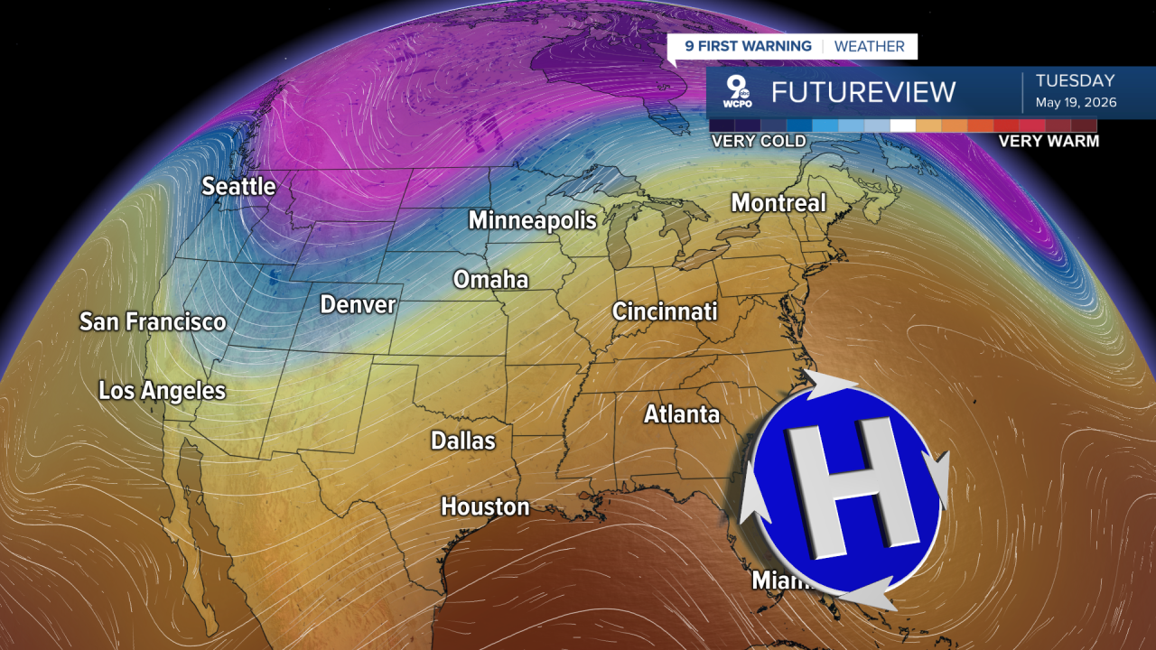
By Sunday, after a 30% chance for an early morning shower, highs climb into the mid to upper 80s, and it’ll be humid. Next week, we will keep the warm, humid conditions generated by a giant high-pressure system sitting off the coast. This is just ahead of some midweek rain and storms again.
OVERNIGHT
Partly Cloudy
Slight chance
MORNING LOW 57
SATURDAY
Marginal Risk severe weather
For storms & rain
HIGH 79
SATURDAY NIGHT
Still wet
LOW 62
SUNDAY
Chance Early
Then mostly sunny
HIGH 87
9 First Warning Weather 24/7 Livestream
==========
- Interactive Radar: Track weather to your doorstep
- Sign up for severe weather email alerts
- Check latest school closings and delays
- WCPO traffic updates
- Metro bus detours and updates (or call the hotline at 513-632-7538)
- Latest power outages from Duke Energy
- Flight cancellations and delays from CVG, other U.S. airports
