


Rain ends around the Tri-State as we head toward morning with a low of 59, as a cold front moves through the region.

By Saturday, our forecast sits with a 30% chance of showers mainly before 8 AM, then skies turn mostly sunny with highs in the mid 70s.

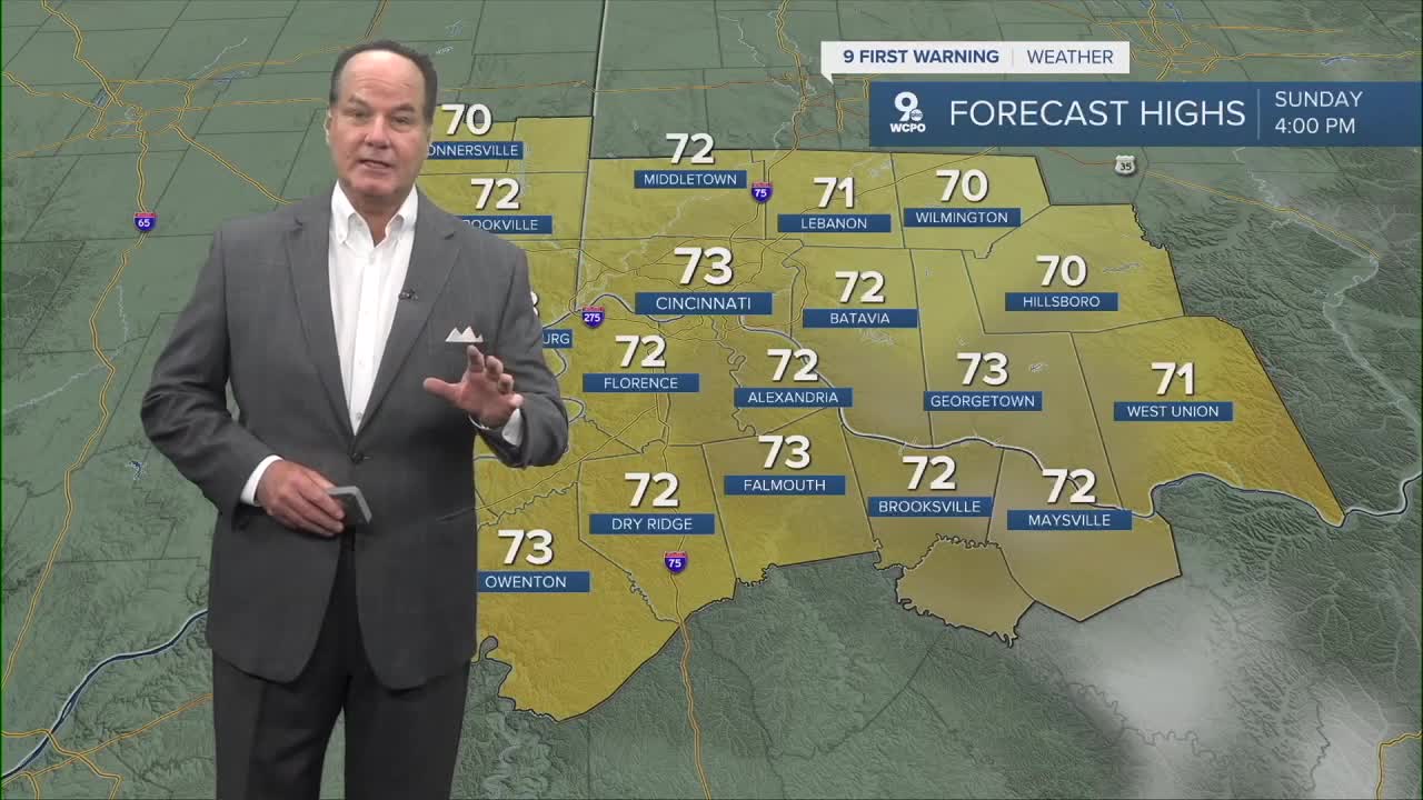
Moving into Sunday, things stay quiet and pleasant with mostly sunny skies and highs slightly cooler in the low 70s.

Looking ahead to next week, the weather signals another system approaching, bringing increasing chances for precipitation on Tuesday. There are indications of a strong set of storms with significantly cooling behind it.
OVERNIGHT
Few showers
Mild
Low: 59
TOMORROW
Clouds & a chance of rain early
Then Partly to mostly sunny
High: 75
TOMORROW NIGHT
Mostly clear
Low: 47
SUNDAY
Mostly sunny
High: 73
9 First Warning Weather 24/7 Livestream
==========
- Interactive Radar: Track weather to your doorstep
- Sign up for severe weather email alerts
- Check latest school closings and delays
- WCPO traffic updates
- Metro bus detours and updates (or call the hotline at 513-632-7538)
- Latest power outages from Duke Energy
- Flight cancellations and delays from CVG, other U.S. airports
