


A few leftover pockets of rain will continue in the Tri-State overnight, but we're dry by the time most of us wake up Monday. After all the recent rain, we could wake up to some foggy areas with temperatures in the low 60s.
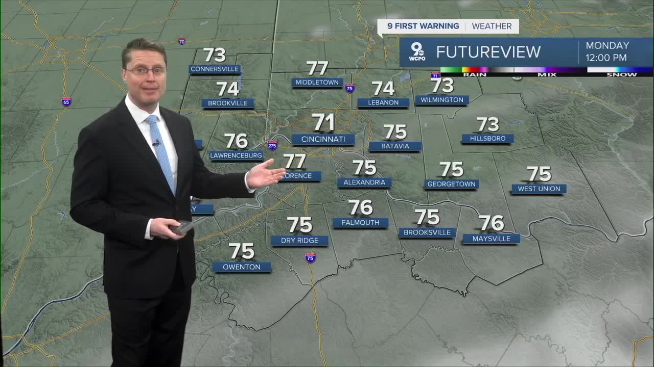
As we head into Memorial Day afternoon, we should start to see some sunshine break through the clouds. We will warm into the mid 70s in Cincinnati.

A center of low pressure to our south will throw some rain at the Tri-State Tuesday. The best chance for rain will be in northern Kentucky, and the farther north you live, the better chance of being dry with some sunshine. Highs will be in the upper 70s where dry.
A cold front moves in from the north Wednesday, bringing another round of widespread showers and storms. This should hold us back in the mid 70s.

With the exception of a few leftover showers early in the day, we dry out Thursday, warming us into the low 80s.
Friday looks really nice with mid 70s and some sunshine.
There's a small chance for rain in the first half of the weekend, but it's far from a guarantee right now.
OVERNIGHT
Mostly cloudy
Isolated rain
Foggy areas
Low: 61
MEMORIAL DAY
Partly cloudy
Slight rain chance
High: 76
MONDAY NIGHT
Partly cloudy
Near average
Low: 60
TUESDAY
Partly cloudy
Rain south
High: 78
9 First Warning Weather 24/7 Livestream
==========
- Interactive Radar: Track weather to your doorstep
- Sign up for severe weather email alerts
- Check latest school closings and delays
- WCPO traffic updates
- Metro bus detours and updates (or call the hotline at 513-632-7538)
- Latest power outages from Duke Energy
- Flight cancellations and delays from CVG, other U.S. airports
