


A large winter storm is set to impact portions of the United States, and confidence continues to grow, it will also impact the Tri-State. We have issued Weather Alert Days for the weekend due to the increasing chance for high snow totals to impact travel and your weekend plans.
A Winter Storm Watch has also been issued by the National Weather Service for Saturday and Sunday in areas south and east of Cincinnati, but we expect impacts for the rest of the region as well, including across Greater Cincinnati.
After a slightly warmer day, a cold front arrives late Wednesday, and temperatures begin to drop into the weekend, eventually tapping back into the arctic air.
We'll get to enjoy more sunshine on Thursday with highs in the mid 30s.
Friday will be partly cloudy, but we only warm up to about 20 degrees in the afternoon.
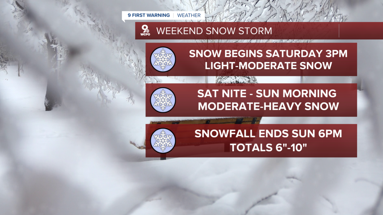
Saturday could be the coldest day coming up. We start in the single digits and only make it into the teens later in the day. At the earliest, snowflakes will start to fly in the afternoon, but the start of the snow could hold off until Saturday night.
The heaviest snow could be late Saturday night and into Sunday morning, but the snow will likely continue at times until at least Sunday afternoon. Highs will be near 20.
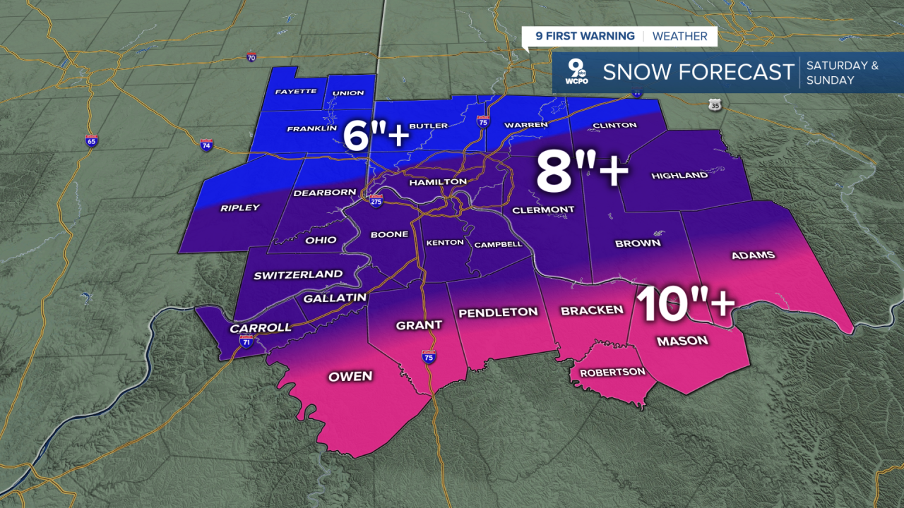
The highest snow totals will be south of Greater Cincinnati, where at least 10 inches are expected right now. Farther north, Greater Cincinnati will likely pick up at least 8 inches. Our most northern areas are looking at a guarantee of 6 inches right now. The storms is still days away, and these totals could shift north or south still. We'll keep you updated as we head into the weekend.
While we likely see all snow in the Tri-State, be aware if you have travel plans south, freezing rain could come as far north as Lexington on Sunday.
The stretch of arctic cold weather continues next week. It looks like highs will be in the 20s most of the workweek.
OVERNIGHT
Mostly cloudy
Clearing before daybreak
Low: 27
THURSDAY
Motly clear
Colder
High: 34
THURSDAY NIGHT
Becoming mostly cloudy
Colder
Low: 15
9 First Warning Weather 24/7 Livestream
==========
- Interactive Radar: Track weather to your doorstep
- Sign up for severe weather email alerts
- Check latest school closings and delays
- WCPO traffic updates
- Metro bus detours and updates (or call the hotline at 513-632-7538)
- Latest power outages from Duke Energy
- Flight cancellations and delays from CVG, other U.S. airports
