


It doesn't get as cold heading into Thursday morning. Temperatures will be closer to average, with lows in the mid 30s to start the day.
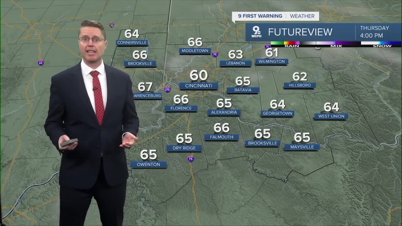
While it will be mostly cloudy Thursday afternoon, the warm-up continues with the help of warmer air blowing in from the south. Highs will be near 60. A few spotty and light showers are possible in the Tri-State from late morning to early afternoon, but most of us will stay dry.
Spring officially kicks off Friday morning! The afternoon looks nice with upper 60s and more clouds than sunshine.
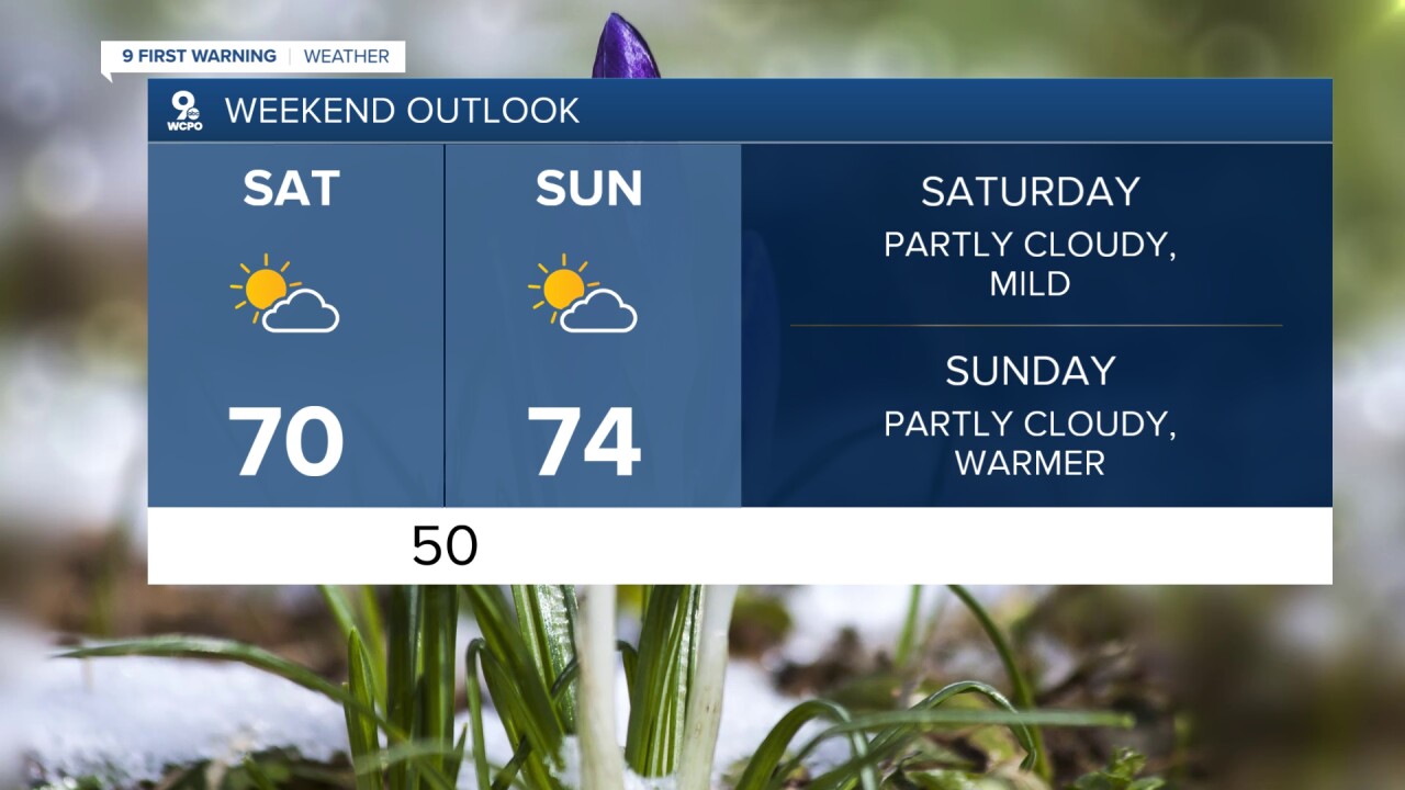
The warm-up keeps going for the weekend! Saturday will be partly cloudy with a high near 70. Then, we push into the mid 70s on Sunday. The morning and early afternoon look dry, but a cold front arrives later in the day, which could bring scattered rain across the Tri-State.
The cold front drops us into the low 50s Monday and Tuesday with a mix of sun and clouds.
We warm back up midweek. Wednesday will be in the upper 50s.
For Opening Day on Thursday, we push closer to 70, which will make for a comfortable parade. A cold front arrives late Thursday with another round of rain, so we'll keep you updated on if we can squeeze in 9 innings before the wet weather gets here.
OVERNIGHT
Mostly cloudy
Not as cold
Low: 36
THURSDAY
Mostly cloudy
Isolated showers
High: 60
THURSDAY NIGHT
Mostly cloudy
Above average
Low: 42
FRIDAY
Mostly cloudy
Spring arrives
High: 68
9 First Warning Weather 24/7 Livestream
==========
- Interactive Radar: Track weather to your doorstep
- Sign up for severe weather email alerts
- Check latest school closings and delays
- WCPO traffic updates
- Metro bus detours and updates (or call the hotline at 513-632-7538)
- Latest power outages from Duke Energy
- Flight cancellations and delays from CVG, other U.S. airports
