



Cincinnati officially set a new record high on Tuesday! We hit 89 degrees, rising above the old record of 88 from 1928.
Today's forecast will still be warm, but the timing of rain will prevent records from being broken again. We are starting at 67 under a partly cloudy sky.
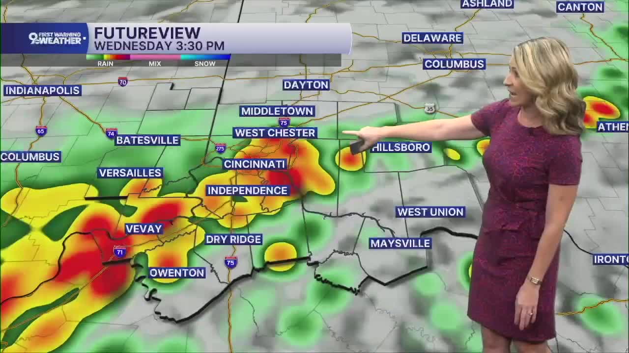
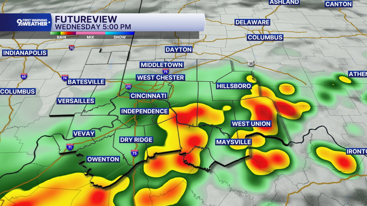
Clouds increase this morning and a line of storms will start moving in around the noon hour in southeast Indiana. By 2 p.m., a line of storms will be stretched across the area and this line of storms will continue moving east. Most of our storm activity will move out of the area by 7 p.m. But as these storms pass today, we can't rule out a severe thunderstorm.
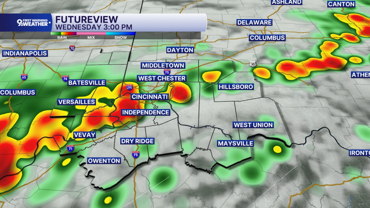
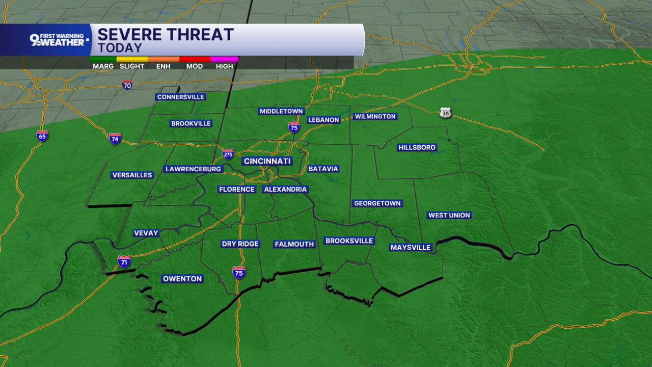
Severe weather isn't as common this time of year but that doesn't mean it doesn't happen! We are mainly looking at the risk of damaging wind gusts between 12 to 6 p.m. Highs will be in the low 80s today.
There will only be isolated rain chances later this evening and overnight. Temperatures cool to 64 tonight under a mostly cloudy sky.
There's another chance for showers and storms on Thursday. A warm front will lift north through our area and this will bring in another window for showers and isolated storms late Thursday afternoon and into the evening hours.
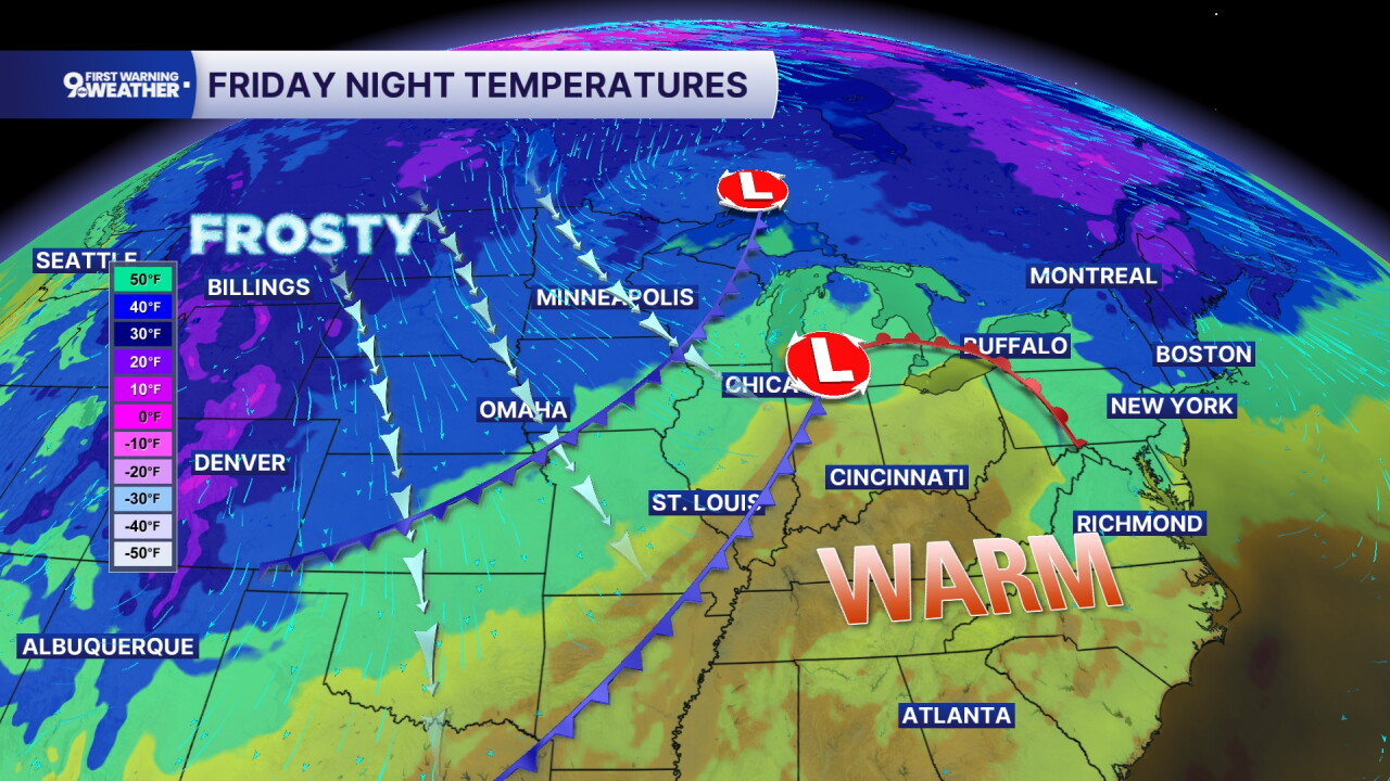
A cold front moves through Friday and it's going to bring about major changes to our forecast. We'll see showers passing between sunrise to noon and then clouds start to decrease. But temperatures also decrease too! The warmest air of the day will be in the morning, with temperatures in the mid-60s. We'll cool to the mid to low 50s Friday afternoon and evening. It will also be windy on Friday with winds from the northwest at 15 to 25 mph, gusting to 35 mph.
And then it gets downright chilly for the weekend! Saturday will only warm to 56 degrees and Sunday morning, patchy frost is expected.
MORNING RUSH
Partly cloudy
Warm
Low: 67
WEDNESDAY
Increasing clouds
Storms likely after 12 p.m.
High: 82
WEDNESDAY NIGHT
Mostly cloudy
Isolated showers
Low: 64
THURSDAY
Mostly cloudy
Scattered evening storms
High: 73
THURSDAY NIGHT
Spotty rain chance
Mostly cloudy
Low: 62
9 First Warning Weather 24/7 Livestream
==========
- Interactive Radar: Track weather to your doorstep
- Sign up for severe weather email alerts
- Check latest school closings and delays
- WCPO traffic updates
- Metro bus detours and updates (or call the hotline at 513-632-7538)
- Latest power outages from Duke Energy
- Flight cancellations and delays from CVG, other U.S. airports
