


Another warmer-than-average day around the Tri-State on Monday as we hit 77 degrees. The overnight forecast is mostly calm with fair skies and lows falling to the upper 50s by morning. We even got a break from the pollen count earlier, but it climbs into the high category on Friday.

Friday continues the quiet break, with sunny skies and highs into the low 80s as a high-pressure system moves in right behind our weak front from Monday. Friday night will be warmer, with lows back to the mid-60s. Friday evening, there's a chance for showers ahead of heavy rain and storms, and the potential for severe weather on Saturday.
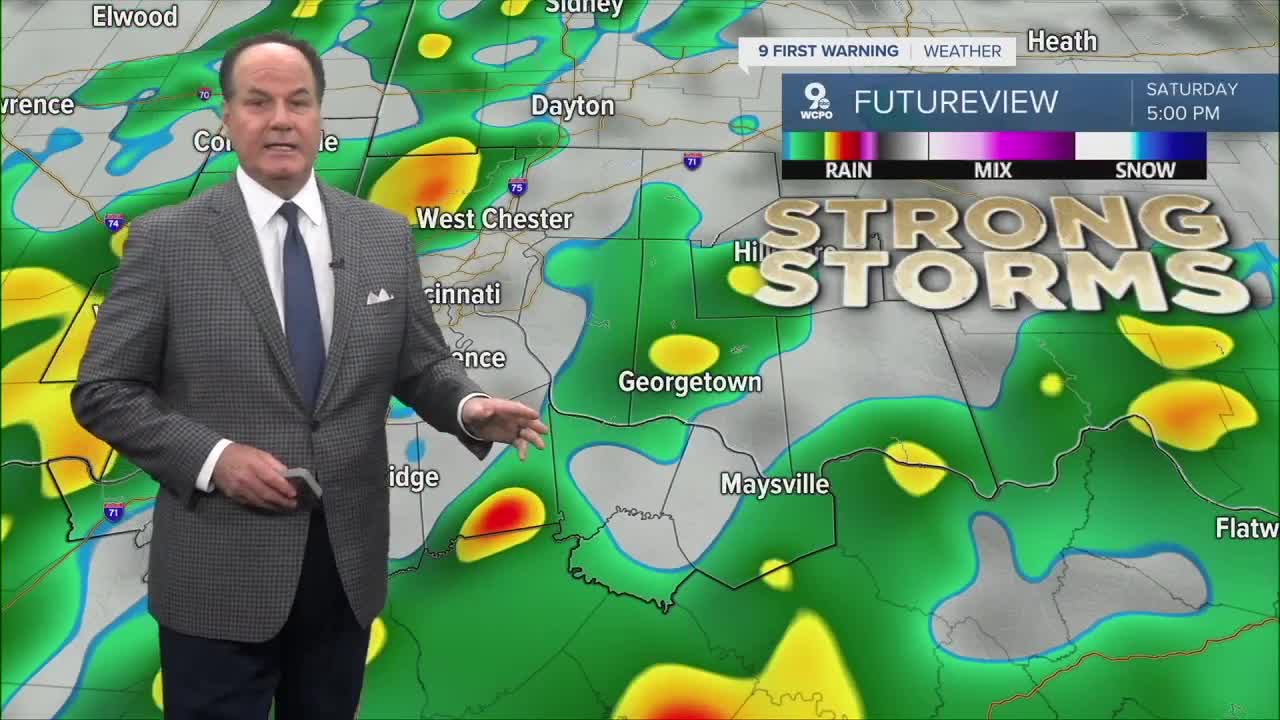
A strong cold front moves through Saturday, and severe storms are possible. To emphasize, right now, this is a fence sitter. Nevertheless, the Storm Prediction Center has highlighted our area under a Slight Risk for isolated strong-to-severe thunderstorms capable of producing damaging winds and hail.

By Sunday, cooler air moves in behind the front, with a 30 percent chance of showers in the morning, then mostly sunny skies and high in the upper 50s to 60 degrees.
OVERNIGHT
Mostly Clear
Cooler
Low: 57
FRIDAY
Partly cloudy
Warm again
High: 84
FRIDAY NIGHT
Partly cloudy
Mild and dry
Low: 65
9 First Warning Weather 24/7 Livestream
==========
- Interactive Radar: Track weather to your doorstep
- Sign up for severe weather email alerts
- Check latest school closings and delays
- WCPO traffic updates
- Metro bus detours and updates (or call the hotline at 513-632-7538)
- Latest power outages from Duke Energy
- Flight cancellations and delays from CVG, other U.S. airports
