

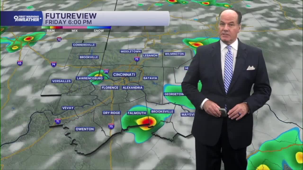


Showers and thunderstorms will remain part of the forecast through into the early overnight. There’s some possibility of a few downpours in the morning too. Otherwise, expect a warm, muggy night with temperatures holding in the low 70s under mostly cloudy skies.
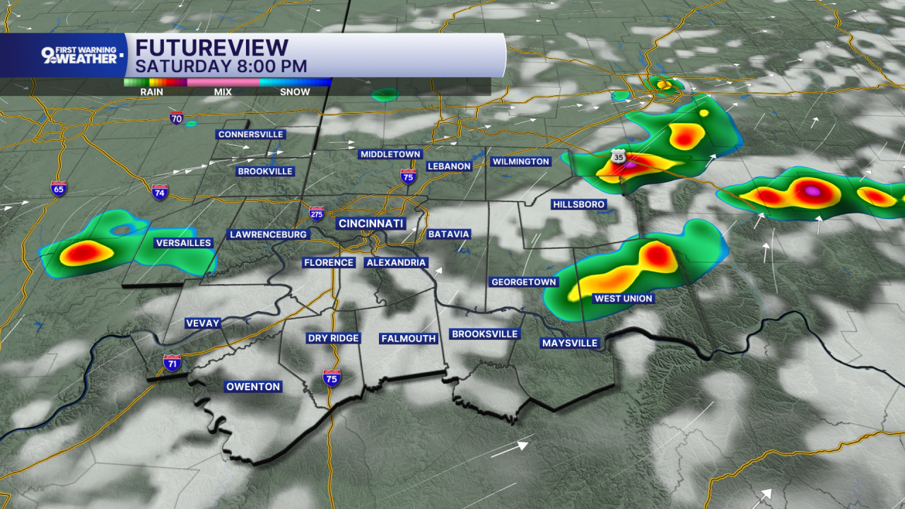
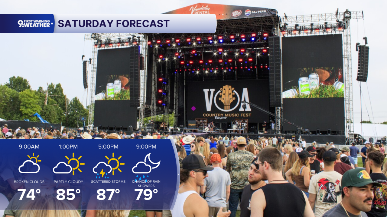
Saturday starts with some sunshine mixed with clouds, and much of the day looks dry before scattered showers and thunderstorms become more likely during the afternoon and continue into the evening as another disturbance approaches from the northwest. Highs will climb into the upper 80s, so it will feel warm and humid once again. Any storm could produce brief heavy rain, although many places will only see light amounts.
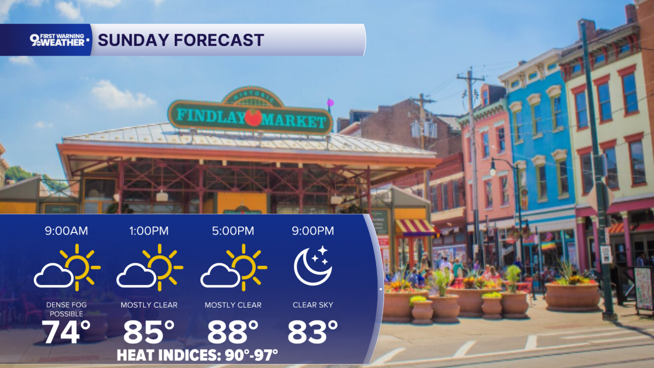
By Sunday, we'll keep a mostly sunny start before another small chance for a late afternoon or evening shower or thunderstorm develops as daytime heating peaks. Again, most places will stay rain-free with highs close to 90 degrees.
Monday looks even hotter, with temperatures reaching the upper 80s to low 90s under mostly sunny skies. Most of the daylight hours stay dry before another chance for showers arrives late Monday night as deeper moisture begins to return.
OVERNIGHT
Spotty showers
Mostly cloudy
Low: 69
SATURDAY
Mostly cloudy
Scattered showers and storms
High: 86
SATURDAY NIGHT
Isolated showers
Mostly cloudy, muggy
Low: 70
SUNDAY
Hot and humid
Partly cloudy
High: 88
9 First Warning Weather 24/7 Livestream
==========
- Interactive Radar: Track weather to your doorstep
- Sign up for severe weather email alerts
- Check latest school closings and delays
- WCPO traffic updates
- Metro bus detours and updates (or call the hotline at 513-632-7538)
- Latest power outages from Duke Energy
- Flight cancellations and delays from CVG, other U.S. airports
