

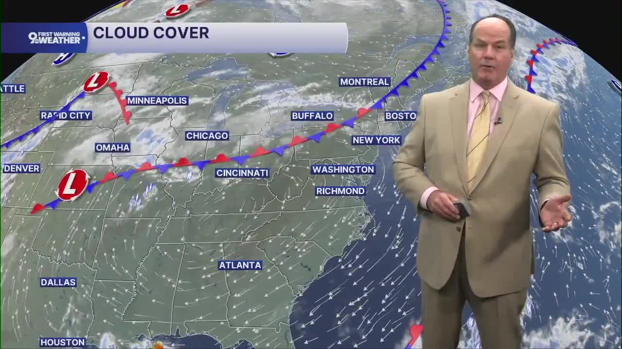


Tonight stays warm and mainly quiet across the Tri-State, with partly cloudy skies, calm winds, and temperatures only falling into the low 70s.
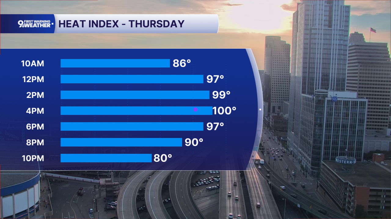
Thursday brings another hot and humid day, with mostly sunny skies and highs reaching the low 90s. The humidity will make it feel even hotter, potentially near 100 degrees during the afternoon. A large area of high pressure over the Southeast continues to keep us in a warm, moisture-rich air mass, while a front remains nearby to our north. That front could help produce a few showers or thunderstorms Thursday, but the chance remains fairly small.
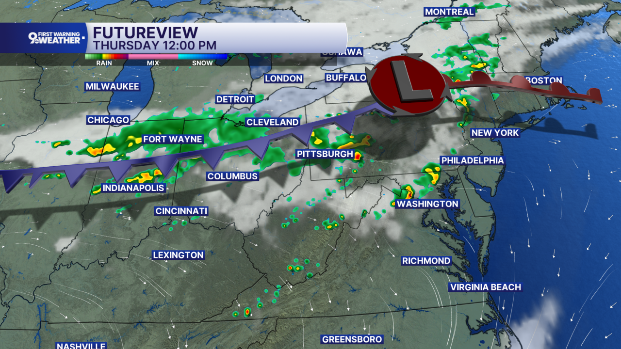
Thursday night brings another chance for showers, especially toward Friday morning. By Friday, the weather begins changing as the ridge of high pressure weakens and the front settles farther south into the Ohio Valley. A morning shower is possible, followed by mostly sunny skies and noticeably lower afternoon temperatures in the mid 80s and not as humid.
Saturday looks mostly sunny and warmer again, with highs in the upper 80s. The weekend becomes more unsettled Saturday night as shower chances increase. Sunday brings mostly cloudy skies with more widespread showers possible and some thunderstorms during the afternoon, while temperatures remain in the upper 80s.
OVERNIGHT
Partly cloudy, muggy
Low: 72
THURSDAY
Partly cloudy
Isolated rain chance
High: 93
THURSDAY NIGHT
Partly cloudy
Still muggy
Low: 72
9 First Warning Weather 24/7 Livestream
==========
- Interactive Radar: Track weather to your doorstep
- Sign up for severe weather email alerts
- Check latest school closings and delays
- WCPO traffic updates
- Metro bus detours and updates (or call the hotline at 513-632-7538)
- Latest power outages from Duke Energy
- Flight cancellations and delays from CVG, other U.S. airports
