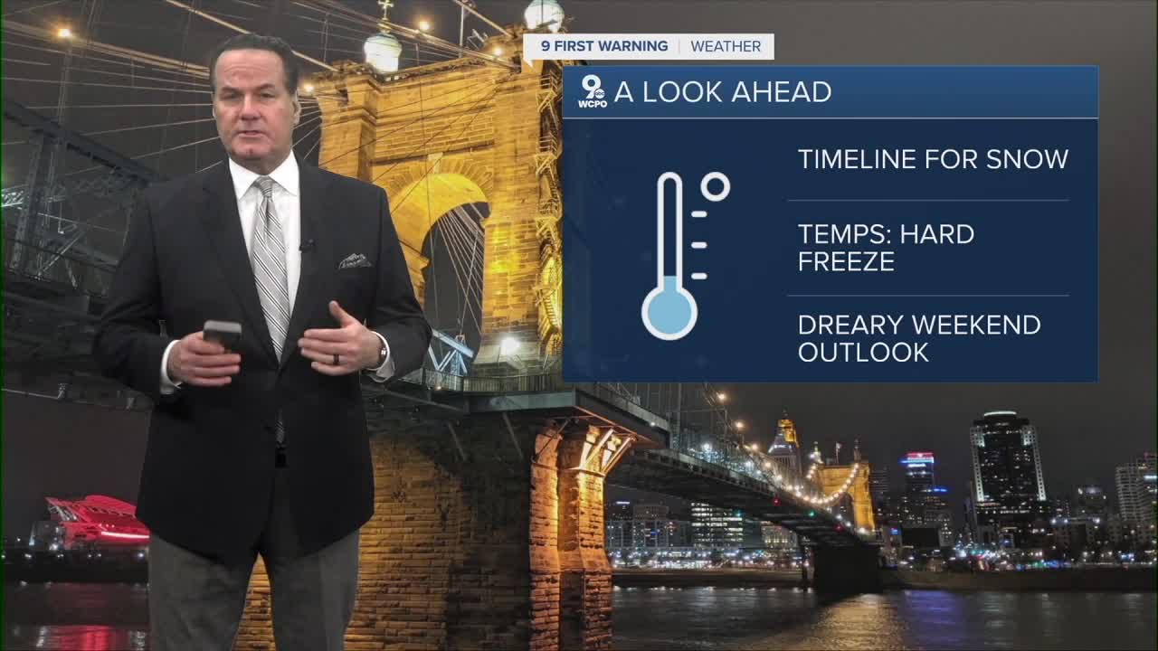


A subtle but spirited shake-up in our weather is brewing tonight as a moisture starved, but arctic cold front slides quietly across the Ohio Valley. It won’t bring a blockbuster storm, but it will introduce just enough lift and moisture to wring out some light snow while most of us are asleep.
Don’t expect much for the Cincinnati metro, just a conversational coating at best, but areas north of the city, especially in Butler, Warren and Clinton counties, could pick up a dusting to perhaps an inch. Just consider the possibility of slick spots on the way out the door.
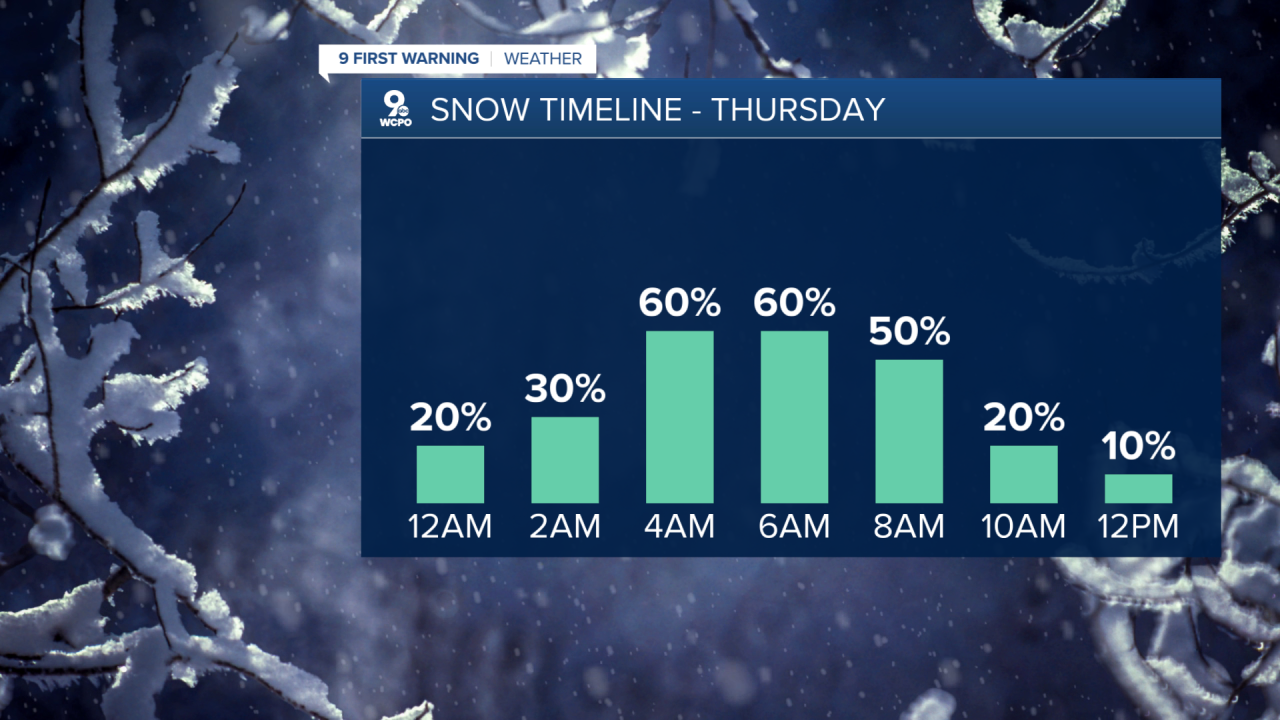
Behind the front, true Arctic air funnels south, and temperatures will hover stubbornly below freezing, while a thick deck of clouds is only broken here or there. As that chilly air deepens Thursday night, our overnight lows plunge into the teens!
Friday brings partial clearing as drier air noses in, and Saturday follows suit with both days featuring a mix of sun and clouds with temperatures in the mid-30s.

Don’t get too comfortable, though. Another system may swing through on Sunday, bringing our next chance for more accumulating snow. We are timing and tracking the system and will keep you posted.
TONIGHT
Light snow chance
overcast
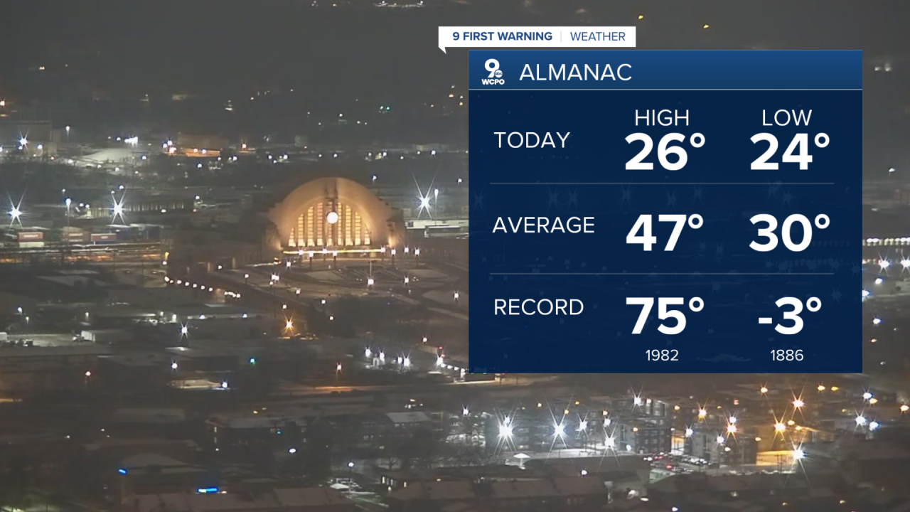
Low: 26
THURSDAY
Less than 1", mainly to the north
Mostly cloudy
Falling temperatures
High: 30
THURSDAY NIGHT
Much colder
Hard freeze
Low: 15
9 First Warning Weather 24/7 Livestream
==========
- Interactive Radar: Track weather to your doorstep
- Sign up for severe weather email alerts
- Check latest school closings and delays
- WCPO traffic updates
- Metro bus detours and updates (or call the hotline at 513-632-7538)
- Latest power outages from Duke Energy
- Flight cancellations and delays from CVG, other U.S. airports
