


We’re about to go on a bit of a weather roller coaster as we head through the weekend. First, it's going to be wet around the Tri-State for the morning. At times, the wet weather will be heavy and the winds will pick up with gusts between 30-35mph.
Springlike temperatures will climb into the 60s in the afternoon, which is unusually warm for this time of year. In fact, my forecast high is 64, which would tie the record set in 1949. So, it’ll be a nice break from winter coats, but don’t get too comfortable just yet.

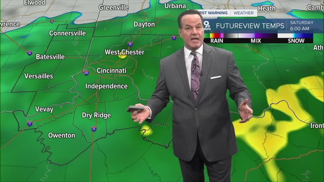
While the latter part of Friday will be dry, Saturday brings another round of rain, especially during the afternoon and evening. Outdoor plans may need a backup, and fields or yards could become muddy quickly. Highs will be around 50 degrees before the temps plummet at night.
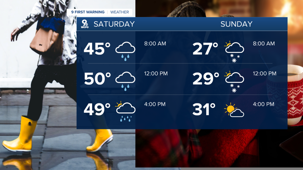
The big change arrives late Saturday night into Sunday as northwest winds bring in the cold air. Rain may briefly mix with snow overnight, and while major accumulation isn’t expected, roads could become slick in spots early Sunday morning.
Sunday feels like winter again with colder, gray, and breezy conditions, with highs falling short of freezing for most neighborhoods.
OVERNIGHT
Rain develops toward daybreak
Overcast, breezy
Low: 57
FRIDAY
Mostly Cloudy
Windy, gusts to 35mph
High: 64
FRIDAY NIGHT
Chance showers
Overcast
Low: 43
9 First Warning Weather 24/7 Livestream
==========
- Interactive Radar: Track weather to your doorstep
- Sign up for severe weather email alerts
- Check latest school closings and delays
- WCPO traffic updates
- Metro bus detours and updates (or call the hotline at 513-632-7538)
- Latest power outages from Duke Energy
- Flight cancellations and delays from CVG, other U.S. airports
