



HOT. It's the word of the day. After refreshing conditions on Monday and a seasonal high of 78 degrees, we are cranking up the heat today!
Temperatures start around 60 degrees for a refreshing start to the day. We'll warm more rapidly today as winds shift to the southwest at 10 mph. This will help push temperatures to the low 90s. Humidity is also rising during the day. That will result in feels-like temperatures in the mid 90s this afternoon.
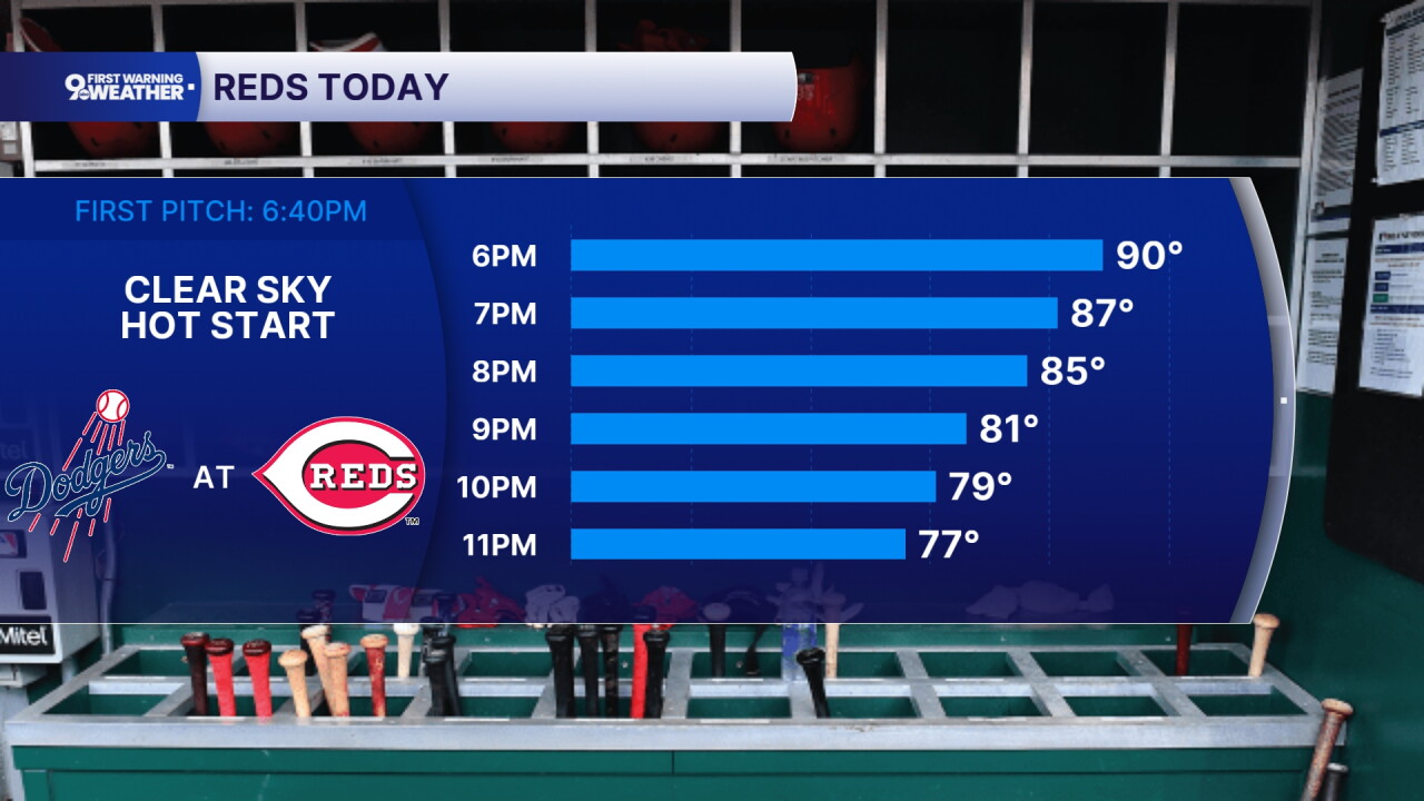
We are monitoring a small chance of rain for the overnight hours. If we did see some isolated activity, it would mainly be in our northwestern locations. It will be a muggy night for everyone as lows only drop to 71 degrees.
Wednesday will be another hot day. The high should be around 92 degrees with a heat index between 95-98 degrees. The sky will be partly cloudy. There's an isolated chance for showers during the day but at no one point is rain likely.
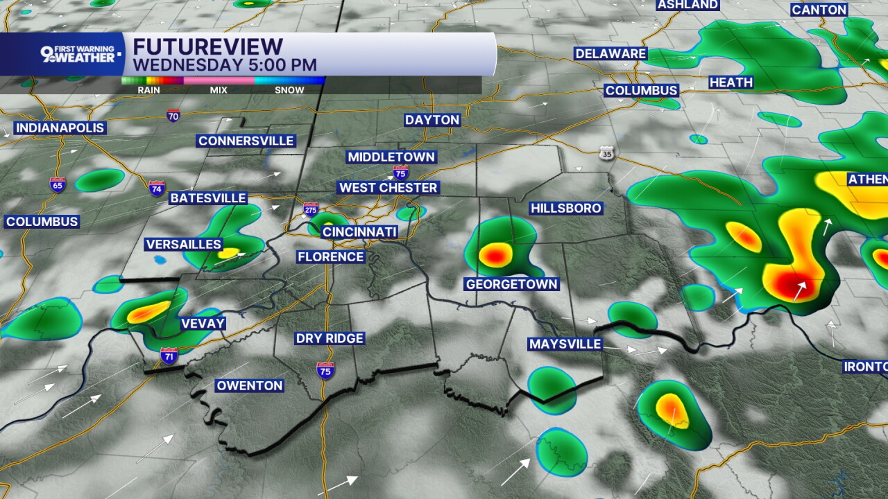
Highs will again be in the low 90s on Thursday, putting us in "heatwave" status. The rain is at 20% or less and it will feel very muggy.
A lot of us are looking ahead to the weekend and Oktoberfest Zinzinnati. Saturday has the lower rain chance at 20% but it's still going to be hot with a high of 88 and feels like temperatures in the low 90s. Sunday is still warm at 85 degrees and the rain chance increases slightly to 30%.
MORNING RUSH
Clear sky
Cool & refreshing
Low: 60
TUESDAY
Sunshine
Hot with rising humidity
High: 91
TUESDAY NIGHT
Partly cloudy
Slight rain chance
Low: 71
WEDNESDAY
Partly cloudy, humid
Isolated storms
High: 92
WEDNESDAY NIGHT
Isolated showers
Mostly cloudy, muggy
Low: 72
9 First Warning Weather 24/7 Livestream
==========
- Interactive Radar: Track weather to your doorstep
- Sign up for severe weather email alerts
- Check latest school closings and delays
- WCPO traffic updates
- Metro bus detours and updates (or call the hotline at 513-632-7538)
- Latest power outages from Duke Energy
- Flight cancellations and delays from CVG, other U.S. airports
